Property Record
7200 Jaywick Ave, Fort Washington, MD 20744


NEARBY LISTINGS FOR SALE OR LEASE
Property Detail
7200 Jaywick Ave
12-1265032
PARCEL 3
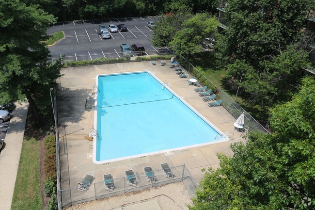
Apartment
Prince George's
X
Maryland
24033C0240E
11.65 AC
2024
Oxon Hill
2025
Washington, DC
801407
Washington-Arlington-Alexandria, DC-VA-MD-WV
DEMOGRAPHICS near 7200 Jaywick Ave
1 Mile
3 Mile
5 Mile
2024 Total Population
10,095
83,147
244,004
2029 Population
9,837
80,858
234,198
Pop Growth 2024-2029
(2.56%)
(2.75%)
(4.02%)
Average Age
42
41
40
2024 Total Households
3,946
31,067
94,702
HH Growth 2024-2029
(2.58%)
(2.80%)
(4.29%)
Median Household Inc
$90,771
$84,892
$74,524
Avg Household Size
2.50
2.60
2.50
2024 Avg HH Vehicles
2.00
2.00
1.00
Median Home Value
$357,545
$347,506
$355,501
Median Year Built
1973
1972
1971
Nearby Places
Map Layers
Map Styles
 Street
 Aerial
- Restaurants
- Banks
- Shops
- Fitness
- Groceries
PUBLIC TRANSPORTATION
COMMUTER RAIL
DRIVE
WALK
Distance
21 min
9.4 mi
Alexandria (Fredericksburg Line - Virginia Railway Express, Manassas Line - Virginia Railway Express)
DRIVE
WALK
Distance
Alexandria (Fredericksburg Line - Virginia Railway Express, Manassas Line - Virginia Railway Express)
20 min
9.4 mi
AIRPORT
Ronald Reagan Washington Ntl
DRIVE
WALK
Distance
Ronald Reagan Washington Ntl
31 min
12.1 mi
Baltimore/Washington International Thurgood Marshall
DRIVE
WALK
Distance
Baltimore/Washington International Thurgood Marshall
61 min
38.6 mi
Washington Dulles International
DRIVE
WALK
Distance
Washington Dulles International
66 min
40.0 mi
Nearby Properties
Address
Land Use
TOTAL SIZE
Lot Size
Zoning
Address
Land Use
TOTAL SIZE
Lot Size
Zoning
1,241,298 SF
11.53 AC
RTOLE
Address
Land Use
TOTAL SIZE
Lot Size
Zoning
1,931,127 SF
11.53 AC
RTOLE
Address
Land Use
TOTAL SIZE
Lot Size
Zoning
373,996 SF
37.74 AC
IE
Address
Land Use
TOTAL SIZE
Lot Size
Zoning
450 SF
20.72 AC
RMF20
Address
Land Use
TOTAL SIZE
Lot Size
Zoning
374,097 SF
36.22 AC
NAC
Address
Land Use
TOTAL SIZE
Lot Size
Zoning
29.24 AC
RMF20
Address
Land Use
TOTAL SIZE
Lot Size
Zoning
380 SF
17.44 AC
RMF20
Address
Land Use
TOTAL SIZE
Lot Size
Zoning
701 SF
29.42 AC
RMF20
Address
Land Use
TOTAL SIZE
Lot Size
Zoning
450 SF
21.14 AC
RMF20
Address
Land Use
TOTAL SIZE
Lot Size
Zoning
336,465 SF
1.38 AC
CSC
Address
Land Use
TOTAL SIZE
Lot Size
Zoning
21.48 AC
RMF20
Address
Land Use
TOTAL SIZE
Lot Size
Zoning
116 SF
10.37 AC
RMF20
Address
Land Use
TOTAL SIZE
Lot Size
Zoning
300,005 SF
9.94 AC
RR
Address
Land Use
TOTAL SIZE
Lot Size
Zoning
154,028 SF
11.42 AC
NAC
Address
Land Use
TOTAL SIZE
Lot Size
Zoning
7.65 AC
RMF20
Address
Land Use
TOTAL SIZE
Lot Size
Zoning
324 SF
8.52 AC
RMF48
Address
Land Use
TOTAL SIZE
Lot Size
Zoning
308 SF
16.03 AC
RMF20
Address
Land Use
TOTAL SIZE
Lot Size
Zoning
434,910 SF
0.46 AC
RR
Address
Land Use
TOTAL SIZE
Lot Size
Zoning
297 SF
13.58 AC
RMF20
Address
Land Use
TOTAL SIZE
Lot Size
Zoning
8.02 AC
RMF20
Address
Land Use
TOTAL SIZE
Lot Size
Zoning
174,894 SF
7.54 AC
CGO
Address
Land Use
TOTAL SIZE
Lot Size
Zoning
6.37 AC
RMF48
Address
Land Use
TOTAL SIZE
Lot Size
Zoning
5.83 AC
RMF20
Address
Land Use
TOTAL SIZE
Lot Size
Zoning
7 AC
RMF20
Address
Land Use
TOTAL SIZE
Lot Size
Zoning
258 SF
11.08 AC
RMF20
Address
Land Use
TOTAL SIZE
Lot Size
Zoning
1,217 SF
8.94 AC
RMF20
Address
Land Use
TOTAL SIZE
Lot Size
Zoning
72,100 SF
11.36 AC
NAC
Address
Land Use
TOTAL SIZE
Lot Size
Zoning
164,340 SF
9.97 AC
IE
Address
Land Use
TOTAL SIZE
Lot Size
Zoning
21.63 AC
RTOLE
The World's #1 Commercial Real Estate Marketplace
Connect with us
© 2025 CoStar Group
The information above has been obtained from sources believed reliable. While we do not doubt its accuracy we have not verified it and make no guarantee, warranty or representation about it. It is your responsibility to independently confirm its accuracy and completeness. Any projections, opinions, assumptions, or estimates used are for example only and do not represent the current or future performance of the property. The value of this transaction to you depends on tax and other factors which should be evaluated by your tax, financial, and legal advisors. You and your advisors should conduct a careful, independent investigation of the property to determine to your satisfaction the suitability of the property for your needs.