Property Record
7200 Mcdonald Rd, Irvington, AL 36544


Property Detail
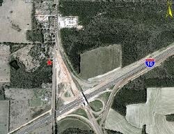
7200 Mcdonald Rd
37-01-11-0-000-013.04
FR NE COR OF SEC 11 T6S R3W RUN S 00 DEG 18 MIN 08 SEC W DIS OF 1321.86 FT TO PT TH RUN N 89 DEG 53 MIN 29 SEC W A DIS OF 240
Vacantlandnec
Mobile
B and X Area of moderate flood hazard, usually the area between the limits of the 100-year and 500-year floods.
Alabama
0
2 AC
2025
Outlying Mobile County
006704
Mobile
4,501 SF
Mobile, AL
NEARBY LISTINGS FOR SALE OR LEASE
DEMOGRAPHICS near 7200 Mcdonald Rd
1 mile
3 mile
5 mile
2025 Total Population
1,107
12,924
37,866
2030 Population
1,088
12,760
37,402
Pop Growth 2025-2030
(1.72%)
(1.27%)
(1.23%)
Average Age
41
39
40
2025 Total Households
410
4,922
14,272
HH Growth 2025-2030
(1.71%)
(1.28%)
(1.25%)
Median Household Inc
$56,973
$58,110
$62,340
Avg Household Size
2.60
2.50
2.60
2025 Avg HH Vehicles
2.00
2.00
2.00
Median Home Value
$153,086
$160,533
$169,842
Median Year Built
1989
1990
1989
Nearby Places
Map Layers
Map Styles
 Street
 Aerial
Layers
 Traffic
 Biking
Places
Listings with unknown addresses are not visible on the map
- Restaurants
- Banks
- Shops
- Fitness
- Groceries
PUBLIC TRANSPORTATION
AIRPORT
Mobile Regional
Drive
Walk
Distance
Mobile Regional
30 min
13.4 mi
Mobile International
Drive
Walk
Distance
Mobile International
20 min
14.1 mi
Freight Ports
Port of Mobile
Drive
Walk
Distance
Port of Mobile
23 min
17.5 mi
Nearby Properties
Address
Land Use
TOTAL SIZE
Lot Size
Zoning
Address
Land Use
TOTAL SIZE
Lot Size
Zoning
2,503,800 SF
400.86 AC
Address
Land Use
TOTAL SIZE
Lot Size
Zoning
362,880 SF
32.55 AC
Address
Land Use
TOTAL SIZE
Lot Size
Zoning
202,866 SF
8.52 AC
Address
Land Use
TOTAL SIZE
Lot Size
Zoning
155,320 SF
21.48 AC
Address
Land Use
TOTAL SIZE
Lot Size
Zoning
342,598 SF
11.94 AC
Address
Land Use
TOTAL SIZE
Lot Size
Zoning
167,968 SF
12.40 AC
Address
Land Use
TOTAL SIZE
Lot Size
Zoning
193,452 SF
17.61 AC
Address
Land Use
TOTAL SIZE
Lot Size
Zoning
12,071 SF
6.87 AC
Address
Land Use
TOTAL SIZE
Lot Size
Zoning
70,838 SF
181.63 AC
Address
Land Use
TOTAL SIZE
Lot Size
Zoning
13,550 SF
14.99 AC
Address
Land Use
TOTAL SIZE
Lot Size
Zoning
77,250 SF
10.64 AC
Address
Land Use
TOTAL SIZE
Lot Size
Zoning
26,460 SF
24.70 AC
Address
Land Use
TOTAL SIZE
Lot Size
Zoning
41,333 SF
6.35 AC
Address
Land Use
TOTAL SIZE
Lot Size
Zoning
70,597 SF
9.70 AC
Address
Land Use
TOTAL SIZE
Lot Size
Zoning
107,156 SF
42.22 AC
Address
Land Use
TOTAL SIZE
Lot Size
Zoning
25,000 SF
10.10 AC
Address
Land Use
TOTAL SIZE
Lot Size
Zoning
12,596 SF
4.30 AC
Address
Land Use
TOTAL SIZE
Lot Size
Zoning
10,304 SF
6.84 AC
Address
Land Use
TOTAL SIZE
Lot Size
Zoning
15,892 SF
50.23 AC
Address
Land Use
TOTAL SIZE
Lot Size
Zoning
43,440 SF
4.13 AC
Address
Land Use
TOTAL SIZE
Lot Size
Zoning
13,440 SF
10 AC
Address
Land Use
TOTAL SIZE
Lot Size
Zoning
39,708 SF
2.36 AC
Address
Land Use
TOTAL SIZE
Lot Size
Zoning
44,183 SF
11 AC
Address
Land Use
TOTAL SIZE
Lot Size
Zoning
7,176 SF
4.60 AC
Address
Land Use
TOTAL SIZE
Lot Size
Zoning
17,240 SF
10 AC
Address
Land Use
TOTAL SIZE
Lot Size
Zoning
139,790 SF
7.68 AC
Address
Land Use
TOTAL SIZE
Lot Size
Zoning
1,035 SF
150 AC
Address
Land Use
TOTAL SIZE
Lot Size
Zoning
9,080 SF
66.38 AC
Address
Land Use
TOTAL SIZE
Lot Size
Zoning
2,400 SF
4.31 AC
Address
Land Use
TOTAL SIZE
Lot Size
Zoning
6,582 SF
5.89 AC
The World's #1 Commercial Real Estate Marketplace
Connect with us
© 2026 CoStar Group
The information above has been obtained from sources believed reliable. While we do not doubt its accuracy we have not verified it and make no guarantee, warranty or representation about it. It is your responsibility to independently confirm its accuracy and completeness. Any projections, opinions, assumptions, or estimates used are for example only and do not represent the current or future performance of the property. The value of this transaction to you depends on tax and other factors which should be evaluated by your tax, financial, and legal advisors. You and your advisors should conduct a careful, independent investigation of the property to determine to your satisfaction the suitability of the property for your needs.