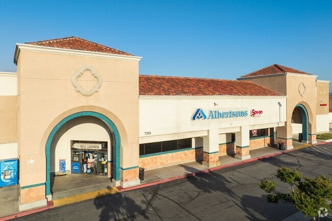
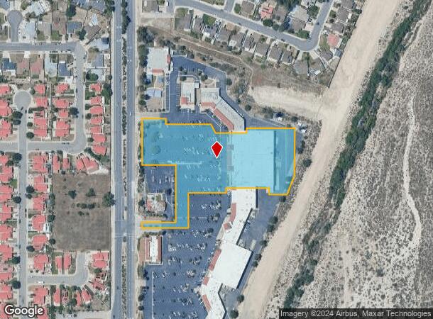
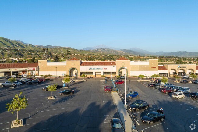
Property Record
7201 Boulder Ave, Highland, CA 92346
NEARBY LISTINGS FOR SALE OR LEASE
Property Detail
7201 Boulder Ave
1200-491-06
Parcel Map 12821
Supermarket
PARCEL MAP 12821 PARCEL 2
X
San Bernardino
06071C8702H
California
2024
6.70 AC
2025
Redlands/Loma Linda
007905
Inland Empire (California)
49,920 SF
Riverside-San Bernardino-Ontario, CA
DEMOGRAPHICS near 7201 Boulder Ave
1 Mile
3 Mile
5 Mile
2024 Total Population
11,806
72,547
173,524
2029 Population
11,991
73,850
176,811
Pop Growth 2024-2029
+ 1.57%
+ 1.80%
+ 1.89%
Average Age
40
37
36
2024 Total Households
3,955
21,857
52,093
HH Growth 2024-2029
+ 1.64%
+ 1.84%
+ 2.02%
Median Household Inc
$90,019
$74,852
$69,646
Avg Household Size
3.00
3.20
3.20
2024 Avg HH Vehicles
2.00
2.00
2.00
Median Home Value
$386,048
$406,924
$394,029
Median Year Built
1984
1980
1976
Nearby Places
Map Layers
Map Styles
 Street
 Aerial
- Restaurants
- Banks
- Shops
- Fitness
- Groceries
PUBLIC TRANSPORTATION
COMMUTER RAIL
Redlands - Esri Metrolink Station (Metrolink San Bernardino Line - Metrolink Trains)
DRIVE
WALK
Distance
Redlands - Esri Metrolink Station (Metrolink San Bernardino Line - Metrolink Trains)
10 min
5.3 mi
Redlands - Downtown Metrolink Station (Metrolink San Bernardino Line - Metrolink Trains)
DRIVE
WALK
Distance
Redlands - Downtown Metrolink Station (Metrolink San Bernardino Line - Metrolink Trains)
9 min
5.9 mi
AIRPORT
Ontario International
DRIVE
WALK
Distance
Ontario International
37 min
28.0 mi
Freight Ports
Port of Long Beach
DRIVE
WALK
Distance
Port of Long Beach
94 min
73.4 mi
Nearby Properties
Address
Land Use
TOTAL SIZE
Lot Size
Zoning
Address
Land Use
TOTAL SIZE
Lot Size
Zoning
1,079,470 SF
46.39 AC
Address
Land Use
TOTAL SIZE
Lot Size
Zoning
1,079,236 SF
54.70 AC
EVIR
Address
Land Use
TOTAL SIZE
Lot Size
Zoning
708,500 SF
97.74 AC
Address
Land Use
TOTAL SIZE
Lot Size
Zoning
198,820 SF
10.84 AC
Address
Land Use
TOTAL SIZE
Lot Size
Zoning
406,710 SF
20.10 AC
Address
Land Use
TOTAL SIZE
Lot Size
Zoning
801,126 SF
36.03 AC
Address
Land Use
TOTAL SIZE
Lot Size
Zoning
542,519 SF
27.07 AC
Address
Land Use
TOTAL SIZE
Lot Size
Zoning
714,538 SF
56.66 AC
Address
Land Use
TOTAL SIZE
Lot Size
Zoning
17.69 AC
Address
Land Use
TOTAL SIZE
Lot Size
Zoning
285,952 SF
13.31 AC
Address
Land Use
TOTAL SIZE
Lot Size
Zoning
150,308 SF
6.75 AC
Address
Land Use
TOTAL SIZE
Lot Size
Zoning
153,869 SF
12.12 AC
Address
Land Use
TOTAL SIZE
Lot Size
Zoning
155,309 SF
5.56 AC
Address
Land Use
TOTAL SIZE
Lot Size
Zoning
60,343 SF
8.03 AC
Address
Land Use
TOTAL SIZE
Lot Size
Zoning
266,850 SF
14.19 AC
EVIR
Address
Land Use
TOTAL SIZE
Lot Size
Zoning
112,520 SF
8.80 AC
Address
Land Use
TOTAL SIZE
Lot Size
Zoning
121,285 SF
8.14 AC
Address
Land Use
TOTAL SIZE
Lot Size
Zoning
156,367 SF
7.40 AC
Address
Land Use
TOTAL SIZE
Lot Size
Zoning
70,386 SF
5.11 AC
Address
Land Use
TOTAL SIZE
Lot Size
Zoning
76,988 SF
8.42 AC
Address
Land Use
TOTAL SIZE
Lot Size
Zoning
138,313 SF
10.96 AC
Address
Land Use
TOTAL SIZE
Lot Size
Zoning
148,639 SF
12.12 AC
Address
Land Use
TOTAL SIZE
Lot Size
Zoning
6.05 AC
Address
Land Use
TOTAL SIZE
Lot Size
Zoning
139,368 SF
38.07 AC
Address
Land Use
TOTAL SIZE
Lot Size
Zoning
134,140 SF
8.27 AC
Address
Land Use
TOTAL SIZE
Lot Size
Zoning
129,968 SF
7.11 AC
Address
Land Use
TOTAL SIZE
Lot Size
Zoning
127,420 SF
7.20 AC
Address
Land Use
TOTAL SIZE
Lot Size
Zoning
88,621 SF
4 AC
Address
Land Use
TOTAL SIZE
Lot Size
Zoning
73,714 SF
5.29 AC
Address
Land Use
TOTAL SIZE
Lot Size
Zoning
162,360 SF
9.89 AC
The World's #1 Commercial Real Estate Marketplace
Connect with us
© 2025 CoStar Group
The information above has been obtained from sources believed reliable. While we do not doubt its accuracy we have not verified it and make no guarantee, warranty or representation about it. It is your responsibility to independently confirm its accuracy and completeness. Any projections, opinions, assumptions, or estimates used are for example only and do not represent the current or future performance of the property. The value of this transaction to you depends on tax and other factors which should be evaluated by your tax, financial, and legal advisors. You and your advisors should conduct a careful, independent investigation of the property to determine to your satisfaction the suitability of the property for your needs.