Property Record
7201 Marsha Sharp Fwy, Lubbock, TX 79407
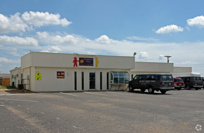

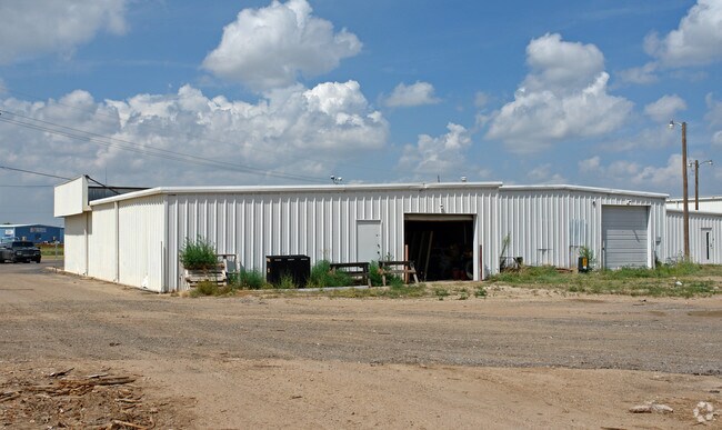
Property Detail
7201 Marsha Sharp Fwy
Lubbock, TX
HARVEST CHURCH TR A (LESS BLDG ONLY)
R38541
Lubbock
Taxexempt
Texas
AE The base floodplain where base flood elevations are provided. AE Zones are now used on new format FIRMs instead of A1-A30 Zones.
7550
0
2.41 AC
2025
South Outer Lubbock
001716
Lubbock
23,960 SF
NEARBY LISTINGS FOR SALE OR LEASE
DEMOGRAPHICS near 7201 Marsha Sharp Fwy
1 mile
3 mile
5 mile
2024 Total Population
2,812
58,478
143,128
2029 Population
2,961
61,579
150,151
Pop Growth 2024-2029
+ 5.30%
+ 5.30%
+ 4.91%
Average Age
36
36
37
2024 Total Households
1,059
24,559
58,596
HH Growth 2024-2029
+ 5.95%
+ 5.57%
+ 5.15%
Median Household Inc
$109,871
$71,840
$69,123
Avg Household Size
2.60
2.40
2.40
2024 Avg HH Vehicles
2.00
2.00
2.00
Median Home Value
$321,243
$256,751
$246,051
Median Year Built
2010
2002
1990
Nearby Places
Map Layers
Map Styles
 Street
 Aerial
Transit
 Traffic
 Biking
Places
Listings with unknown addresses are not visible on the map
- Restaurants
- Banks
- Shops
- Fitness
- Groceries
PUBLIC TRANSPORTATION
AIRPORT
Lubbock Preston Smith International
Drive
Walk
Distance
Lubbock Preston Smith International
31 min
18.6 mi
Nearby Properties
Address
Land Use
TOTAL SIZE
Lot Size
Zoning
Address
Land Use
TOTAL SIZE
Lot Size
Zoning
791,096 SF
63.76 AC
Address
Land Use
TOTAL SIZE
Lot Size
Zoning
111,769 SF
25.03 AC
Address
Land Use
TOTAL SIZE
Lot Size
Zoning
236,871 SF
6.77 AC
Address
Land Use
TOTAL SIZE
Lot Size
Zoning
276,552 SF
12.05 AC
Address
Land Use
TOTAL SIZE
Lot Size
Zoning
290,322 SF
11.96 AC
Address
Land Use
TOTAL SIZE
Lot Size
Zoning
303,724 SF
17.32 AC
Address
Land Use
TOTAL SIZE
Lot Size
Zoning
289,796 SF
14.67 AC
Address
Land Use
TOTAL SIZE
Lot Size
Zoning
187,409 SF
15.92 AC
Address
Land Use
TOTAL SIZE
Lot Size
Zoning
247,870 SF
11.48 AC
Address
Land Use
TOTAL SIZE
Lot Size
Zoning
207,374 SF
15.51 AC
Address
Land Use
TOTAL SIZE
Lot Size
Zoning
108,363 SF
11.35 AC
Address
Land Use
TOTAL SIZE
Lot Size
Zoning
215,338 SF
26.49 AC
Address
Land Use
TOTAL SIZE
Lot Size
Zoning
196,103 SF
12.33 AC
Address
Land Use
TOTAL SIZE
Lot Size
Zoning
246,478 SF
13 AC
Address
Land Use
TOTAL SIZE
Lot Size
Zoning
177,643 SF
10.13 AC
Address
Land Use
TOTAL SIZE
Lot Size
Zoning
149,710 SF
10.57 AC
Address
Land Use
TOTAL SIZE
Lot Size
Zoning
156,495 SF
15.85 AC
Address
Land Use
TOTAL SIZE
Lot Size
Zoning
138,202 SF
11.33 AC
Address
Land Use
TOTAL SIZE
Lot Size
Zoning
24,540 SF
8.06 AC
Address
Land Use
TOTAL SIZE
Lot Size
Zoning
178,895 SF
7.85 AC
Address
Land Use
TOTAL SIZE
Lot Size
Zoning
156,038 SF
12.05 AC
Address
Land Use
TOTAL SIZE
Lot Size
Zoning
69.21 AC
Address
Land Use
TOTAL SIZE
Lot Size
Zoning
103,560 SF
7.04 AC
Address
Land Use
TOTAL SIZE
Lot Size
Zoning
79,733 SF
3.14 AC
Address
Land Use
TOTAL SIZE
Lot Size
Zoning
100,132 SF
8.42 AC
Address
Land Use
TOTAL SIZE
Lot Size
Zoning
172,627 SF
8.12 AC
Address
Land Use
TOTAL SIZE
Lot Size
Zoning
139,501 SF
10.56 AC
Address
Land Use
TOTAL SIZE
Lot Size
Zoning
220,236 SF
13.42 AC
Address
Land Use
TOTAL SIZE
Lot Size
Zoning
198,209 SF
9.98 AC
Address
Land Use
TOTAL SIZE
Lot Size
Zoning
75,154 SF
6.95 AC
The World's #1 Commercial Real Estate Marketplace
Connect with us
© 2026 CoStar Group
The information above has been obtained from sources believed reliable. While we do not doubt its accuracy we have not verified it and make no guarantee, warranty or representation about it. It is your responsibility to independently confirm its accuracy and completeness. Any projections, opinions, assumptions, or estimates used are for example only and do not represent the current or future performance of the property. The value of this transaction to you depends on tax and other factors which should be evaluated by your tax, financial, and legal advisors. You and your advisors should conduct a careful, independent investigation of the property to determine to your satisfaction the suitability of the property for your needs.