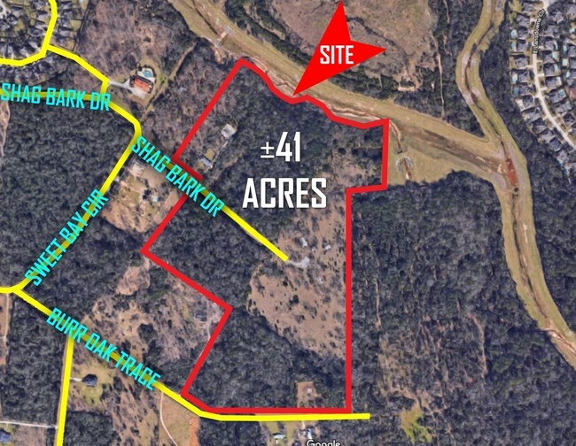
Property Record
7202 Shag Bark St, Magnolia, TX 77354
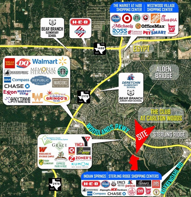
NEARBY LISTINGS FOR SALE OR LEASE
Property Detail
7202 Shag Bark St
Houston-Pasadena-The Woodlands, TX
Northland Indian Hills
6143-00-01605
S614300 - NORTHLAND INDIAN HILLS, LOT 8, ACRES 7.5
Residentialacreage
Montgomery
AE
Texas
48339C0520G
8
2024
4.80 AC
2025
The Woodlands
690603
Houston
DEMOGRAPHICS near 7202 Shag Bark St
1 Mile
3 Mile
5 Mile
2024 Total Population
5,484
63,368
152,424
2029 Population
6,644
74,322
177,501
Pop Growth 2024-2029
+ 21.15%
+ 17.29%
+ 16.45%
Average Age
37
37
38
2024 Total Households
1,697
21,248
53,451
HH Growth 2024-2029
+ 21.33%
+ 17.55%
+ 16.85%
Median Household Inc
$227,263
$156,220
$125,410
Avg Household Size
3.20
2.90
2.80
2024 Avg HH Vehicles
2.00
2.00
2.00
Median Home Value
$611,453
$465,871
$397,161
Median Year Built
2006
2006
2003
Nearby Places
Map Layers
Map Styles
 Street
 Aerial
- Restaurants
- Banks
- Shops
- Fitness
- Groceries
PUBLIC TRANSPORTATION
AIRPORT
George Bush Intcntl/Houston
DRIVE
WALK
Distance
George Bush Intcntl/Houston
45 min
30.3 mi
Freight Ports
Port of Houston
DRIVE
WALK
Distance
Port of Houston
68 min
46.0 mi
SALE & LEASE HISTORY
LISTING DATE
SALE/LEASE

Sep 24, 2016
For Sale
Mar 02, 2018
For Sale
Nearby Properties
Address
Land Use
TOTAL SIZE
Lot Size
Zoning
Address
Land Use
TOTAL SIZE
Lot Size
Zoning
461,345 SF
28.36 AC
Address
Land Use
TOTAL SIZE
Lot Size
Zoning
370,296 SF
14.05 AC
Address
Land Use
TOTAL SIZE
Lot Size
Zoning
370,029 SF
16.12 AC
Address
Land Use
TOTAL SIZE
Lot Size
Zoning
361,747 SF
16.71 AC
Address
Land Use
TOTAL SIZE
Lot Size
Zoning
289,737 SF
13.83 AC
Address
Land Use
TOTAL SIZE
Lot Size
Zoning
296,538 SF
12.58 AC
Address
Land Use
TOTAL SIZE
Lot Size
Zoning
194,272 SF
11.06 AC
Address
Land Use
TOTAL SIZE
Lot Size
Zoning
289,611 SF
13.57 AC
Address
Land Use
TOTAL SIZE
Lot Size
Zoning
198,969 SF
32.78 AC
Address
Land Use
TOTAL SIZE
Lot Size
Zoning
212,071 SF
7 AC
Address
Land Use
TOTAL SIZE
Lot Size
Zoning
163,392 SF
4.53 AC
Address
Land Use
TOTAL SIZE
Lot Size
Zoning
87,445 SF
6.45 AC
Address
Land Use
TOTAL SIZE
Lot Size
Zoning
153,063 SF
17.50 AC
Address
Land Use
TOTAL SIZE
Lot Size
Zoning
106,857 SF
10.12 AC
Address
Land Use
TOTAL SIZE
Lot Size
Zoning
123,497 SF
18.77 AC
Address
Land Use
TOTAL SIZE
Lot Size
Zoning
76,841 SF
12.17 AC
Address
Land Use
TOTAL SIZE
Lot Size
Zoning
13.76 AC
Address
Land Use
TOTAL SIZE
Lot Size
Zoning
100,374 SF
11.24 AC
Address
Land Use
TOTAL SIZE
Lot Size
Zoning
211,965 SF
25.17 AC
Address
Land Use
TOTAL SIZE
Lot Size
Zoning
61,218 SF
9.30 AC
Address
Land Use
TOTAL SIZE
Lot Size
Zoning
172,784 SF
20.60 AC
2
Address
Land Use
TOTAL SIZE
Lot Size
Zoning
278,939 SF
13.76 AC
Address
Land Use
TOTAL SIZE
Lot Size
Zoning
5,044 SF
42.52 AC
6
Address
Land Use
TOTAL SIZE
Lot Size
Zoning
182,115 SF
16.52 AC
Address
Land Use
TOTAL SIZE
Lot Size
Zoning
190,000 SF
24.21 AC
Address
Land Use
TOTAL SIZE
Lot Size
Zoning
165,218 SF
17.40 AC
2
Address
Land Use
TOTAL SIZE
Lot Size
Zoning
51,134 SF
25 AC
2
Address
Land Use
TOTAL SIZE
Lot Size
Zoning
1,440 SF
126.83 AC
2
Address
Land Use
TOTAL SIZE
Lot Size
Zoning
151,978 SF
21.94 AC
Address
Land Use
TOTAL SIZE
Lot Size
Zoning
48,525 SF
4.68 AC
The World's #1 Commercial Real Estate Marketplace
Connect with us
© 2026 CoStar Group
The information above has been obtained from sources believed reliable. While we do not doubt its accuracy we have not verified it and make no guarantee, warranty or representation about it. It is your responsibility to independently confirm its accuracy and completeness. Any projections, opinions, assumptions, or estimates used are for example only and do not represent the current or future performance of the property. The value of this transaction to you depends on tax and other factors which should be evaluated by your tax, financial, and legal advisors. You and your advisors should conduct a careful, independent investigation of the property to determine to your satisfaction the suitability of the property for your needs.