Property Record
7205 Boleyn Dr, Cincinnati, OH 45239
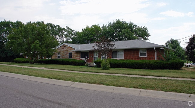


Property Detail
7205 Boleyn Dr
Cincinnati, OH-KY-IN
BANNING RD 94.87 X 139.41IRR LOT 52 BALLAUER SUB NO 1 BLK G
510-0083-0487
HAMILTON
Apartment
Ohio
B and X Area of moderate flood hazard, usually the area between the limits of the 100-year and 500-year floods.
52
2025
0.43 AC
2025
White Oak
020764
Cincinnati/Dayton
2,808 SF
NEARBY LISTINGS FOR SALE OR LEASE
DEMOGRAPHICS near 7205 Boleyn Dr
1 mile
3 mile
5 mile
2025 Total Population
14,265
88,150
204,522
2030 Population
14,245
88,862
205,994
Pop Growth 2025-2030
(0.14%)
+ 0.81%
+ 0.72%
Average Age
40
40
40
2025 Total Households
5,888
36,054
85,027
HH Growth 2025-2030
(0.17%)
+ 0.77%
+ 0.68%
Median Household Inc
$61,483
$63,156
$62,287
Avg Household Size
2.40
2.30
2.30
2025 Avg HH Vehicles
2.00
2.00
2.00
Median Home Value
$176,619
$190,106
$193,973
Median Year Built
1964
1964
1963
Nearby Places
Map Layers
Map Styles
 Street
 Aerial
Layers
 Traffic
 Biking
Places
Listings with unknown addresses are not visible on the map
- Restaurants
- Banks
- Shops
- Fitness
- Groceries
PUBLIC TRANSPORTATION
COMMUTER RAIL
Drive
Walk
Distance
18 min
8.7 mi
AIRPORT
Cincinnati/Northern Kentucky International
Drive
Walk
Distance
Cincinnati/Northern Kentucky International
43 min
22.7 mi
Nearby Properties
Address
Land Use
TOTAL SIZE
Lot Size
Zoning
Address
Land Use
TOTAL SIZE
Lot Size
Zoning
Address
Land Use
TOTAL SIZE
Lot Size
Zoning
26.16 AC
Address
Land Use
TOTAL SIZE
Lot Size
Zoning
112.35 AC
RM20
Address
Land Use
TOTAL SIZE
Lot Size
Zoning
Address
Land Use
TOTAL SIZE
Lot Size
Zoning
60.86 AC
Address
Land Use
TOTAL SIZE
Lot Size
Zoning
24.69 AC
Address
Land Use
TOTAL SIZE
Lot Size
Zoning
5,984 SF
15.91 AC
Address
Land Use
TOTAL SIZE
Lot Size
Zoning
Address
Land Use
TOTAL SIZE
Lot Size
Zoning
30.43 AC
Address
Land Use
TOTAL SIZE
Lot Size
Zoning
2,678 SF
8.76 AC
Address
Land Use
TOTAL SIZE
Lot Size
Zoning
6,620 SF
16.91 AC
Address
Land Use
TOTAL SIZE
Lot Size
Zoning
41,564 SF
13.21 AC
Address
Land Use
TOTAL SIZE
Lot Size
Zoning
59,744 SF
31.77 AC
Address
Land Use
TOTAL SIZE
Lot Size
Zoning
11.65 AC
Address
Land Use
TOTAL SIZE
Lot Size
Zoning
50.02 AC
Address
Land Use
TOTAL SIZE
Lot Size
Zoning
14.19 AC
Address
Land Use
TOTAL SIZE
Lot Size
Zoning
1,302 SF
11.62 AC
Address
Land Use
TOTAL SIZE
Lot Size
Zoning
60,614 SF
13.35 AC
SF6
Address
Land Use
TOTAL SIZE
Lot Size
Zoning
4,800 SF
7.20 AC
Address
Land Use
TOTAL SIZE
Lot Size
Zoning
60.59 AC
Address
Land Use
TOTAL SIZE
Lot Size
Zoning
Address
Land Use
TOTAL SIZE
Lot Size
Zoning
Address
Land Use
TOTAL SIZE
Lot Size
Zoning
27.60 AC
Address
Land Use
TOTAL SIZE
Lot Size
Zoning
9,982 SF
36.33 AC
Address
Land Use
TOTAL SIZE
Lot Size
Zoning
8.57 AC
Address
Land Use
TOTAL SIZE
Lot Size
Zoning
1,860 SF
12.01 AC
A2
Address
Land Use
TOTAL SIZE
Lot Size
Zoning
20.33 AC
SF6
Address
Land Use
TOTAL SIZE
Lot Size
Zoning
49,056 SF
5.70 AC
RM20
Address
Land Use
TOTAL SIZE
Lot Size
Zoning
Address
Land Use
TOTAL SIZE
Lot Size
Zoning
The World's #1 Commercial Real Estate Marketplace
Connect with us
© 2026 CoStar Group
The information above has been obtained from sources believed reliable. While we do not doubt its accuracy we have not verified it and make no guarantee, warranty or representation about it. It is your responsibility to independently confirm its accuracy and completeness. Any projections, opinions, assumptions, or estimates used are for example only and do not represent the current or future performance of the property. The value of this transaction to you depends on tax and other factors which should be evaluated by your tax, financial, and legal advisors. You and your advisors should conduct a careful, independent investigation of the property to determine to your satisfaction the suitability of the property for your needs.