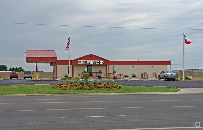
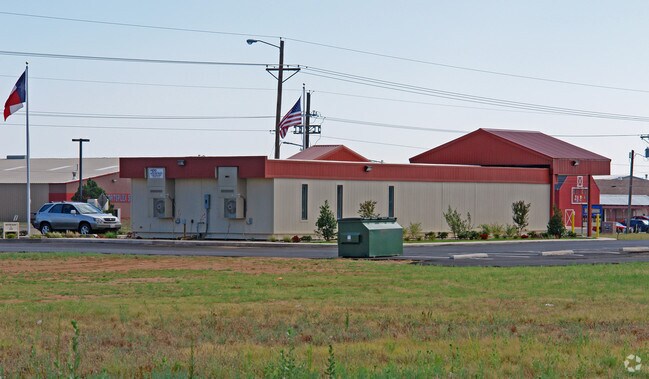
Property Record
7207 82Nd St, Lubbock, TX 79424

Property Detail
7207 82Nd St
R300287
WESTWOOD TR D1
Commercialnec
Lubbock
B and X Area of moderate flood hazard, usually the area between the limits of the 100-year and 500-year floods.
Texas
2024
1.44 AC
2025
South Outer Lubbock
010413
Lubbock
5,105 SF
Lubbock, TX
NEARBY LISTINGS FOR SALE OR LEASE
DEMOGRAPHICS near 7207 82Nd St
1 mile
3 mile
5 mile
2025 Total Population
7,063
50,676
128,737
2030 Population
7,366
53,286
135,275
Pop Growth 2025-2030
+ 4.29%
+ 5.15%
+ 5.08%
Average Age
34
37
37
2025 Total Households
2,453
20,154
52,719
HH Growth 2025-2030
+ 4.53%
+ 5.38%
+ 5.31%
Median Household Inc
$86,298
$86,047
$71,414
Avg Household Size
2.90
2.50
2.40
2025 Avg HH Vehicles
2.00
2.00
2.00
Median Home Value
$248,548
$264,724
$252,918
Median Year Built
2005
2003
1993
Nearby Places
Map Layers
Map Styles
 Street
 Aerial
Transit
 Traffic
 Biking
Places
Listings with unknown addresses are not visible on the map
- Restaurants
- Banks
- Shops
- Fitness
- Groceries
PUBLIC TRANSPORTATION
AIRPORT
Lubbock Preston Smith International
Drive
Walk
Distance
Lubbock Preston Smith International
33 min
19.6 mi
Freight Ports
Tulsa Port Of Catoosa
Drive
Walk
Distance
Tulsa Port Of Catoosa
516 min
477.0 mi
Nearby Properties
Address
Land Use
TOTAL SIZE
Lot Size
Zoning
Address
Land Use
TOTAL SIZE
Lot Size
Zoning
111,769 SF
25.03 AC
Address
Land Use
TOTAL SIZE
Lot Size
Zoning
236,871 SF
6.77 AC
Address
Land Use
TOTAL SIZE
Lot Size
Zoning
276,552 SF
12.05 AC
Address
Land Use
TOTAL SIZE
Lot Size
Zoning
290,322 SF
11.96 AC
Address
Land Use
TOTAL SIZE
Lot Size
Zoning
289,796 SF
14.67 AC
Address
Land Use
TOTAL SIZE
Lot Size
Zoning
187,409 SF
15.92 AC
Address
Land Use
TOTAL SIZE
Lot Size
Zoning
108,363 SF
11.35 AC
Address
Land Use
TOTAL SIZE
Lot Size
Zoning
215,338 SF
26.49 AC
Address
Land Use
TOTAL SIZE
Lot Size
Zoning
196,103 SF
12.33 AC
Address
Land Use
TOTAL SIZE
Lot Size
Zoning
149,710 SF
10.57 AC
Address
Land Use
TOTAL SIZE
Lot Size
Zoning
24,540 SF
8.06 AC
Address
Land Use
TOTAL SIZE
Lot Size
Zoning
137.37 AC
Address
Land Use
TOTAL SIZE
Lot Size
Zoning
69.21 AC
Address
Land Use
TOTAL SIZE
Lot Size
Zoning
103,560 SF
7.04 AC
Address
Land Use
TOTAL SIZE
Lot Size
Zoning
79,733 SF
3.14 AC
Address
Land Use
TOTAL SIZE
Lot Size
Zoning
172,627 SF
8.12 AC
Address
Land Use
TOTAL SIZE
Lot Size
Zoning
139,501 SF
10.56 AC
Address
Land Use
TOTAL SIZE
Lot Size
Zoning
198,209 SF
9.98 AC
Address
Land Use
TOTAL SIZE
Lot Size
Zoning
75,154 SF
6.95 AC
Address
Land Use
TOTAL SIZE
Lot Size
Zoning
128,355 SF
8.91 AC
Address
Land Use
TOTAL SIZE
Lot Size
Zoning
139,085 SF
17.53 AC
Address
Land Use
TOTAL SIZE
Lot Size
Zoning
75,080 SF
0.04 AC
Address
Land Use
TOTAL SIZE
Lot Size
Zoning
217,245 SF
61.96 AC
Address
Land Use
TOTAL SIZE
Lot Size
Zoning
55,778 SF
8.71 AC
Address
Land Use
TOTAL SIZE
Lot Size
Zoning
175,958 SF
8.13 AC
Address
Land Use
TOTAL SIZE
Lot Size
Zoning
40,118 SF
3.82 AC
Address
Land Use
TOTAL SIZE
Lot Size
Zoning
81,695 SF
2.70 AC
Address
Land Use
TOTAL SIZE
Lot Size
Zoning
125,090 SF
12.03 AC
Address
Land Use
TOTAL SIZE
Lot Size
Zoning
99,432 SF
10.29 AC
Address
Land Use
TOTAL SIZE
Lot Size
Zoning
78,993 SF
8.77 AC
The World's #1 Commercial Real Estate Marketplace
Connect with us
© 2026 CoStar Group
The information above has been obtained from sources believed reliable. While we do not doubt its accuracy we have not verified it and make no guarantee, warranty or representation about it. It is your responsibility to independently confirm its accuracy and completeness. Any projections, opinions, assumptions, or estimates used are for example only and do not represent the current or future performance of the property. The value of this transaction to you depends on tax and other factors which should be evaluated by your tax, financial, and legal advisors. You and your advisors should conduct a careful, independent investigation of the property to determine to your satisfaction the suitability of the property for your needs.