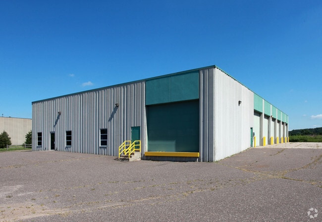
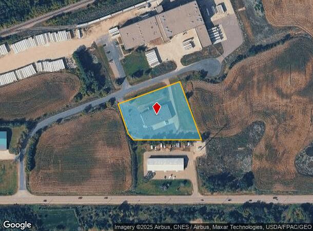
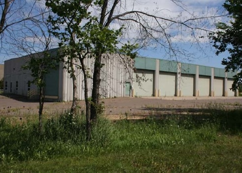
Property Record
721 Norflex Dr, Hudson, WI 54016
NEARBY LISTINGS FOR SALE OR LEASE
-
-
View all Hudson listings for sale on LoopNet.com
Property Detail
721 Norflex Dr
Minneapolis-St. Paul-Bloomington, MN-WI
SEC 23 T29N R19W PT N1/2 NW1/4 FKA LOT 4 OF CSM 10/2807 (2 AC) NKA LOT 9 CSM 25-5832 (2.18 AC) STATE ASSESSED MANUF
020-1062-30-210
St Croix
Manufacturinglight
Wisconsin
X
4,9
55093C0025E
2.18 AC
2025
St Croix County
2024
Minneapolis/St Paul
120202
DEMOGRAPHICS near 721 Norflex Dr
1 Mile
3 Mile
5 Mile
2024 Total Population
1,167
7,916
32,527
2029 Population
1,261
8,533
35,082
Pop Growth 2024-2029
+ 8.05%
+ 7.79%
+ 7.86%
Average Age
39
41
41
2024 Total Households
371
2,696
12,526
HH Growth 2024-2029
+ 8.09%
+ 7.83%
+ 7.90%
Median Household Inc
$163,587
$145,256
$114,228
Avg Household Size
3.10
2.90
2.60
2024 Avg HH Vehicles
3.00
3.00
2.00
Median Home Value
$434,134
$387,696
$357,571
Median Year Built
2002
1998
1995
Nearby Places
Map Layers
Map Styles
 Street
 Aerial
- Restaurants
- Banks
- Shops
- Fitness
- Groceries
PUBLIC TRANSPORTATION
AIRPORT
Minneapolis-St Paul International/Wold-Chamberlain
DRIVE
WALK
Distance
Minneapolis-St Paul International/Wold-Chamberlain
45 min
33.0 mi
Nearby Properties
Address
Land Use
TOTAL SIZE
Lot Size
Zoning
Address
Land Use
TOTAL SIZE
Lot Size
Zoning
16.42 AC
Address
Land Use
TOTAL SIZE
Lot Size
Zoning
43,342 SF
8.11 AC
B-2
Address
Land Use
TOTAL SIZE
Lot Size
Zoning
1.87 AC
Address
Land Use
TOTAL SIZE
Lot Size
Zoning
9.20 AC
Address
Land Use
TOTAL SIZE
Lot Size
Zoning
5.20 AC
Address
Land Use
TOTAL SIZE
Lot Size
Zoning
2.97 AC
Address
Land Use
TOTAL SIZE
Lot Size
Zoning
1.36 AC
Address
Land Use
TOTAL SIZE
Lot Size
Zoning
3.27 AC
Address
Land Use
TOTAL SIZE
Lot Size
Zoning
2.46 AC
Address
Land Use
TOTAL SIZE
Lot Size
Zoning
3.66 AC
Address
Land Use
TOTAL SIZE
Lot Size
Zoning
2.24 AC
Address
Land Use
TOTAL SIZE
Lot Size
Zoning
2.15 AC
Address
Land Use
TOTAL SIZE
Lot Size
Zoning
24.17 AC
Address
Land Use
TOTAL SIZE
Lot Size
Zoning
Address
Land Use
TOTAL SIZE
Lot Size
Zoning
2.73 AC
Address
Land Use
TOTAL SIZE
Lot Size
Zoning
2.01 AC
Address
Land Use
TOTAL SIZE
Lot Size
Zoning
Address
Land Use
TOTAL SIZE
Lot Size
Zoning
5.10 AC
Address
Land Use
TOTAL SIZE
Lot Size
Zoning
4.95 AC
Address
Land Use
TOTAL SIZE
Lot Size
Zoning
Address
Land Use
TOTAL SIZE
Lot Size
Zoning
1.91 AC
Address
Land Use
TOTAL SIZE
Lot Size
Zoning
1.99 AC
Address
Land Use
TOTAL SIZE
Lot Size
Zoning
2.26 AC
Address
Land Use
TOTAL SIZE
Lot Size
Zoning
2.23 AC
Address
Land Use
TOTAL SIZE
Lot Size
Zoning
1.09 AC
Address
Land Use
TOTAL SIZE
Lot Size
Zoning
2.67 AC
Address
Land Use
TOTAL SIZE
Lot Size
Zoning
3.30 AC
Address
Land Use
TOTAL SIZE
Lot Size
Zoning
2.95 AC
Address
Land Use
TOTAL SIZE
Lot Size
Zoning
3.51 AC
Address
Land Use
TOTAL SIZE
Lot Size
Zoning
The World's #1 Commercial Real Estate Marketplace
Connect with us
© 2026 CoStar Group
The information above has been obtained from sources believed reliable. While we do not doubt its accuracy we have not verified it and make no guarantee, warranty or representation about it. It is your responsibility to independently confirm its accuracy and completeness. Any projections, opinions, assumptions, or estimates used are for example only and do not represent the current or future performance of the property. The value of this transaction to you depends on tax and other factors which should be evaluated by your tax, financial, and legal advisors. You and your advisors should conduct a careful, independent investigation of the property to determine to your satisfaction the suitability of the property for your needs.