Property Record
7211 S Hill Dr, Manassas, VA 20109


NEARBY LISTINGS FOR SALE OR LEASE
Property Detail
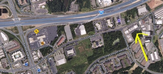
7211 S Hill Dr
Washington-Arlington-Alexandria, DC-VA-MD-WV
Ballsford
7697-56-8308
BALLSFORD IND SEC 3
Vacantlandnec
Prince William
X
Virginia
51059C0225E
8308
2024
1.83 AC
2025
Route 29/I-66 Corridor
901602
Washington, DC
DEMOGRAPHICS near 7211 S Hill Dr
1 Mile
3 Mile
5 Mile
2024 Total Population
9,845
69,064
187,145
2029 Population
10,117
70,083
187,479
Pop Growth 2024-2029
+ 2.76%
+ 1.48%
+ 0.18%
Average Age
35
35
36
2024 Total Households
3,064
21,373
60,620
HH Growth 2024-2029
+ 2.87%
+ 1.65%
+ 0.16%
Median Household Inc
$84,509
$89,524
$107,626
Avg Household Size
3.10
3.20
3.00
2024 Avg HH Vehicles
2.00
2.00
2.00
Median Home Value
$360,869
$356,950
$422,697
Median Year Built
1981
1983
1988
Nearby Places
Map Layers
Map Styles
 Street
 Aerial
- Restaurants
- Banks
- Shops
- Fitness
- Groceries
PUBLIC TRANSPORTATION
COMMUTER RAIL
Manassas (Manassas Line - Virginia Railway Express)
DRIVE
WALK
Distance
Manassas (Manassas Line - Virginia Railway Express)
12 min
5.2 mi
Broad Run/Airport (Manassas Line - Virginia Railway Express)
DRIVE
WALK
Distance
Broad Run/Airport (Manassas Line - Virginia Railway Express)
14 min
6.9 mi
AIRPORT
Washington Dulles International
DRIVE
WALK
Distance
Washington Dulles International
30 min
17.9 mi
Ronald Reagan Washington Ntl
DRIVE
WALK
Distance
Ronald Reagan Washington Ntl
44 min
32.5 mi
Freight Ports
Port of Baltimore
DRIVE
WALK
Distance
Port of Baltimore
89 min
68.1 mi
SALE & LEASE HISTORY
LISTING DATE
SALE/LEASE

Jun 03, 2024
For Lease
Nearby Properties
Address
Land Use
TOTAL SIZE
Lot Size
Zoning
Address
Land Use
TOTAL SIZE
Lot Size
Zoning
824,085 SF
120.07 AC
MIXED
Address
Land Use
TOTAL SIZE
Lot Size
Zoning
328,915 SF
117.39 AC
030
Address
Land Use
TOTAL SIZE
Lot Size
Zoning
40.47 AC
PBD
Address
Land Use
TOTAL SIZE
Lot Size
Zoning
352,401 SF
91.60 AC
M2
Address
Land Use
TOTAL SIZE
Lot Size
Zoning
51.84 AC
MIXED
Address
Land Use
TOTAL SIZE
Lot Size
Zoning
75,816 SF
29.15 AC
R16
Address
Land Use
TOTAL SIZE
Lot Size
Zoning
29,500 SF
21.97 AC
M1
Address
Land Use
TOTAL SIZE
Lot Size
Zoning
203,544 SF
20.90 AC
GENERAL CO
Address
Land Use
TOTAL SIZE
Lot Size
Zoning
327,574 SF
34.13 AC
R16
Address
Land Use
TOTAL SIZE
Lot Size
Zoning
240,103 SF
19.93 AC
R16
Address
Land Use
TOTAL SIZE
Lot Size
Zoning
69,276 SF
18.15 AC
R16
Address
Land Use
TOTAL SIZE
Lot Size
Zoning
406,297 SF
67.08 AC
A1
Address
Land Use
TOTAL SIZE
Lot Size
Zoning
34.66 AC
PBD
Address
Land Use
TOTAL SIZE
Lot Size
Zoning
3,621 SF
48.25 AC
A1
Address
Land Use
TOTAL SIZE
Lot Size
Zoning
213,662 SF
22.18 AC
R16
Address
Land Use
TOTAL SIZE
Lot Size
Zoning
371,926 SF
38.17 AC
B1
Address
Land Use
TOTAL SIZE
Lot Size
Zoning
111,222 SF
15.75 AC
R16
Address
Land Use
TOTAL SIZE
Lot Size
Zoning
267,292 SF
13.66 AC
R16
Address
Land Use
TOTAL SIZE
Lot Size
Zoning
28.35 AC
PMD
Address
Land Use
TOTAL SIZE
Lot Size
Zoning
420,634 SF
29.54 AC
M1
Address
Land Use
TOTAL SIZE
Lot Size
Zoning
30.92 AC
PMD
Address
Land Use
TOTAL SIZE
Lot Size
Zoning
49,528 SF
15.34 AC
R16
Address
Land Use
TOTAL SIZE
Lot Size
Zoning
82,216 SF
76.98 AC
M1
Address
Land Use
TOTAL SIZE
Lot Size
Zoning
499,912 SF
49.96 AC
B1
Address
Land Use
TOTAL SIZE
Lot Size
Zoning
128,850 SF
5.04 AC
030
Address
Land Use
TOTAL SIZE
Lot Size
Zoning
75,202 SF
14.06 AC
R16
Address
Land Use
TOTAL SIZE
Lot Size
Zoning
78,124 SF
13.92 AC
R16
Address
Land Use
TOTAL SIZE
Lot Size
Zoning
18,750 SF
12.25 AC
M1
Address
Land Use
TOTAL SIZE
Lot Size
Zoning
175,260 SF
30.39 AC
MT
Address
Land Use
TOTAL SIZE
Lot Size
Zoning
16.44 AC
PBD
The World's #1 Commercial Real Estate Marketplace
Connect with us
© 2026 CoStar Group
The information above has been obtained from sources believed reliable. While we do not doubt its accuracy we have not verified it and make no guarantee, warranty or representation about it. It is your responsibility to independently confirm its accuracy and completeness. Any projections, opinions, assumptions, or estimates used are for example only and do not represent the current or future performance of the property. The value of this transaction to you depends on tax and other factors which should be evaluated by your tax, financial, and legal advisors. You and your advisors should conduct a careful, independent investigation of the property to determine to your satisfaction the suitability of the property for your needs.