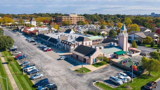
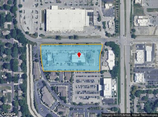
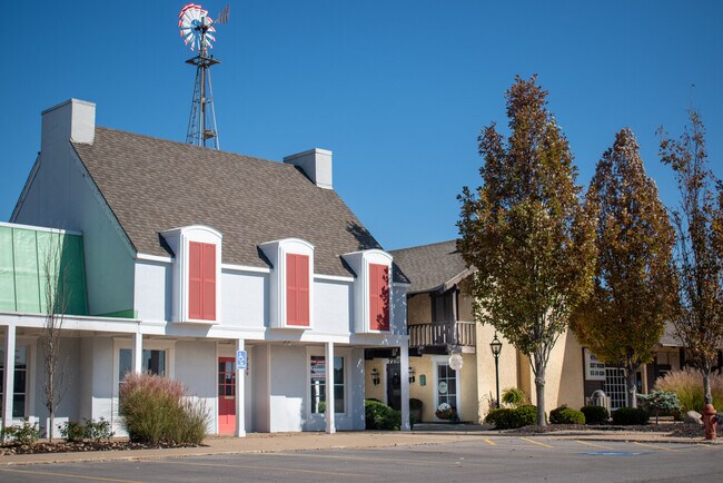
Property Record
7211 W 97Th St, Overland Park, KS 66212
NEARBY LISTINGS FOR SALE OR LEASE
Property Detail
7211 W 97Th St
NF251306-3011
6-13-25 PT SE1/4 NE1/4 BG 353.84 S & 306 W NE CR SE1/4NE1/4 N 135.55 NLY & NE 92.12 & 81.66 N 9.06 TO S R/W 97 ST W 725.65 S 74.98 S& SE 243.77 E 660.02 TO BG 5.031 ACS M/L OPC 810F
Regionalshoppingcenterormallwithanchorstore
Johnson
AE
Kansas
20091C0053G
4.96 AC
2024
Northeast Johnson County
2024
Kansas City
051804
Kansas City, MO-KS
50,226 SF
DEMOGRAPHICS near 7211 W 97Th St
1 Mile
3 Mile
5 Mile
2024 Total Population
11,466
97,154
259,578
2029 Population
11,918
101,436
268,907
Pop Growth 2024-2029
+ 3.94%
+ 4.41%
+ 3.59%
Average Age
43
41
42
2024 Total Households
5,133
42,958
115,605
HH Growth 2024-2029
+ 4.25%
+ 4.62%
+ 3.71%
Median Household Inc
$75,591
$82,020
$83,169
Avg Household Size
2.10
2.20
2.20
2024 Avg HH Vehicles
2.00
2.00
2.00
Median Home Value
$288,092
$310,935
$315,588
Median Year Built
1967
1971
1975
Nearby Places
Map Layers
Map Styles
 Street
 Aerial
- Restaurants
- Banks
- Shops
- Fitness
- Groceries
PUBLIC TRANSPORTATION
AIRPORT
Kansas City International
DRIVE
WALK
Distance
Kansas City International
43 min
30.6 mi
Nearby Properties
Address
Land Use
TOTAL SIZE
Lot Size
Zoning
Address
Land Use
TOTAL SIZE
Lot Size
Zoning
47.39 AC
AG
Address
Land Use
TOTAL SIZE
Lot Size
Zoning
177,588 SF
9.27 AC
CP-O
Address
Land Use
TOTAL SIZE
Lot Size
Zoning
189,882 SF
13.04 AC
CP-O
Address
Land Use
TOTAL SIZE
Lot Size
Zoning
316,432 SF
29.39 AC
R-1
Address
Land Use
TOTAL SIZE
Lot Size
Zoning
3,426,762 SF
183.73 AC
CP-O
Address
Land Use
TOTAL SIZE
Lot Size
Zoning
188,248 SF
4.78 AC
C-2
Address
Land Use
TOTAL SIZE
Lot Size
Zoning
122,309 SF
76.14 AC
R-1
Address
Land Use
TOTAL SIZE
Lot Size
Zoning
234,968 SF
37.40 AC
R-1
Address
Land Use
TOTAL SIZE
Lot Size
Zoning
325,588 SF
36.63 AC
SD-CR
Address
Land Use
TOTAL SIZE
Lot Size
Zoning
120,305 SF
7.01 AC
CP-O
Address
Land Use
TOTAL SIZE
Lot Size
Zoning
166,039 SF
35.38 AC
R-1
Address
Land Use
TOTAL SIZE
Lot Size
Zoning
81,051 SF
7.17 AC
R-1
Address
Land Use
TOTAL SIZE
Lot Size
Zoning
110,710 SF
4.66 AC
CP-O
Address
Land Use
TOTAL SIZE
Lot Size
Zoning
81,762 SF
9.66 AC
R-1
Address
Land Use
TOTAL SIZE
Lot Size
Zoning
62,293 SF
6.50 AC
MXD
Address
Land Use
TOTAL SIZE
Lot Size
Zoning
146,143 SF
10.59 AC
CP-2
Address
Land Use
TOTAL SIZE
Lot Size
Zoning
113,263 SF
3.53 AC
CP-O
Address
Land Use
TOTAL SIZE
Lot Size
Zoning
73,383 SF
9.53 AC
R-1
Address
Land Use
TOTAL SIZE
Lot Size
Zoning
411,435 SF
17.41 AC
CP-2
Address
Land Use
TOTAL SIZE
Lot Size
Zoning
79,437 SF
4.12 AC
DFD
Address
Land Use
TOTAL SIZE
Lot Size
Zoning
94,034 SF
6.96 AC
MXD
Address
Land Use
TOTAL SIZE
Lot Size
Zoning
114,689 SF
60.46 AC
R-1
Address
Land Use
TOTAL SIZE
Lot Size
Zoning
73,793 SF
9.21 AC
R-1A
Address
Land Use
TOTAL SIZE
Lot Size
Zoning
69,958 SF
10.93 AC
R-1
Address
Land Use
TOTAL SIZE
Lot Size
Zoning
85,703 SF
7.84 AC
R-1
Address
Land Use
TOTAL SIZE
Lot Size
Zoning
355,197 SF
30.05 AC
CP-2
Address
Land Use
TOTAL SIZE
Lot Size
Zoning
179,965 SF
6.15 AC
CP-O
Address
Land Use
TOTAL SIZE
Lot Size
Zoning
863,831 SF
31.21 AC
BP
Address
Land Use
TOTAL SIZE
Lot Size
Zoning
120,225 SF
9.13 AC
R-1
Address
Land Use
TOTAL SIZE
Lot Size
Zoning
89,002 SF
8.77 AC
R-1
The World's #1 Commercial Real Estate Marketplace
Connect with us
© 2025 CoStar Group
The information above has been obtained from sources believed reliable. While we do not doubt its accuracy we have not verified it and make no guarantee, warranty or representation about it. It is your responsibility to independently confirm its accuracy and completeness. Any projections, opinions, assumptions, or estimates used are for example only and do not represent the current or future performance of the property. The value of this transaction to you depends on tax and other factors which should be evaluated by your tax, financial, and legal advisors. You and your advisors should conduct a careful, independent investigation of the property to determine to your satisfaction the suitability of the property for your needs.