Property Record
7212 E Kings Canyon Rd, Fresno, CA 93737


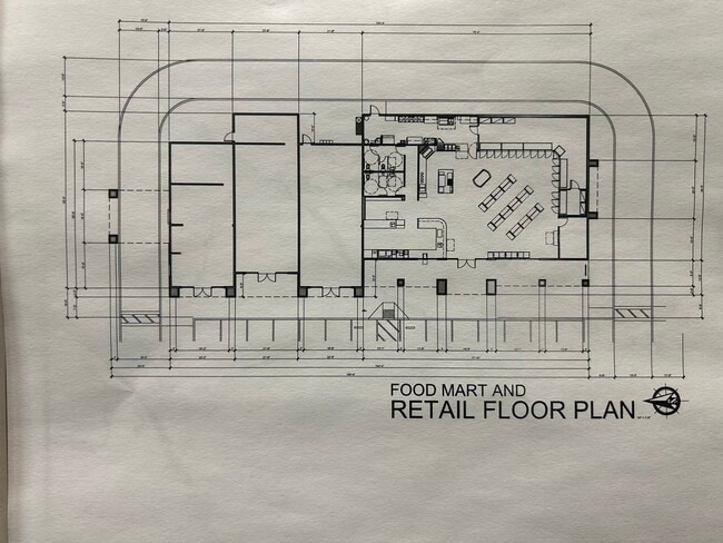
Current Lease Availabilities
NEARBY LISTINGS FOR SALE OR LEASE
Property Detail
7212 E Kings Canyon Rd
Fresno
Calimyrna Colony
Fresno, CA
Fresno
313-081-61
California
Residentialnec
6.85 AC
X
E Outlying Fresno County
06019C2135H
DEMOGRAPHICS near 7212 E Kings Canyon Rd
1 Mile
3 Mile
5 Mile
2024 Total Population
7,366
51,507
164,963
2029 Population
7,701
53,391
169,209
Pop Growth 2024-2029
+ 4.55%
+ 3.66%
+ 2.57%
Average Age
34
34
35
2024 Total Households
2,015
14,608
48,377
HH Growth 2024-2029
+ 4.62%
+ 3.66%
+ 2.59%
Median Household Inc
$108,046
$93,063
$72,004
Avg Household Size
3.60
3.50
3.30
2024 Avg HH Vehicles
2.00
2.00
2.00
Median Home Value
$350,226
$363,623
$349,066
Median Year Built
2006
2000
1986
Nearby Places
Map Layers
Map Styles
 Street
 Aerial
- Restaurants
- Banks
- Shops
- Fitness
- Groceries
PUBLIC TRANSPORTATION
COMMUTER RAIL
Fresno (San Joaquins - Amtrak)
DRIVE
WALK
Distance
Fresno (San Joaquins - Amtrak)
12 min
8.5 mi
AIRPORT
Fresno Yosemite International
DRIVE
WALK
Distance
Fresno Yosemite International
9 min
5.5 mi
Freight Ports
Port of Stockton
DRIVE
WALK
Distance
Port of Stockton
160 min
135.5 mi
Nearby Properties
Address
Land Use
TOTAL SIZE
Lot Size
Zoning
Address
Land Use
TOTAL SIZE
Lot Size
Zoning
74,499 SF
17.48 AC
M3
Address
Land Use
TOTAL SIZE
Lot Size
Zoning
2,008 SF
20.14 AC
M1
Address
Land Use
TOTAL SIZE
Lot Size
Zoning
216,342 SF
28.49 AC
Address
Land Use
TOTAL SIZE
Lot Size
Zoning
372,862 SF
42.43 AC
R1
Address
Land Use
TOTAL SIZE
Lot Size
Zoning
60,227 SF
4.72 AC
M1
Address
Land Use
TOTAL SIZE
Lot Size
Zoning
93,172 SF
4.97 AC
Address
Land Use
TOTAL SIZE
Lot Size
Zoning
249,126 SF
17.33 AC
SPLIT
Address
Land Use
TOTAL SIZE
Lot Size
Zoning
102,765 SF
8.90 AC
M1
Address
Land Use
TOTAL SIZE
Lot Size
Zoning
76,720 SF
10.78 AC
Address
Land Use
TOTAL SIZE
Lot Size
Zoning
69,015 SF
8.15 AC
C1
Address
Land Use
TOTAL SIZE
Lot Size
Zoning
20,038 SF
2 AC
CP
Address
Land Use
TOTAL SIZE
Lot Size
Zoning
95,792 SF
2.31 AC
Address
Land Use
TOTAL SIZE
Lot Size
Zoning
71,377 SF
4.37 AC
RS1
Address
Land Use
TOTAL SIZE
Lot Size
Zoning
62,400 SF
5.82 AC
C3
Address
Land Use
TOTAL SIZE
Lot Size
Zoning
59,442 SF
2.65 AC
R3
Address
Land Use
TOTAL SIZE
Lot Size
Zoning
52,776 SF
0.79 AC
CR/CZ
Address
Land Use
TOTAL SIZE
Lot Size
Zoning
150,080 SF
7.99 AC
M1
Address
Land Use
TOTAL SIZE
Lot Size
Zoning
25,600 SF
1.99 AC
IL
Address
Land Use
TOTAL SIZE
Lot Size
Zoning
90,940 SF
5.31 AC
R2
Address
Land Use
TOTAL SIZE
Lot Size
Zoning
41,156 SF
4.64 AC
Address
Land Use
TOTAL SIZE
Lot Size
Zoning
42,630 SF
0.59 AC
CR/CZ
Address
Land Use
TOTAL SIZE
Lot Size
Zoning
217,130 SF
10.53 AC
SL
Address
Land Use
TOTAL SIZE
Lot Size
Zoning
57,407 SF
3.68 AC
R2
Address
Land Use
TOTAL SIZE
Lot Size
Zoning
23,749 SF
2.83 AC
C3
Address
Land Use
TOTAL SIZE
Lot Size
Zoning
52,065 SF
1.89 AC
C2
Address
Land Use
TOTAL SIZE
Lot Size
Zoning
59,978 SF
7.26 AC
C2
Address
Land Use
TOTAL SIZE
Lot Size
Zoning
57,390 SF
2.47 AC
R2
Address
Land Use
TOTAL SIZE
Lot Size
Zoning
82,984 SF
3.64 AC
R2
Address
Land Use
TOTAL SIZE
Lot Size
Zoning
40,069 SF
3.46 AC
C3
The World's #1 Commercial Real Estate Marketplace
Connect with us
© 2025 CoStar Group
The information above has been obtained from sources believed reliable. While we do not doubt its accuracy we have not verified it and make no guarantee, warranty or representation about it. It is your responsibility to independently confirm its accuracy and completeness. Any projections, opinions, assumptions, or estimates used are for example only and do not represent the current or future performance of the property. The value of this transaction to you depends on tax and other factors which should be evaluated by your tax, financial, and legal advisors. You and your advisors should conduct a careful, independent investigation of the property to determine to your satisfaction the suitability of the property for your needs.