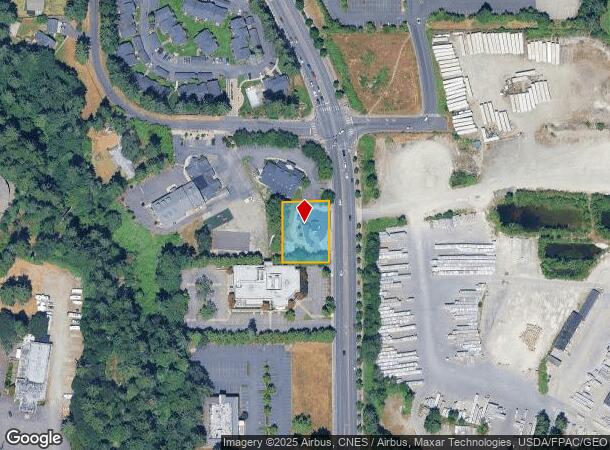
Property Record
7214 Bridgeport Way W, Lakewood, WA 98499
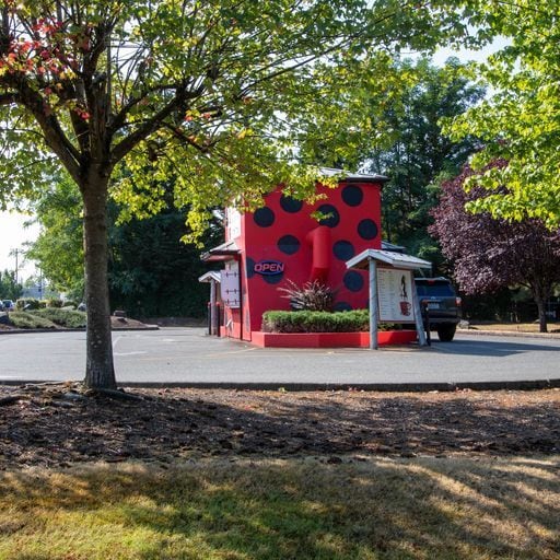
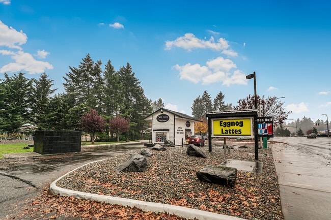
This Property Is For Sale
NEARBY LISTINGS FOR SALE OR LEASE
Property Detail
7214 Bridgeport Way W
022026-3156
SECTION 26 TOWNSHIP 20 RANGE 02 QUARTER 31 PARCEL B OF ROS FOR BLA 2019-11-19-5001 DESC AS FOLL COM ON W LI OF SD GOVT LOT 5 AT A PT 582.2 FT N OF SW COR THEREOF TH S 89 DEG 52 MIN E PAR/W S LI OF SD GOVT LOT 5 501.29 FT TO POB TH N 00 DEG 08 MIN E 1
Restaurantbuilding
Pierce
X
Washington
53053C0284E
5
2024
0.43 AC
2025
Univ. Place/Lakewood
072106
Seattle/Puget Sound
264 SF
Seattle-Tacoma-Bellevue, WA
DEMOGRAPHICS near 7214 Bridgeport Way W
1 Mile
3 Mile
5 Mile
2024 Total Population
13,325
112,901
272,524
2029 Population
13,866
116,541
281,944
Pop Growth 2024-2029
+ 4.06%
+ 3.22%
+ 3.46%
Average Age
39
39
38
2024 Total Households
5,557
44,698
106,199
HH Growth 2024-2029
+ 4.23%
+ 3.31%
+ 3.54%
Median Household Inc
$67,617
$70,075
$71,230
Avg Household Size
2.30
2.40
2.50
2024 Avg HH Vehicles
2.00
2.00
2.00
Median Home Value
$436,337
$433,003
$423,150
Median Year Built
1982
1977
1974
Nearby Places
- Restaurants
- Banks
- Shops
- Fitness
- Groceries
PUBLIC TRANSPORTATION
COMMUTER RAIL
DRIVE
WALK
Distance
6 min
2.9 mi
DRIVE
WALK
Distance
9 min
4.7 mi
AIRPORT
Seattle-Tacoma International
DRIVE
WALK
Distance
Seattle-Tacoma International
45 min
27.7 mi
Freight Ports
Port of Tacoma
DRIVE
WALK
Distance
Port of Tacoma
15 min
9.5 mi
Nearby Properties
Address
Land Use
TOTAL SIZE
Lot Size
Zoning
Address
Land Use
TOTAL SIZE
Lot Size
Zoning
515,971 SF
42.45 AC
Address
Land Use
TOTAL SIZE
Lot Size
Zoning
1,379,695 SF
215.71 AC
LKWD
Address
Land Use
TOTAL SIZE
Lot Size
Zoning
509,712 SF
70.20 AC
PI
Address
Land Use
TOTAL SIZE
Lot Size
Zoning
566,355 SF
69.03 AC
Address
Land Use
TOTAL SIZE
Lot Size
Zoning
1,056,518 SF
65.31 AC
LKWD
Address
Land Use
TOTAL SIZE
Lot Size
Zoning
12,075 SF
254.10 AC
LKWD
Address
Land Use
TOTAL SIZE
Lot Size
Zoning
87,528 SF
224.76 AC
R1
Address
Land Use
TOTAL SIZE
Lot Size
Zoning
412,549 SF
56.87 AC
R1
Address
Land Use
TOTAL SIZE
Lot Size
Zoning
309,156 SF
33.79 AC
M2
Address
Land Use
TOTAL SIZE
Lot Size
Zoning
296,154 SF
46.83 AC
R2
Address
Land Use
TOTAL SIZE
Lot Size
Zoning
8,177 SF
343.30 AC
R1
Address
Land Use
TOTAL SIZE
Lot Size
Zoning
238,852 SF
15.34 AC
OSR1
Address
Land Use
TOTAL SIZE
Lot Size
Zoning
244,143 SF
11.79 AC
MF3
Address
Land Use
TOTAL SIZE
Lot Size
Zoning
211,786 SF
16.84 AC
MF2
Address
Land Use
TOTAL SIZE
Lot Size
Zoning
149,844 SF
11.50 AC
MF
Address
Land Use
TOTAL SIZE
Lot Size
Zoning
254,934 SF
5.02 AC
MF
Address
Land Use
TOTAL SIZE
Lot Size
Zoning
140,287 SF
12.95 AC
MF2
Address
Land Use
TOTAL SIZE
Lot Size
Zoning
162,000 SF
9.93 AC
Address
Land Use
TOTAL SIZE
Lot Size
Zoning
125,725 SF
9.17 AC
MF2
Address
Land Use
TOTAL SIZE
Lot Size
Zoning
393,488 SF
15.58 AC
MHR
Address
Land Use
TOTAL SIZE
Lot Size
Zoning
149,364 SF
35.69 AC
PI
Address
Land Use
TOTAL SIZE
Lot Size
Zoning
332,140 SF
9.23 AC
M2
Address
Land Use
TOTAL SIZE
Lot Size
Zoning
124,308 SF
9.38 AC
PI
Address
Land Use
TOTAL SIZE
Lot Size
Zoning
128,914 SF
16.03 AC
Address
Land Use
TOTAL SIZE
Lot Size
Zoning
267,056 SF
39.14 AC
PI
Address
Land Use
TOTAL SIZE
Lot Size
Zoning
61.20 AC
M2
Address
Land Use
TOTAL SIZE
Lot Size
Zoning
190,976 SF
6.49 AC
R4L
Address
Land Use
TOTAL SIZE
Lot Size
Zoning
160,514 SF
15.61 AC
MF2
Address
Land Use
TOTAL SIZE
Lot Size
Zoning
293,624 SF
21.16 AC
IBP
Address
Land Use
TOTAL SIZE
Lot Size
Zoning
169,397 SF
18.65 AC
CBD
The World's #1 Commercial Real Estate Marketplace
Connect with us
© 2025 CoStar Group
The information above has been obtained from sources believed reliable. While we do not doubt its accuracy we have not verified it and make no guarantee, warranty or representation about it. It is your responsibility to independently confirm its accuracy and completeness. Any projections, opinions, assumptions, or estimates used are for example only and do not represent the current or future performance of the property. The value of this transaction to you depends on tax and other factors which should be evaluated by your tax, financial, and legal advisors. You and your advisors should conduct a careful, independent investigation of the property to determine to your satisfaction the suitability of the property for your needs.