Property Record
7215 E Silverstone Dr, Scottsdale, AZ 85255


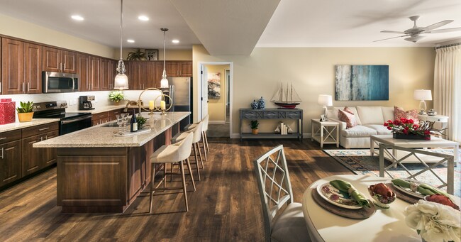
Property Detail
7215 E Silverstone Dr
212-03-597
SILVERSTONE AT PINNACLE PEAK MOD MCR 883-17
Apartment
Maricopa
PAD
Arizona
AO River or stream flood hazard areas, and areas with a 1% or greater chance of shallow flooding each year. These areas have a 26% chance of flooding over the life of a 30-year mortgage.
e
2025
16.71 AC
2025
North Scottsdale
216841
Phoenix
397,568 SF
Phoenix-Mesa-Chandler, AZ
NEARBY LISTINGS FOR SALE OR LEASE
-
-
View all Scottsdale listings for sale on LoopNet.com
DEMOGRAPHICS near 7215 E Silverstone Dr
1 mile
3 mile
5 mile
2025 Total Population
6,398
36,265
121,944
2030 Population
6,710
38,808
129,073
Pop Growth 2025-2030
+ 4.88%
+ 7.01%
+ 5.85%
Average Age
46
46
44
2025 Total Households
2,637
16,966
52,967
HH Growth 2025-2030
+ 4.89%
+ 7.54%
+ 6.37%
Median Household Inc
$127,724
$121,193
$129,005
Avg Household Size
2.30
2.10
2.30
2025 Avg HH Vehicles
2.00
2.00
2.00
Median Home Value
$829,866
$901,206
$849,850
Median Year Built
1999
2003
1999
Nearby Places
Map Layers
Map Styles
 Street
 Aerial
Layers
 Traffic
 Biking
Places
Listings with unknown addresses are not visible on the map
- Restaurants
- Banks
- Shops
- Fitness
- Groceries
PUBLIC TRANSPORTATION
AIRPORT
Phoenix Sky Harbor International
Drive
Walk
Distance
Phoenix Sky Harbor International
37 min
26.2 mi
Freight Ports
Port of San Diego
Drive
Walk
Distance
Port of San Diego
424 min
377.7 mi
Nearby Properties
Address
Land Use
TOTAL SIZE
Lot Size
Zoning
Address
Land Use
TOTAL SIZE
Lot Size
Zoning
20.98 AC
Address
Land Use
TOTAL SIZE
Lot Size
Zoning
13.01 AC
Address
Land Use
TOTAL SIZE
Lot Size
Zoning
14.58 AC
Address
Land Use
TOTAL SIZE
Lot Size
Zoning
1,479,005 SF
12.55 AC
PC
Address
Land Use
TOTAL SIZE
Lot Size
Zoning
Address
Land Use
TOTAL SIZE
Lot Size
Zoning
Address
Land Use
TOTAL SIZE
Lot Size
Zoning
229,856 SF
7.71 AC
C-T
Address
Land Use
TOTAL SIZE
Lot Size
Zoning
368,657 SF
40.11 AC
Address
Land Use
TOTAL SIZE
Lot Size
Zoning
734,840 SF
33.12 AC
M-H
Address
Land Use
TOTAL SIZE
Lot Size
Zoning
487,786 SF
18.42 AC
S1
Address
Land Use
TOTAL SIZE
Lot Size
Zoning
90.73 AC
O-S
Address
Land Use
TOTAL SIZE
Lot Size
Zoning
539,135 SF
15.11 AC
R3A
Address
Land Use
TOTAL SIZE
Lot Size
Zoning
525,073 SF
8.51 AC
R4
Address
Land Use
TOTAL SIZE
Lot Size
Zoning
255,313 SF
22.54 AC
PNC
Address
Land Use
TOTAL SIZE
Lot Size
Zoning
385,376 SF
13.65 AC
PAD
Address
Land Use
TOTAL SIZE
Lot Size
Zoning
702,652 SF
4.58 AC
Address
Land Use
TOTAL SIZE
Lot Size
Zoning
375,257 SF
12 AC
M-H
Address
Land Use
TOTAL SIZE
Lot Size
Zoning
41.63 AC
I-1
Address
Land Use
TOTAL SIZE
Lot Size
Zoning
498,417 SF
5.12 AC
PRC
Address
Land Use
TOTAL SIZE
Lot Size
Zoning
240,187 SF
14.26 AC
S1
Address
Land Use
TOTAL SIZE
Lot Size
Zoning
731,843 SF
29.85 AC
M-H
Address
Land Use
TOTAL SIZE
Lot Size
Zoning
328,616 SF
10.56 AC
PAD
Address
Land Use
TOTAL SIZE
Lot Size
Zoning
297,352 SF
7.17 AC
R-18
Address
Land Use
TOTAL SIZE
Lot Size
Zoning
163,122 SF
8.63 AC
C-C
Address
Land Use
TOTAL SIZE
Lot Size
Zoning
373,066 SF
13 AC
M-H
Address
Land Use
TOTAL SIZE
Lot Size
Zoning
163,122 SF
8.70 AC
C-C
Address
Land Use
TOTAL SIZE
Lot Size
Zoning
58.66 AC
R-43AG
Address
Land Use
TOTAL SIZE
Lot Size
Zoning
161,955 SF
2.65 AC
Address
Land Use
TOTAL SIZE
Lot Size
Zoning
157,340 SF
4.40 AC
PC
The World's #1 Commercial Real Estate Marketplace
Connect with us
© 2026 CoStar Group
The information above has been obtained from sources believed reliable. While we do not doubt its accuracy we have not verified it and make no guarantee, warranty or representation about it. It is your responsibility to independently confirm its accuracy and completeness. Any projections, opinions, assumptions, or estimates used are for example only and do not represent the current or future performance of the property. The value of this transaction to you depends on tax and other factors which should be evaluated by your tax, financial, and legal advisors. You and your advisors should conduct a careful, independent investigation of the property to determine to your satisfaction the suitability of the property for your needs.