Property Record
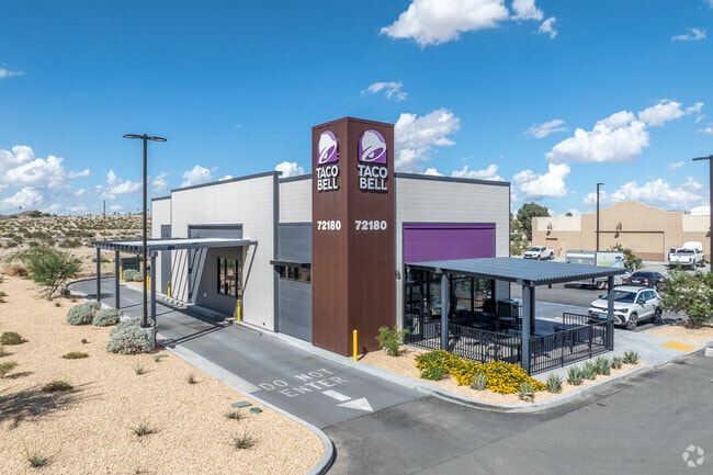
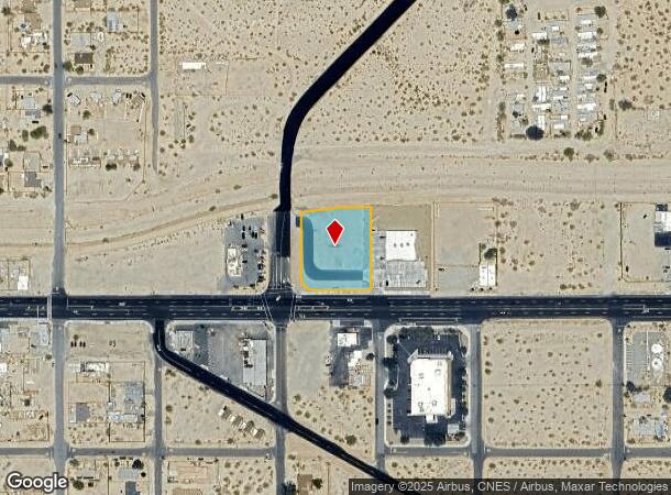
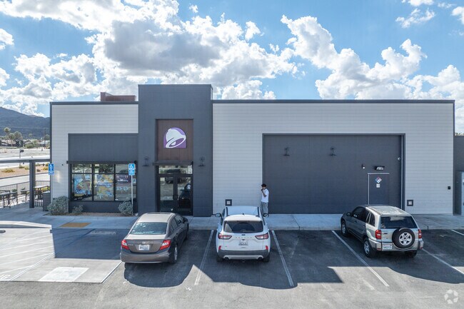
72180 29 Palms Hwy, Twentynine Palms, CA 92277
NEARBY LISTINGS FOR SALE OR LEASE
Property Detail
72180 29 Palms Hwy
Riverside-San Bernardino-Ontario, CA
LOT 18 AND 19 TRACT 3416 PER BOOK 47 PAGE 35, RECORD OF SURVEY 08-014 RECORDED IN BOOK 139 PAGE 19 AND PER LLA RECORDED ON DATE 07/9/2021 AS INSTRUMENT # 2021-0308696 ALL IN SECTION 30 TOWNSHIP 1 NORTH RANGE 9 EAST DESCRIBED AS FOLLOWS BEGINNING AT T
0618-012-89
San Bernardino
Restaurantdrivein
California
2024
18
2025
1.12 AC
010415
Twentynine Palms
2,239 SF
Inland Empire (California)
DEMOGRAPHICS near 72180 29 Palms Hwy
1 Mile
3 Mile
5 Mile
2024 Total Population
4,632
15,201
19,709
2029 Population
4,793
15,819
20,530
Pop Growth 2024-2029
+ 3.48%
+ 4.07%
+ 4.17%
Average Age
37
35
36
2024 Total Households
1,815
6,213
8,003
HH Growth 2024-2029
+ 3.47%
+ 4.10%
+ 4.24%
Median Household Inc
$80,186
$57,002
$59,999
Avg Household Size
2.50
2.40
2.40
2024 Avg HH Vehicles
2.00
2.00
2.00
Median Home Value
$312,786
$312,698
$290,144
Median Year Built
1983
1986
1985
Nearby Places
Map Layers
Map Styles
 Street
 Aerial
- Restaurants
- Banks
- Shops
- Fitness
- Groceries
Nearby Properties
Address
Land Use
TOTAL SIZE
Lot Size
Zoning
Address
Land Use
TOTAL SIZE
Lot Size
Zoning
448,671 SF
65.68 AC
Address
Land Use
TOTAL SIZE
Lot Size
Zoning
252,350 SF
29.43 AC
Address
Land Use
TOTAL SIZE
Lot Size
Zoning
49,866 SF
3.63 AC
Address
Land Use
TOTAL SIZE
Lot Size
Zoning
47,763 SF
1.43 AC
Address
Land Use
TOTAL SIZE
Lot Size
Zoning
79,214 SF
4.93 AC
Address
Land Use
TOTAL SIZE
Lot Size
Zoning
17,394 SF
1.87 AC
Address
Land Use
TOTAL SIZE
Lot Size
Zoning
35,970 SF
7.21 AC
Address
Land Use
TOTAL SIZE
Lot Size
Zoning
16,000 SF
2.78 AC
Address
Land Use
TOTAL SIZE
Lot Size
Zoning
24,425 SF
1.22 AC
Address
Land Use
TOTAL SIZE
Lot Size
Zoning
36,478 SF
2.30 AC
Address
Land Use
TOTAL SIZE
Lot Size
Zoning
45,360 SF
4.23 AC
Address
Land Use
TOTAL SIZE
Lot Size
Zoning
18,072 SF
1.38 AC
Address
Land Use
TOTAL SIZE
Lot Size
Zoning
2,000 SF
0.23 AC
Address
Land Use
TOTAL SIZE
Lot Size
Zoning
12,153 SF
1.40 AC
Address
Land Use
TOTAL SIZE
Lot Size
Zoning
10,559 SF
1.11 AC
Address
Land Use
TOTAL SIZE
Lot Size
Zoning
45,226 SF
6.71 AC
Address
Land Use
TOTAL SIZE
Lot Size
Zoning
9,370 SF
0.81 AC
Address
Land Use
TOTAL SIZE
Lot Size
Zoning
35,826 SF
2.70 AC
Address
Land Use
TOTAL SIZE
Lot Size
Zoning
960 SF
3.22 AC
Address
Land Use
TOTAL SIZE
Lot Size
Zoning
2,121 SF
0.32 AC
Address
Land Use
TOTAL SIZE
Lot Size
Zoning
7,225 SF
1.18 AC
Address
Land Use
TOTAL SIZE
Lot Size
Zoning
9,187 SF
31.13 AC
Address
Land Use
TOTAL SIZE
Lot Size
Zoning
37,380 SF
3.03 AC
Address
Land Use
TOTAL SIZE
Lot Size
Zoning
60,440 SF
2.38 AC
Address
Land Use
TOTAL SIZE
Lot Size
Zoning
18,200 SF
7.80 AC
Address
Land Use
TOTAL SIZE
Lot Size
Zoning
18,790 SF
7.71 AC
Address
Land Use
TOTAL SIZE
Lot Size
Zoning
38,453 SF
6 AC
Address
Land Use
TOTAL SIZE
Lot Size
Zoning
15,506 SF
1.53 AC
Address
Land Use
TOTAL SIZE
Lot Size
Zoning
15,136 SF
0.76 AC
The World's #1 Commercial Real Estate Marketplace
Connect with us
© 2026 CoStar Group
The information above has been obtained from sources believed reliable. While we do not doubt its accuracy we have not verified it and make no guarantee, warranty or representation about it. It is your responsibility to independently confirm its accuracy and completeness. Any projections, opinions, assumptions, or estimates used are for example only and do not represent the current or future performance of the property. The value of this transaction to you depends on tax and other factors which should be evaluated by your tax, financial, and legal advisors. You and your advisors should conduct a careful, independent investigation of the property to determine to your satisfaction the suitability of the property for your needs.