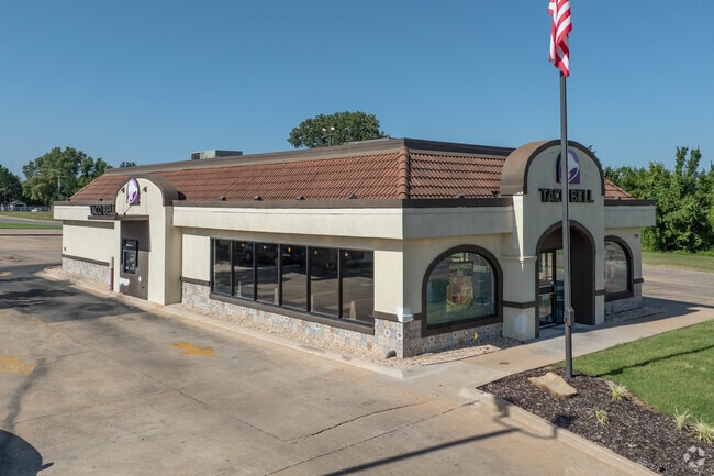
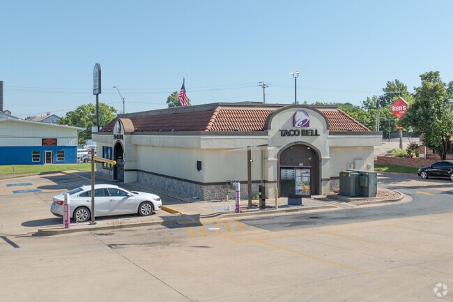
Property Record
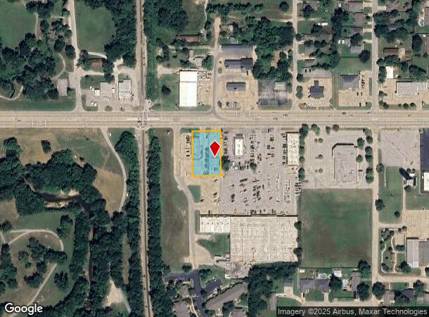
722 E Taft Ave, Sapulpa, OK 74066
NEARBY LISTINGS FOR SALE OR LEASE
Property Detail
722 E Taft Ave
Tulsa, OK
Unplatted Sapulpa
1999-02-017-011-0-675-00
2-17-11 COMM NE COR TH S 00'01 35 E55 TH N89'59 35 W748.89 TO POB TH N89'59 35 W130 TH S00'01 25 E20 0 TH S89'59 35 E130 N00'
Restaurantbuilding
Creek
X
Oklahoma
40037C0305D
11
2024
0.59 AC
2025
Creek County
021600
Tulsa
2,866 SF
DEMOGRAPHICS near 722 E Taft Ave
1 Mile
3 Mile
5 Mile
2024 Total Population
7,973
23,359
37,934
2029 Population
8,501
24,708
39,773
Pop Growth 2024-2029
+ 6.62%
+ 5.78%
+ 4.85%
Average Age
40
40
40
2024 Total Households
3,165
9,173
14,559
HH Growth 2024-2029
+ 6.73%
+ 5.85%
+ 4.92%
Median Household Inc
$50,234
$54,790
$59,748
Avg Household Size
2.40
2.50
2.50
2024 Avg HH Vehicles
2.00
2.00
2.00
Median Home Value
$131,812
$149,259
$174,658
Median Year Built
1970
1977
1985
Nearby Places
Map Layers
Map Styles
 Street
 Aerial
- Restaurants
- Banks
- Shops
- Fitness
- Groceries
PUBLIC TRANSPORTATION
AIRPORT
Tulsa International
DRIVE
WALK
Distance
Tulsa International
34 min
23.0 mi
Freight Ports
Tulsa Port Of Catoosa
DRIVE
WALK
Distance
Tulsa Port Of Catoosa
44 min
32.3 mi
SALE & LEASE HISTORY
LISTING DATE
SALE/LEASE

Jan 06, 2025
For Sale
Nearby Properties
Address
Land Use
TOTAL SIZE
Lot Size
Zoning
Address
Land Use
TOTAL SIZE
Lot Size
Zoning
92,224 SF
0.40 AC
Address
Land Use
TOTAL SIZE
Lot Size
Zoning
9,462 SF
3.79 AC
Address
Land Use
TOTAL SIZE
Lot Size
Zoning
4,785 SF
7.34 AC
Address
Land Use
TOTAL SIZE
Lot Size
Zoning
86,700 SF
22.68 AC
Address
Land Use
TOTAL SIZE
Lot Size
Zoning
12,032 SF
9.09 AC
Address
Land Use
TOTAL SIZE
Lot Size
Zoning
1,360 SF
11.70 AC
Address
Land Use
TOTAL SIZE
Lot Size
Zoning
3,176 SF
4.08 AC
Address
Land Use
TOTAL SIZE
Lot Size
Zoning
10,822 SF
10.32 AC
Address
Land Use
TOTAL SIZE
Lot Size
Zoning
1,276 SF
5.77 AC
Address
Land Use
TOTAL SIZE
Lot Size
Zoning
18,334 SF
1.78 AC
Address
Land Use
TOTAL SIZE
Lot Size
Zoning
5,085 SF
2.39 AC
Address
Land Use
TOTAL SIZE
Lot Size
Zoning
8,652 SF
4.52 AC
Address
Land Use
TOTAL SIZE
Lot Size
Zoning
7,076 SF
1.30 AC
Address
Land Use
TOTAL SIZE
Lot Size
Zoning
5,764 SF
48.93 AC
Address
Land Use
TOTAL SIZE
Lot Size
Zoning
89,000 SF
10.64 AC
Address
Land Use
TOTAL SIZE
Lot Size
Zoning
15,000 SF
6.99 AC
Address
Land Use
TOTAL SIZE
Lot Size
Zoning
1,500 SF
4.64 AC
Address
Land Use
TOTAL SIZE
Lot Size
Zoning
10,950 SF
11.34 AC
Address
Land Use
TOTAL SIZE
Lot Size
Zoning
6,555 SF
0.80 AC
Address
Land Use
TOTAL SIZE
Lot Size
Zoning
2,910 SF
4.53 AC
Address
Land Use
TOTAL SIZE
Lot Size
Zoning
1,300 SF
2.46 AC
Address
Land Use
TOTAL SIZE
Lot Size
Zoning
9,246 SF
0.73 AC
Address
Land Use
TOTAL SIZE
Lot Size
Zoning
3,116 SF
0.38 AC
Address
Land Use
TOTAL SIZE
Lot Size
Zoning
921 SF
0.24 AC
Address
Land Use
TOTAL SIZE
Lot Size
Zoning
7,367 SF
77.36 AC
Address
Land Use
TOTAL SIZE
Lot Size
Zoning
6,957 SF
6.03 AC
Address
Land Use
TOTAL SIZE
Lot Size
Zoning
17,692 SF
1.10 AC
Address
Land Use
TOTAL SIZE
Lot Size
Zoning
27,204 SF
1.96 AC
The World's #1 Commercial Real Estate Marketplace
Connect with us
© 2025 CoStar Group
The information above has been obtained from sources believed reliable. While we do not doubt its accuracy we have not verified it and make no guarantee, warranty or representation about it. It is your responsibility to independently confirm its accuracy and completeness. Any projections, opinions, assumptions, or estimates used are for example only and do not represent the current or future performance of the property. The value of this transaction to you depends on tax and other factors which should be evaluated by your tax, financial, and legal advisors. You and your advisors should conduct a careful, independent investigation of the property to determine to your satisfaction the suitability of the property for your needs.