Property Record
722 Hite Rd, Harwick, PA 15049


NEARBY LISTINGS FOR SALE OR LEASE
Property Detail
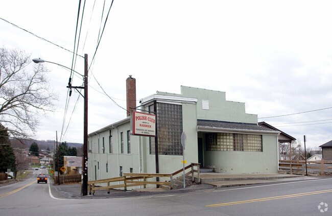
722 Hite Rd
Pittsburgh, PA
Anthiny Hodel Plan
0625-G-00022-0000-00
ANTHINY HODEL PLAN 7 LOT 50XAVG137.11 HITE RD C OR PILLOW AVE 1 STY C B STUCCO CLUB BLDG 722
Amusementpark
Allegheny
X
Pennsylvania
42003C0241H
22
2024
0.16 AC
2025
Northeast Pittsburgh
416000
Pittsburgh
DEMOGRAPHICS near 722 Hite Rd
1 mile
3 mile
5 mile
2024 Total Population
3,146
30,292
80,894
2029 Population
3,067
29,888
79,417
Pop Growth 2024-2029
(2.51%)
(1.33%)
(1.83%)
Average Age
49
44
45
2024 Total Households
1,474
13,703
36,021
HH Growth 2024-2029
(2.71%)
(1.39%)
(1.87%)
Median Household Inc
$59,766
$58,387
$63,824
Avg Household Size
2.00
2.10
2.20
2024 Avg HH Vehicles
2.00
2.00
2.00
Median Home Value
$150,364
$161,197
$164,794
Median Year Built
1955
1955
1957
Nearby Places
Map Layers
Map Styles
 Street
 Aerial
Transit
 Traffic
 Biking
Places
Listings with unknown addresses are not visible on the map
- Restaurants
- Banks
- Shops
- Fitness
- Groceries
PUBLIC TRANSPORTATION
AIRPORT
Pittsburgh International
Drive
Walk
Distance
Pittsburgh International
50 min
31.8 mi
Arnold Palmer Regional
Drive
Walk
Distance
Arnold Palmer Regional
59 min
39.7 mi
Nearby Properties
Address
Land Use
TOTAL SIZE
Lot Size
Zoning
Address
Land Use
TOTAL SIZE
Lot Size
Zoning
36.44 AC
Address
Land Use
TOTAL SIZE
Lot Size
Zoning
11.28 AC
Address
Land Use
TOTAL SIZE
Lot Size
Zoning
23.45 AC
Address
Land Use
TOTAL SIZE
Lot Size
Zoning
42.71 AC
Address
Land Use
TOTAL SIZE
Lot Size
Zoning
528.43 AC
Address
Land Use
TOTAL SIZE
Lot Size
Zoning
119.91 AC
Address
Land Use
TOTAL SIZE
Lot Size
Zoning
6.35 AC
Address
Land Use
TOTAL SIZE
Lot Size
Zoning
5.44 AC
Address
Land Use
TOTAL SIZE
Lot Size
Zoning
15.37 AC
Address
Land Use
TOTAL SIZE
Lot Size
Zoning
48.10 AC
Address
Land Use
TOTAL SIZE
Lot Size
Zoning
13.68 AC
Address
Land Use
TOTAL SIZE
Lot Size
Zoning
84.40 AC
Address
Land Use
TOTAL SIZE
Lot Size
Zoning
37.84 AC
Address
Land Use
TOTAL SIZE
Lot Size
Zoning
Address
Land Use
TOTAL SIZE
Lot Size
Zoning
Address
Land Use
TOTAL SIZE
Lot Size
Zoning
10.20 AC
Address
Land Use
TOTAL SIZE
Lot Size
Zoning
1.21 AC
Address
Land Use
TOTAL SIZE
Lot Size
Zoning
23.95 AC
Address
Land Use
TOTAL SIZE
Lot Size
Zoning
Address
Land Use
TOTAL SIZE
Lot Size
Zoning
889 SF
31.93 AC
Address
Land Use
TOTAL SIZE
Lot Size
Zoning
Address
Land Use
TOTAL SIZE
Lot Size
Zoning
21.20 AC
Address
Land Use
TOTAL SIZE
Lot Size
Zoning
35.56 AC
Address
Land Use
TOTAL SIZE
Lot Size
Zoning
1.81 AC
Address
Land Use
TOTAL SIZE
Lot Size
Zoning
114.41 AC
Address
Land Use
TOTAL SIZE
Lot Size
Zoning
20.10 AC
Address
Land Use
TOTAL SIZE
Lot Size
Zoning
Address
Land Use
TOTAL SIZE
Lot Size
Zoning
Address
Land Use
TOTAL SIZE
Lot Size
Zoning
9.04 AC
Address
Land Use
TOTAL SIZE
Lot Size
Zoning
75.25 AC
The World's #1 Commercial Real Estate Marketplace
Connect with us
© 2026 CoStar Group
The information above has been obtained from sources believed reliable. While we do not doubt its accuracy we have not verified it and make no guarantee, warranty or representation about it. It is your responsibility to independently confirm its accuracy and completeness. Any projections, opinions, assumptions, or estimates used are for example only and do not represent the current or future performance of the property. The value of this transaction to you depends on tax and other factors which should be evaluated by your tax, financial, and legal advisors. You and your advisors should conduct a careful, independent investigation of the property to determine to your satisfaction the suitability of the property for your needs.