No Photo
Property Record
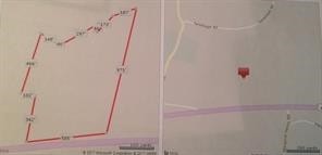
722 Providence Pike, Danielson, CT 06239

Property Detail
722 Providence Pike
KILL-000212-000000-000022
Windham
Residentialacreage
Connecticut
RD
11.90 AC
B and X Area of moderate flood hazard, usually the area between the limits of the 100-year and 500-year floods.
Windham County
2025
Hartford
2025
Willimantic, CT
904102
NEARBY LISTINGS FOR SALE OR LEASE
DEMOGRAPHICS near 722 Providence Pike
1 mile
3 mile
5 mile
2025 Total Population
901
6,989
22,210
2030 Population
922
7,181
22,798
Pop Growth 2025-2030
+ 2.33%
+ 2.75%
+ 2.65%
Average Age
45
44
43
2025 Total Households
358
2,817
9,086
HH Growth 2025-2030
+ 2.51%
+ 2.88%
+ 2.75%
Median Household Inc
$122,916
$86,587
$86,102
Avg Household Size
2.50
2.40
2.40
2025 Avg HH Vehicles
2.00
2.00
2.00
Median Home Value
$310,667
$309,931
$303,387
Median Year Built
1979
1969
1969
Nearby Places
Map Layers
Map Styles
 Street
 Aerial
Transit
 Traffic
 Biking
Places
Listings with unknown addresses are not visible on the map
- Restaurants
- Banks
- Shops
- Fitness
- Groceries
PUBLIC TRANSPORTATION
AIRPORT
Rhode Island Tf Green International
Drive
Walk
Distance
Rhode Island Tf Green International
38 min
28.5 mi
Freight Ports
Port of Davisville, RI
Drive
Walk
Distance
Port of Davisville, RI
50 min
37.7 mi
SALE & LEASE HISTORY
LISTING DATE
SALE/LEASE

Aug 23, 2017
For Sale
Nearby Properties
Address
Land Use
TOTAL SIZE
Lot Size
Zoning
Address
Land Use
TOTAL SIZE
Lot Size
Zoning
22 AC
I
Address
Land Use
TOTAL SIZE
Lot Size
Zoning
53,306 SF
1.60 AC
BI
Address
Land Use
TOTAL SIZE
Lot Size
Zoning
59,552 SF
4.28 AC
GC
Address
Land Use
TOTAL SIZE
Lot Size
Zoning
50,707 SF
10.50 AC
BRHD
Address
Land Use
TOTAL SIZE
Lot Size
Zoning
67,994 SF
8.30 AC
GC
Address
Land Use
TOTAL SIZE
Lot Size
Zoning
18,958 SF
1.52 AC
BGC
Address
Land Use
TOTAL SIZE
Lot Size
Zoning
14,524 SF
0.92 AC
RHD
Address
Land Use
TOTAL SIZE
Lot Size
Zoning
6,250 SF
225 AC
RD
Address
Land Use
TOTAL SIZE
Lot Size
Zoning
4.60 AC
BRHD
Address
Land Use
TOTAL SIZE
Lot Size
Zoning
28,678 SF
0.95 AC
BRHD
Address
Land Use
TOTAL SIZE
Lot Size
Zoning
4.80 AC
RHD
Address
Land Use
TOTAL SIZE
Lot Size
Zoning
Address
Land Use
TOTAL SIZE
Lot Size
Zoning
2.83 AC
GC
Address
Land Use
TOTAL SIZE
Lot Size
Zoning
7,116 SF
2.10 AC
BGC
Address
Land Use
TOTAL SIZE
Lot Size
Zoning
4.75 AC
PBO
Address
Land Use
TOTAL SIZE
Lot Size
Zoning
23,584 SF
1.60 AC
BGC
Address
Land Use
TOTAL SIZE
Lot Size
Zoning
Address
Land Use
TOTAL SIZE
Lot Size
Zoning
105 AC
RD
Address
Land Use
TOTAL SIZE
Lot Size
Zoning
23,075 SF
3.88 AC
GC
Address
Land Use
TOTAL SIZE
Lot Size
Zoning
15,840 SF
14.90 AC
RD
Address
Land Use
TOTAL SIZE
Lot Size
Zoning
34,900 SF
0.64 AC
CBD
Address
Land Use
TOTAL SIZE
Lot Size
Zoning
5.32 AC
GC
Address
Land Use
TOTAL SIZE
Lot Size
Zoning
10.30 AC
RD
Address
Land Use
TOTAL SIZE
Lot Size
Zoning
2 AC
RD
Address
Land Use
TOTAL SIZE
Lot Size
Zoning
8,470 SF
0.69 AC
RHD
Address
Land Use
TOTAL SIZE
Lot Size
Zoning
7.80 AC
RD
Address
Land Use
TOTAL SIZE
Lot Size
Zoning
4,550 SF
2.30 AC
PBO
Address
Land Use
TOTAL SIZE
Lot Size
Zoning
10,545 SF
23 AC
30
Address
Land Use
TOTAL SIZE
Lot Size
Zoning
6.61 AC
RA60
Address
Land Use
TOTAL SIZE
Lot Size
Zoning
0.78 AC
RHD
The World's #1 Commercial Real Estate Marketplace
Connect with us
© 2026 CoStar Group
The information above has been obtained from sources believed reliable. While we do not doubt its accuracy we have not verified it and make no guarantee, warranty or representation about it. It is your responsibility to independently confirm its accuracy and completeness. Any projections, opinions, assumptions, or estimates used are for example only and do not represent the current or future performance of the property. The value of this transaction to you depends on tax and other factors which should be evaluated by your tax, financial, and legal advisors. You and your advisors should conduct a careful, independent investigation of the property to determine to your satisfaction the suitability of the property for your needs.