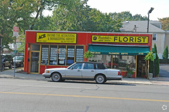
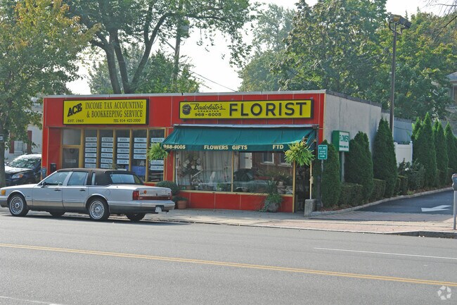
Property Record
722 Yonkers Ave, Yonkers, NY 10704
NEARBY LISTINGS FOR SALE OR LEASE
Property Detail
722 Yonkers Ave
1800-006-000-06102-000-0006
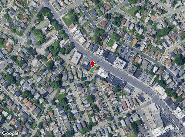
Section One Map Showing Subdivision
Commercialofficeresidentialmixeduse
Westchester
X
New York
36119C0336F
6.000
2025
0.07 AC
2024
Southwest
001401
Westchester/So Connecticut
2,156 SF
New York-Jersey City-White Plains, NY-NJ
DEMOGRAPHICS near 722 Yonkers Ave
1 Mile
3 Mile
5 Mile
2024 Total Population
21,561
365,464
971,832
2029 Population
20,577
347,951
919,634
Pop Growth 2024-2029
(4.56%)
(4.79%)
(5.37%)
Average Age
43
40
40
2024 Total Households
8,092
137,456
358,980
HH Growth 2024-2029
(4.66%)
(4.94%)
(5.74%)
Median Household Inc
$98,707
$69,408
$63,547
Avg Household Size
2.50
2.50
2.60
2024 Avg HH Vehicles
2.00
1.00
1.00
Median Home Value
$528,040
$469,514
$524,397
Median Year Built
1953
1951
1951
Nearby Places
Map Layers
Map Styles
 Street
 Aerial
- Restaurants
- Banks
- Shops
- Fitness
- Groceries
PUBLIC TRANSPORTATION
COMMUTER RAIL
Wakefield Station (Harlem Line - Metro-North Commuter Railroad Company (Metro-North))
DRIVE
WALK
Distance
Wakefield Station (Harlem Line - Metro-North Commuter Railroad Company (Metro-North))
7 min
3.7 mi
Mount Vernon West Station (Harlem Line - Metro-North Commuter Railroad Company (Metro-North))
DRIVE
WALK
Distance
Mount Vernon West Station (Harlem Line - Metro-North Commuter Railroad Company (Metro-North))
8 min
4.2 mi
AIRPORT
LaGuardia
DRIVE
WALK
Distance
LaGuardia
26 min
15.4 mi
Westchester County
DRIVE
WALK
Distance
Westchester County
27 min
18.4 mi
John F Kennedy International
DRIVE
WALK
Distance
John F Kennedy International
34 min
23.4 mi
Freight Ports
NY - Red Hook Container Terminal
DRIVE
WALK
Distance
NY - Red Hook Container Terminal
38 min
23.6 mi
Nearby Properties
Address
Land Use
TOTAL SIZE
Lot Size
Zoning
Address
Land Use
TOTAL SIZE
Lot Size
Zoning
18,000 SF
13.85 AC
A
Address
Land Use
TOTAL SIZE
Lot Size
Zoning
201,590 SF
4.13 AC
BA
Address
Land Use
TOTAL SIZE
Lot Size
Zoning
301,156 SF
13.94 AC
A
Address
Land Use
TOTAL SIZE
Lot Size
Zoning
70,737 SF
1.67 AC
BB
Address
Land Use
TOTAL SIZE
Lot Size
Zoning
617,567 SF
3.19 AC
R7-1
Address
Land Use
TOTAL SIZE
Lot Size
Zoning
269,100 SF
1.63 AC
R4
Address
Land Use
TOTAL SIZE
Lot Size
Zoning
87,000 SF
455.70 AC
PARK
Address
Land Use
TOTAL SIZE
Lot Size
Zoning
450,784 SF
42.36 AC
R4
Address
Land Use
TOTAL SIZE
Lot Size
Zoning
18,445 SF
510.83 AC
PARK
Address
Land Use
TOTAL SIZE
Lot Size
Zoning
64,165 SF
3.24 AC
B
Address
Land Use
TOTAL SIZE
Lot Size
Zoning
1,028,976 SF
23.03 AC
R5
Address
Land Use
TOTAL SIZE
Lot Size
Zoning
614,887 SF
14.77 AC
R4
Address
Land Use
TOTAL SIZE
Lot Size
Zoning
1,038,034 SF
23.41 AC
R5
Address
Land Use
TOTAL SIZE
Lot Size
Zoning
61,055 SF
343.42 AC
R6
Address
Land Use
TOTAL SIZE
Lot Size
Zoning
5,170 SF
9.08 AC
B
Address
Land Use
TOTAL SIZE
Lot Size
Zoning
193,520 SF
4.32 AC
R4
Address
Land Use
TOTAL SIZE
Lot Size
Zoning
Address
Land Use
TOTAL SIZE
Lot Size
Zoning
174,896 SF
8.69 AC
R4
Address
Land Use
TOTAL SIZE
Lot Size
Zoning
560 SF
61.32 AC
PARK
Address
Land Use
TOTAL SIZE
Lot Size
Zoning
336,240 SF
8.45 AC
R5
Address
Land Use
TOTAL SIZE
Lot Size
Zoning
219,285 SF
15.51 AC
R4
Address
Land Use
TOTAL SIZE
Lot Size
Zoning
193,856 SF
1.25 AC
R7-1
Address
Land Use
TOTAL SIZE
Lot Size
Zoning
159,260 SF
12.19 AC
R4
Address
Land Use
TOTAL SIZE
Lot Size
Zoning
192,939 SF
12.57 AC
R4
Address
Land Use
TOTAL SIZE
Lot Size
Zoning
144,307 SF
1.65 AC
R4
Address
Land Use
TOTAL SIZE
Lot Size
Zoning
103,158 SF
1.82 AC
R4
Address
Land Use
TOTAL SIZE
Lot Size
Zoning
38,912 SF
19.25 AC
R4
Address
Land Use
TOTAL SIZE
Lot Size
Zoning
198,360 SF
2.13 AC
R5
Address
Land Use
TOTAL SIZE
Lot Size
Zoning
7,855 SF
1.10 AC
C
Address
Land Use
TOTAL SIZE
Lot Size
Zoning
143,260 SF
1.79 AC
R5
The World's #1 Commercial Real Estate Marketplace
Connect with us
© 2025 CoStar Group
The information above has been obtained from sources believed reliable. While we do not doubt its accuracy we have not verified it and make no guarantee, warranty or representation about it. It is your responsibility to independently confirm its accuracy and completeness. Any projections, opinions, assumptions, or estimates used are for example only and do not represent the current or future performance of the property. The value of this transaction to you depends on tax and other factors which should be evaluated by your tax, financial, and legal advisors. You and your advisors should conduct a careful, independent investigation of the property to determine to your satisfaction the suitability of the property for your needs.