Property Record
7220 Sw Asbury Dr, Topeka, KS 66614
NEARBY LISTINGS FOR SALE OR LEASE
Property Detail
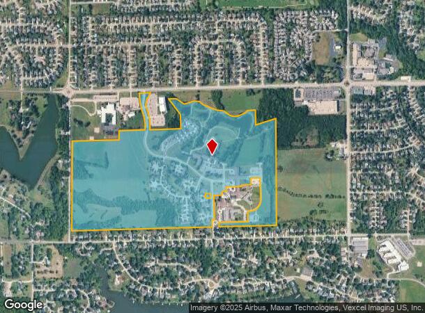
7220 Sw Asbury Dr
Topeka, KS
Sherwood Estates Sub No 67
144-18-0-20-01-001-000
SHERWOOD ESTATES SUB NO 67, S18, T12, R15, BLOCK A, LOT 1, ACRES 140.67, SHERWOOD ESTATES SUB NO 67, S18, T12, R15, BLK A, LT 1 DAF BEG NW COR OF NW 1/4, S 764.43(S) TO POB, TH E 815.23(S) N 161.44(S) E 442.03 NLY 577.39(S) E 194.68(S) SLY 759.42(
Hospitalprivate
Shawnee
A
Kansas
20177C0193E
1
2024
140.67 AC
2025
Topeka
003604
Kansas City
339,925 SF
DEMOGRAPHICS near 7220 Sw Asbury Dr
1 Mile
3 Mile
5 Mile
2024 Total Population
6,737
31,344
67,742
2029 Population
6,589
30,738
66,594
Pop Growth 2024-2029
(2.20%)
(1.93%)
(1.69%)
Average Age
42
43
42
2024 Total Households
2,505
13,252
29,835
HH Growth 2024-2029
(2.32%)
(2.04%)
(1.79%)
Median Household Inc
$104,098
$74,456
$64,062
Avg Household Size
2.60
2.30
2.20
2024 Avg HH Vehicles
2.00
2.00
2.00
Median Home Value
$209,294
$188,516
$166,300
Median Year Built
1992
1984
1975
Nearby Places
Map Layers
Map Styles
 Street
 Aerial
- Restaurants
- Banks
- Shops
- Fitness
- Groceries
Nearby Properties
Address
Land Use
TOTAL SIZE
Lot Size
Zoning
Address
Land Use
TOTAL SIZE
Lot Size
Zoning
43,282 SF
19.33 AC
PUD,M2
Address
Land Use
TOTAL SIZE
Lot Size
Zoning
208,685 SF
38.23 AC
R1
Address
Land Use
TOTAL SIZE
Lot Size
Zoning
52,375 SF
12.94 AC
RR1
Address
Land Use
TOTAL SIZE
Lot Size
Zoning
88,935 SF
20.24 AC
C4
Address
Land Use
TOTAL SIZE
Lot Size
Zoning
6.95 AC
PUD,OI1
Address
Land Use
TOTAL SIZE
Lot Size
Zoning
81,364 SF
19.52 AC
R1
Address
Land Use
TOTAL SIZE
Lot Size
Zoning
53,136 SF
18.28 AC
PUD,M2
Address
Land Use
TOTAL SIZE
Lot Size
Zoning
11.05 AC
PUD,C2,C4,
Address
Land Use
TOTAL SIZE
Lot Size
Zoning
19.37 AC
Address
Land Use
TOTAL SIZE
Lot Size
Zoning
59,337 SF
6.84 AC
R1
Address
Land Use
TOTAL SIZE
Lot Size
Zoning
72,482 SF
19.53 AC
R1
Address
Land Use
TOTAL SIZE
Lot Size
Zoning
51,636 SF
3.89 AC
C4
Address
Land Use
TOTAL SIZE
Lot Size
Zoning
57,380 SF
15.03 AC
RR1
Address
Land Use
TOTAL SIZE
Lot Size
Zoning
74,659 SF
15.24 AC
RR1
Address
Land Use
TOTAL SIZE
Lot Size
Zoning
36,511 SF
7.05 AC
R1
Address
Land Use
TOTAL SIZE
Lot Size
Zoning
58,568 SF
8.73 AC
R1
Address
Land Use
TOTAL SIZE
Lot Size
Zoning
135,625 SF
23.52 AC
PUD,M2
Address
Land Use
TOTAL SIZE
Lot Size
Zoning
93.05 AC
PUD,RR1
Address
Land Use
TOTAL SIZE
Lot Size
Zoning
84,794 SF
11.55 AC
C4
Address
Land Use
TOTAL SIZE
Lot Size
Zoning
115,103 SF
9.35 AC
C4
Address
Land Use
TOTAL SIZE
Lot Size
Zoning
26.73 AC
PUD,R1
Address
Land Use
TOTAL SIZE
Lot Size
Zoning
3.43 AC
PUD,C4,M3
Address
Land Use
TOTAL SIZE
Lot Size
Zoning
30,902 SF
2.83 AC
PUD,C4
Address
Land Use
TOTAL SIZE
Lot Size
Zoning
51,933 SF
16.73 AC
PUD,M2
Address
Land Use
TOTAL SIZE
Lot Size
Zoning
42,415 SF
7.56 AC
R1
Address
Land Use
TOTAL SIZE
Lot Size
Zoning
43,265 SF
4.91 AC
C4
Address
Land Use
TOTAL SIZE
Lot Size
Zoning
31,098 SF
5.88 AC
RR1
Address
Land Use
TOTAL SIZE
Lot Size
Zoning
173,406 SF
46.61 AC
Address
Land Use
TOTAL SIZE
Lot Size
Zoning
11,460 SF
5.03 AC
R1
Address
Land Use
TOTAL SIZE
Lot Size
Zoning
104,668 SF
10.49 AC
C4
The World's #1 Commercial Real Estate Marketplace
Connect with us
© 2025 CoStar Group
The information above has been obtained from sources believed reliable. While we do not doubt its accuracy we have not verified it and make no guarantee, warranty or representation about it. It is your responsibility to independently confirm its accuracy and completeness. Any projections, opinions, assumptions, or estimates used are for example only and do not represent the current or future performance of the property. The value of this transaction to you depends on tax and other factors which should be evaluated by your tax, financial, and legal advisors. You and your advisors should conduct a careful, independent investigation of the property to determine to your satisfaction the suitability of the property for your needs.