Property Record
7220 Us Highway 158, Stokesdale, NC 27357
NEARBY LISTINGS FOR SALE OR LEASE
Property Detail
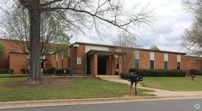
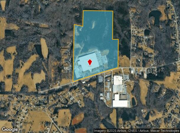
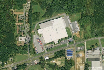
7220 Us Highway 158
Greensboro-High Point, NC
Stokesdale
0167623
STOKESDALE DISTRIBUTION CENTER
Industrialgeneral
Guilford
AE
North Carolina
3710791000J
9
2024
106.85 AC
2025
NW Guilford County
015901
Greensboro/Winston-Salem
516,221 SF
DEMOGRAPHICS near 7220 Us Highway 158
1 Mile
3 Mile
5 Mile
2024 Total Population
1,511
9,169
21,594
2029 Population
1,524
9,282
21,826
Pop Growth 2024-2029
+ 0.86%
+ 1.23%
+ 1.07%
Average Age
41
41
41
2024 Total Households
548
3,334
7,936
HH Growth 2024-2029
+ 0.91%
+ 1.20%
+ 1.10%
Median Household Inc
$94,791
$97,590
$90,917
Avg Household Size
2.70
2.70
2.70
2024 Avg HH Vehicles
2.00
2.00
2.00
Median Home Value
$249,476
$275,136
$307,094
Median Year Built
1994
1995
1995
Nearby Places
Map Layers
Map Styles
 Street
 Aerial
- Restaurants
- Banks
- Shops
- Fitness
- Groceries
PUBLIC TRANSPORTATION
AIRPORT
Piedmont Triad International
DRIVE
WALK
Distance
Piedmont Triad International
28 min
18.5 mi
Freight Ports
Virginia Port Authority - Richmond
DRIVE
WALK
Distance
Virginia Port Authority - Richmond
242 min
186.8 mi
SALE & LEASE HISTORY
LISTING DATE
SALE/LEASE

Aug 28, 2017
For Sale
Apr 06, 2017
For Lease
Nearby Properties
Address
Land Use
TOTAL SIZE
Lot Size
Zoning
Address
Land Use
TOTAL SIZE
Lot Size
Zoning
264,990 SF
43.64 AC
LIGHT INDU
Address
Land Use
TOTAL SIZE
Lot Size
Zoning
516,172 SF
58.24 AC
LI
Address
Land Use
TOTAL SIZE
Lot Size
Zoning
173,448 SF
26.10 AC
LIGHT INDU
Address
Land Use
TOTAL SIZE
Lot Size
Zoning
54,260 SF
18.91 AC
RS-30
Address
Land Use
TOTAL SIZE
Lot Size
Zoning
121,825 SF
36.43 AC
GO-M
Address
Land Use
TOTAL SIZE
Lot Size
Zoning
25,755 SF
509.95 AC
AG
Address
Land Use
TOTAL SIZE
Lot Size
Zoning
50,853 SF
23.39 AC
CD-HB
Address
Land Use
TOTAL SIZE
Lot Size
Zoning
55,958 SF
5.82 AC
PI
Address
Land Use
TOTAL SIZE
Lot Size
Zoning
2,191 SF
43.13 AC
GB
Address
Land Use
TOTAL SIZE
Lot Size
Zoning
26,410 SF
5.06 AC
GB
Address
Land Use
TOTAL SIZE
Lot Size
Zoning
8,774 SF
2.07 AC
HB
Address
Land Use
TOTAL SIZE
Lot Size
Zoning
14,080 SF
40.69 AC
IN MORE TH
Address
Land Use
TOTAL SIZE
Lot Size
Zoning
10,000 SF
2.12 AC
RES PROTEC
Address
Land Use
TOTAL SIZE
Lot Size
Zoning
21.17 AC
GB
Address
Land Use
TOTAL SIZE
Lot Size
Zoning
16,640 SF
4.20 AC
HB
Address
Land Use
TOTAL SIZE
Lot Size
Zoning
12,000 SF
4.43 AC
LI
Address
Land Use
TOTAL SIZE
Lot Size
Zoning
4,389 SF
119.23 AC
AG
Address
Land Use
TOTAL SIZE
Lot Size
Zoning
7,403 SF
3.36 AC
GO-M
Address
Land Use
TOTAL SIZE
Lot Size
Zoning
23,850 SF
8.38 AC
LI
Address
Land Use
TOTAL SIZE
Lot Size
Zoning
12,496 SF
7.65 AC
RS-30
Address
Land Use
TOTAL SIZE
Lot Size
Zoning
11,763 SF
5.65 AC
RS-30
Address
Land Use
TOTAL SIZE
Lot Size
Zoning
7,582 SF
3.82 AC
RS-30
Address
Land Use
TOTAL SIZE
Lot Size
Zoning
7,620 SF
60.13 AC
HI
Address
Land Use
TOTAL SIZE
Lot Size
Zoning
828 SF
37.20 AC
AG
Address
Land Use
TOTAL SIZE
Lot Size
Zoning
1 SF
155.18 AC
CZ-PD-R
Address
Land Use
TOTAL SIZE
Lot Size
Zoning
35,000 SF
5.48 AC
LI
Address
Land Use
TOTAL SIZE
Lot Size
Zoning
1,568 SF
84.67 AC
AG
Address
Land Use
TOTAL SIZE
Lot Size
Zoning
1,580 SF
94.33 AC
AG
Address
Land Use
TOTAL SIZE
Lot Size
Zoning
6,895 SF
1.76 AC
HB
The World's #1 Commercial Real Estate Marketplace
Connect with us
© 2026 CoStar Group
The information above has been obtained from sources believed reliable. While we do not doubt its accuracy we have not verified it and make no guarantee, warranty or representation about it. It is your responsibility to independently confirm its accuracy and completeness. Any projections, opinions, assumptions, or estimates used are for example only and do not represent the current or future performance of the property. The value of this transaction to you depends on tax and other factors which should be evaluated by your tax, financial, and legal advisors. You and your advisors should conduct a careful, independent investigation of the property to determine to your satisfaction the suitability of the property for your needs.