Property Record
7225 Maplecrest Rd, Fort Wayne, IN 46835


NEARBY LISTINGS FOR SALE OR LEASE
Property Detail
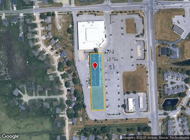
7225 Maplecrest Rd
02-08-16-227-023.002-072
Bridlewood
Regionalshoppingcenterormallwithanchorstore
1.488 A TR E OF BRIDLEWOOD SEC II NE 1/4 SEC 16
X
Allen
18003C0189G
Indiana
2024
14.90 AC
2025
North Fort Wayne
010807
Fort Wayne
25,600 SF
Fort Wayne, IN
DEMOGRAPHICS near 7225 Maplecrest Rd
1 Mile
3 Mile
5 Mile
2024 Total Population
8,308
60,995
128,501
2029 Population
8,564
63,185
133,187
Pop Growth 2024-2029
+ 3.08%
+ 3.59%
+ 3.65%
Average Age
40
39
39
2024 Total Households
3,345
24,998
52,126
HH Growth 2024-2029
+ 3.08%
+ 3.65%
+ 3.70%
Median Household Inc
$71,453
$67,706
$67,458
Avg Household Size
2.40
2.40
2.40
2024 Avg HH Vehicles
2.00
2.00
2.00
Median Home Value
$154,069
$172,825
$174,848
Median Year Built
1975
1980
1979
Nearby Places
Map Layers
Map Styles
 Street
 Aerial
- Restaurants
- Banks
- Shops
- Fitness
- Groceries
PUBLIC TRANSPORTATION
AIRPORT
Fort Wayne International
DRIVE
WALK
Distance
Fort Wayne International
35 min
24.4 mi
Freight Ports
Port of Toledo
DRIVE
WALK
Distance
Port of Toledo
134 min
101.8 mi
SALE & LEASE HISTORY
LISTING DATE
SALE/LEASE

Sep 25, 2016
For Lease
Sep 23, 2016
For Sale
Nov 30, 2016
For Lease
Jan 25, 2024
For Lease
Feb 11, 2020
For Lease
Aug 13, 2018
For Lease
Apr 08, 2022
For Sale
Nearby Properties
Address
Land Use
TOTAL SIZE
Lot Size
Zoning
Address
Land Use
TOTAL SIZE
Lot Size
Zoning
855,487 SF
95.76 AC
Address
Land Use
TOTAL SIZE
Lot Size
Zoning
702,400 SF
37.91 AC
Address
Land Use
TOTAL SIZE
Lot Size
Zoning
206,109 SF
122.14 AC
Address
Land Use
TOTAL SIZE
Lot Size
Zoning
314,200 SF
24.05 AC
Address
Land Use
TOTAL SIZE
Lot Size
Zoning
401,523 SF
273.50 AC
Address
Land Use
TOTAL SIZE
Lot Size
Zoning
303,926 SF
1,956.20 AC
Address
Land Use
TOTAL SIZE
Lot Size
Zoning
294,942 SF
13.83 AC
Address
Land Use
TOTAL SIZE
Lot Size
Zoning
147,628 SF
6.48 AC
Address
Land Use
TOTAL SIZE
Lot Size
Zoning
298,087 SF
24.71 AC
Address
Land Use
TOTAL SIZE
Lot Size
Zoning
68,817 SF
14.72 AC
Address
Land Use
TOTAL SIZE
Lot Size
Zoning
59,089 SF
28.68 AC
Address
Land Use
TOTAL SIZE
Lot Size
Zoning
106,005 SF
33.71 AC
Address
Land Use
TOTAL SIZE
Lot Size
Zoning
98,274 SF
93.21 AC
Address
Land Use
TOTAL SIZE
Lot Size
Zoning
116,411 SF
50.80 AC
Address
Land Use
TOTAL SIZE
Lot Size
Zoning
144,297 SF
19.63 AC
Address
Land Use
TOTAL SIZE
Lot Size
Zoning
75,690 SF
268.40 AC
Address
Land Use
TOTAL SIZE
Lot Size
Zoning
126,197 SF
4.88 AC
Address
Land Use
TOTAL SIZE
Lot Size
Zoning
79,886 SF
58.50 AC
Address
Land Use
TOTAL SIZE
Lot Size
Zoning
81,654 SF
130.70 AC
Address
Land Use
TOTAL SIZE
Lot Size
Zoning
295,073 SF
27.09 AC
Address
Land Use
TOTAL SIZE
Lot Size
Zoning
32,189 SF
9.65 AC
Address
Land Use
TOTAL SIZE
Lot Size
Zoning
58,913 SF
226.43 AC
Address
Land Use
TOTAL SIZE
Lot Size
Zoning
156,706 SF
200.38 AC
Address
Land Use
TOTAL SIZE
Lot Size
Zoning
229,678 SF
264.24 AC
Address
Land Use
TOTAL SIZE
Lot Size
Zoning
87,317 SF
125.91 AC
Address
Land Use
TOTAL SIZE
Lot Size
Zoning
25,272 SF
25.84 AC
Address
Land Use
TOTAL SIZE
Lot Size
Zoning
255,864 SF
9.21 AC
Address
Land Use
TOTAL SIZE
Lot Size
Zoning
210,230 SF
353.02 AC
Address
Land Use
TOTAL SIZE
Lot Size
Zoning
232,515 SF
306.20 AC
Address
Land Use
TOTAL SIZE
Lot Size
Zoning
19,872 SF
14.05 AC
The World's #1 Commercial Real Estate Marketplace
Connect with us
© 2026 CoStar Group
The information above has been obtained from sources believed reliable. While we do not doubt its accuracy we have not verified it and make no guarantee, warranty or representation about it. It is your responsibility to independently confirm its accuracy and completeness. Any projections, opinions, assumptions, or estimates used are for example only and do not represent the current or future performance of the property. The value of this transaction to you depends on tax and other factors which should be evaluated by your tax, financial, and legal advisors. You and your advisors should conduct a careful, independent investigation of the property to determine to your satisfaction the suitability of the property for your needs.