Property Record
7228 39Th St, Lyons, IL 60534

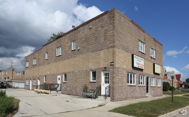
Property Detail
7228 39Th St
15-36-416-043-1003
Cook
Commercialcondominium
Illinois
B and X Area of moderate flood hazard, usually the area between the limits of the 100-year and 500-year floods.
0.27 AC
2023
Cicero/Berwyn Area
2025
Chicago
815701
Chicago-Naperville-Elgin, IL-IN
952 SF
NEARBY LISTINGS FOR SALE OR LEASE
DEMOGRAPHICS near 7228 39Th St
1 mile
3 mile
5 mile
2025 Total Population
23,126
181,875
500,305
2030 Population
23,057
179,170
491,491
Pop Growth 2025-2030
(0.30%)
(1.49%)
(1.76%)
Average Age
41
39
39
2025 Total Households
8,498
61,421
175,990
HH Growth 2025-2030
(0.44%)
(1.58%)
(1.67%)
Median Household Inc
$84,075
$83,112
$77,712
Avg Household Size
2.70
2.90
2.70
2025 Avg HH Vehicles
2.00
2.00
2.00
Median Home Value
$297,465
$291,746
$295,347
Median Year Built
1952
1949
1950
Nearby Places
Map Layers
Map Styles
 Street
 Aerial
Transit
 Traffic
 Biking
Places
Listings with unknown addresses are not visible on the map
- Restaurants
- Banks
- Shops
- Fitness
- Groceries
PUBLIC TRANSPORTATION
TRANSIT/SUBWAY
Harlem Avenue Station (Burlington Northern-Santa Fe Railway Line - Northeast Illinois Regional Commuter Railroad (Metra))
Drive
Walk
Distance
Harlem Avenue Station (Burlington Northern-Santa Fe Railway Line - Northeast Illinois Regional Commuter Railroad (Metra))
2 min
15 min
0.8 mi
Riverside Station (Burlington Northern-Santa Fe Railway Line - Northeast Illinois Regional Commuter Railroad (Metra))
Drive
Walk
Distance
Riverside Station (Burlington Northern-Santa Fe Railway Line - Northeast Illinois Regional Commuter Railroad (Metra))
4 min
20 min
1.1 mi
COMMUTER RAIL
Harlem Avenue Station (Burlington Northern-Santa Fe Railway Line - Northeast Illinois Regional Commuter Railroad (Metra))
Drive
Walk
Distance
Harlem Avenue Station (Burlington Northern-Santa Fe Railway Line - Northeast Illinois Regional Commuter Railroad (Metra))
2 min
15 min
0.8 mi
Riverside Station (Burlington Northern-Santa Fe Railway Line - Northeast Illinois Regional Commuter Railroad (Metra))
Drive
Walk
Distance
Riverside Station (Burlington Northern-Santa Fe Railway Line - Northeast Illinois Regional Commuter Railroad (Metra))
4 min
20 min
1.1 mi
AIRPORT
Chicago Midway International
Drive
Walk
Distance
Chicago Midway International
9 min
4.8 mi
Chicago O'Hare International
Drive
Walk
Distance
Chicago O'Hare International
31 min
15.8 mi
SALE & LEASE HISTORY
LISTING DATE
SALE/LEASE

Jan 09, 2019
For Lease
Aug 05, 2017
For Sale
Nearby Properties
Address
Land Use
TOTAL SIZE
Lot Size
Zoning
Address
Land Use
TOTAL SIZE
Lot Size
Zoning
1,182,079 SF
Address
Land Use
TOTAL SIZE
Lot Size
Zoning
646,763 SF
17.54 AC
Address
Land Use
TOTAL SIZE
Lot Size
Zoning
604,145 SF
28.21 AC
Address
Land Use
TOTAL SIZE
Lot Size
Zoning
377,265 SF
25.73 AC
Address
Land Use
TOTAL SIZE
Lot Size
Zoning
57,366 SF
10 AC
Address
Land Use
TOTAL SIZE
Lot Size
Zoning
246,248 SF
19.35 AC
Address
Land Use
TOTAL SIZE
Lot Size
Zoning
445,440 SF
24.50 AC
Address
Land Use
TOTAL SIZE
Lot Size
Zoning
140,814 SF
Address
Land Use
TOTAL SIZE
Lot Size
Zoning
189,908 SF
23.82 AC
Address
Land Use
TOTAL SIZE
Lot Size
Zoning
549,955 SF
18.01 AC
Address
Land Use
TOTAL SIZE
Lot Size
Zoning
220,137 SF
13.24 AC
Address
Land Use
TOTAL SIZE
Lot Size
Zoning
153,954 SF
14.36 AC
Address
Land Use
TOTAL SIZE
Lot Size
Zoning
1,107,999 SF
119.41 AC
Address
Land Use
TOTAL SIZE
Lot Size
Zoning
313,899 SF
13.43 AC
Address
Land Use
TOTAL SIZE
Lot Size
Zoning
206,736 SF
10.38 AC
Address
Land Use
TOTAL SIZE
Lot Size
Zoning
124.04 AC
Address
Land Use
TOTAL SIZE
Lot Size
Zoning
120,929 SF
9 AC
Address
Land Use
TOTAL SIZE
Lot Size
Zoning
365,359 SF
25.39 AC
Address
Land Use
TOTAL SIZE
Lot Size
Zoning
242,662 SF
21.02 AC
Address
Land Use
TOTAL SIZE
Lot Size
Zoning
8,400 SF
0.53 AC
M1-1
Address
Land Use
TOTAL SIZE
Lot Size
Zoning
317,321 SF
15.99 AC
Address
Land Use
TOTAL SIZE
Lot Size
Zoning
358,212 SF
17.87 AC
Address
Land Use
TOTAL SIZE
Lot Size
Zoning
188,000 SF
8.91 AC
Address
Land Use
TOTAL SIZE
Lot Size
Zoning
17.09 AC
Address
Land Use
TOTAL SIZE
Lot Size
Zoning
303,192 SF
15.47 AC
Address
Land Use
TOTAL SIZE
Lot Size
Zoning
226,088 SF
12.95 AC
Address
Land Use
TOTAL SIZE
Lot Size
Zoning
0.15 AC
Address
Land Use
TOTAL SIZE
Lot Size
Zoning
0.16 AC
Address
Land Use
TOTAL SIZE
Lot Size
Zoning
130,116 SF
12.32 AC
Address
Land Use
TOTAL SIZE
Lot Size
Zoning
0.58 AC
The World's #1 Commercial Real Estate Marketplace
Connect with us
© 2026 CoStar Group
The information above has been obtained from sources believed reliable. While we do not doubt its accuracy we have not verified it and make no guarantee, warranty or representation about it. It is your responsibility to independently confirm its accuracy and completeness. Any projections, opinions, assumptions, or estimates used are for example only and do not represent the current or future performance of the property. The value of this transaction to you depends on tax and other factors which should be evaluated by your tax, financial, and legal advisors. You and your advisors should conduct a careful, independent investigation of the property to determine to your satisfaction the suitability of the property for your needs.