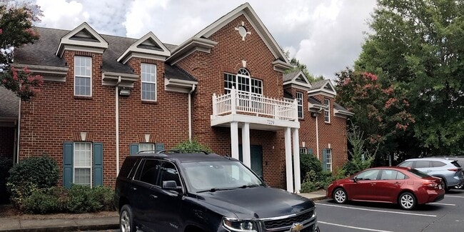
Property Record
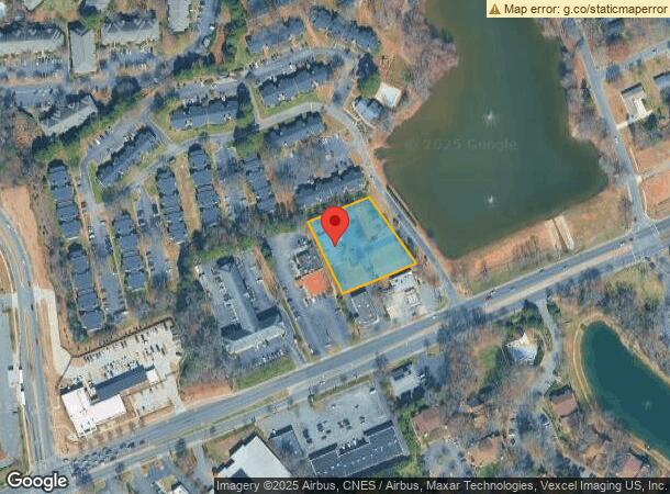
7229 Albemarle Rd, Charlotte, NC 28227
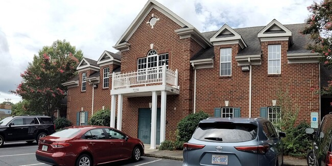
This Property Is For Sale
NEARBY LISTINGS FOR SALE OR LEASE
Property Detail
7229 Albemarle Rd
109-161-09
Ben R Norwood & Carol S Norwoo
Commercialnec
Mecklenburg
X
North Carolina
3710458300K
9
0
1.14 AC
2025
East Charlotte
001923
Charlotte
5,498 SF
Charlotte-Concord-Gastonia, NC-SC
DEMOGRAPHICS near 7229 Albemarle Rd
1 Mile
3 Mile
5 Mile
2024 Total Population
14,717
99,255
217,933
2029 Population
15,429
104,309
229,889
Pop Growth 2024-2029
+ 4.84%
+ 5.09%
+ 5.49%
Average Age
35
36
37
2024 Total Households
5,653
36,636
84,591
HH Growth 2024-2029
+ 4.92%
+ 5.15%
+ 5.51%
Median Household Inc
$44,576
$53,981
$59,139
Avg Household Size
2.50
2.60
2.50
2024 Avg HH Vehicles
2.00
2.00
2.00
Median Home Value
$212,681
$228,547
$275,899
Median Year Built
1981
1982
1982
Nearby Places
- Restaurants
- Banks
- Shops
- Fitness
- Groceries
PUBLIC TRANSPORTATION
COMMUTER RAIL
DRIVE
WALK
Distance
14 min
8.6 mi
AIRPORT
Charlotte/Douglas International
DRIVE
WALK
Distance
Charlotte/Douglas International
28 min
15.9 mi
Concord-Padgett Regional
DRIVE
WALK
Distance
Concord-Padgett Regional
26 min
16.3 mi
Nearby Properties
Address
Land Use
TOTAL SIZE
Lot Size
Zoning
Address
Land Use
TOTAL SIZE
Lot Size
Zoning
539,702 SF
83.70 AC
I
Address
Land Use
TOTAL SIZE
Lot Size
Zoning
258,272 SF
22.10 AC
R9MFCD
Address
Land Use
TOTAL SIZE
Lot Size
Zoning
299,998 SF
19.55 AC
R17MF
Address
Land Use
TOTAL SIZE
Lot Size
Zoning
325,177 SF
43.11 AC
R12MFCD
Address
Land Use
TOTAL SIZE
Lot Size
Zoning
347,952 SF
28.37 AC
OACUD
Address
Land Use
TOTAL SIZE
Lot Size
Zoning
300,346 SF
45.50 AC
R3
Address
Land Use
TOTAL SIZE
Lot Size
Zoning
311,245 SF
16.83 AC
INSTCD
Address
Land Use
TOTAL SIZE
Lot Size
Zoning
324,323 SF
31.39 AC
R17MF
Address
Land Use
TOTAL SIZE
Lot Size
Zoning
316,763 SF
21.18 AC
R17MF
Address
Land Use
TOTAL SIZE
Lot Size
Zoning
270,091 SF
32.43 AC
R17MF
Address
Land Use
TOTAL SIZE
Lot Size
Zoning
322,517 SF
30.74 AC
R15MFCD
Address
Land Use
TOTAL SIZE
Lot Size
Zoning
197,180 SF
4.89 AC
Address
Land Use
TOTAL SIZE
Lot Size
Zoning
208,846 SF
14.99 AC
R17MF
Address
Land Use
TOTAL SIZE
Lot Size
Zoning
197,367 SF
6.07 AC
Address
Land Use
TOTAL SIZE
Lot Size
Zoning
193,365 SF
15.06 AC
R17MF
Address
Land Use
TOTAL SIZE
Lot Size
Zoning
205,701 SF
13.73 AC
OACUD
Address
Land Use
TOTAL SIZE
Lot Size
Zoning
249,650 SF
20.17 AC
R17MF
Address
Land Use
TOTAL SIZE
Lot Size
Zoning
207,338 SF
13.96 AC
R17MF
Address
Land Use
TOTAL SIZE
Lot Size
Zoning
306,762 SF
21.23 AC
R17MF
Address
Land Use
TOTAL SIZE
Lot Size
Zoning
177,855 SF
9.14 AC
O2
Address
Land Use
TOTAL SIZE
Lot Size
Zoning
188,607 SF
10.68 AC
R22MF
Address
Land Use
TOTAL SIZE
Lot Size
Zoning
166,800 SF
19.50 AC
R17MF
Address
Land Use
TOTAL SIZE
Lot Size
Zoning
220,767 SF
40.75 AC
R17MF
Address
Land Use
TOTAL SIZE
Lot Size
Zoning
170,913 SF
11.36 AC
R17MF
Address
Land Use
TOTAL SIZE
Lot Size
Zoning
134,161 SF
11.40 AC
R-4
Address
Land Use
TOTAL SIZE
Lot Size
Zoning
148,190 SF
14.50 AC
R17MF
Address
Land Use
TOTAL SIZE
Lot Size
Zoning
155,648 SF
22.52 AC
R20MF
Address
Land Use
TOTAL SIZE
Lot Size
Zoning
203,509 SF
14.77 AC
R17MF
Address
Land Use
TOTAL SIZE
Lot Size
Zoning
110,441 SF
46.57 AC
I-1
Address
Land Use
TOTAL SIZE
Lot Size
Zoning
168,878 SF
14.05 AC
R17MF
The World's #1 Commercial Real Estate Marketplace
Connect with us
© 2025 CoStar Group
The information above has been obtained from sources believed reliable. While we do not doubt its accuracy we have not verified it and make no guarantee, warranty or representation about it. It is your responsibility to independently confirm its accuracy and completeness. Any projections, opinions, assumptions, or estimates used are for example only and do not represent the current or future performance of the property. The value of this transaction to you depends on tax and other factors which should be evaluated by your tax, financial, and legal advisors. You and your advisors should conduct a careful, independent investigation of the property to determine to your satisfaction the suitability of the property for your needs.