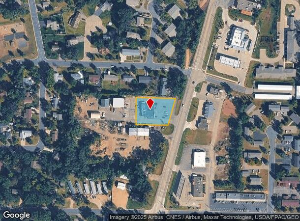
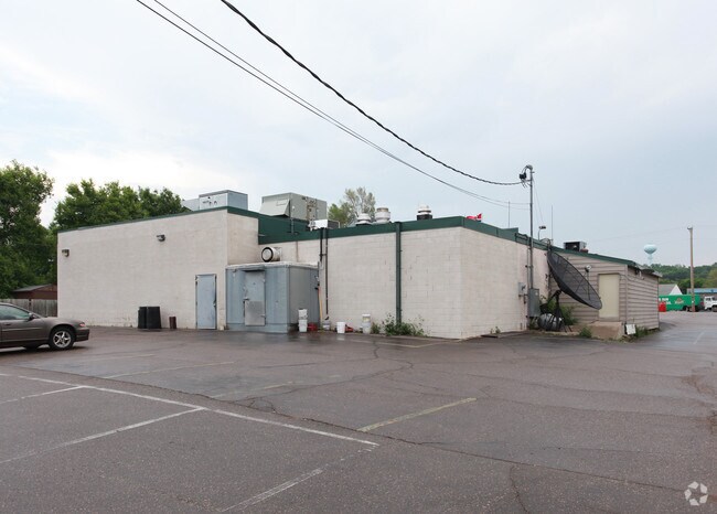
Property Record
723 6Th St N, Hudson, WI 54016

NEARBY LISTINGS FOR SALE OR LEASE
Property Detail
723 6Th St N
Minneapolis-St. Paul-Bloomington, MN-WI
Matteson Add
161-1016-20-000
LOT 1 BLK 1 EXC W 421' & LOT 2 BLK 1 EXC W 421' MATTESON ADD VIL NH
Commercialnec
St Croix
X
Wisconsin
27163C0269E
1,2
2025
0.62 AC
2024
St Croix County
120300
Minneapolis/St Paul
DEMOGRAPHICS near 723 6Th St N
1 Mile
3 Mile
5 Mile
2024 Total Population
4,131
19,849
51,602
2029 Population
4,444
21,439
55,698
Pop Growth 2024-2029
+ 7.58%
+ 8.01%
+ 7.94%
Average Age
42
42
43
2024 Total Households
1,693
7,983
21,211
HH Growth 2024-2029
+ 7.62%
+ 8.07%
+ 8.06%
Median Household Inc
$134,452
$107,790
$102,317
Avg Household Size
2.40
2.50
2.40
2024 Avg HH Vehicles
2.00
2.00
2.00
Median Home Value
$367,874
$358,833
$370,648
Median Year Built
1983
1982
1989
Nearby Places
Map Layers
Map Styles
 Street
 Aerial
- Restaurants
- Banks
- Shops
- Fitness
- Groceries
PUBLIC TRANSPORTATION
AIRPORT
Minneapolis-St Paul International/Wold-Chamberlain
DRIVE
WALK
Distance
Minneapolis-St Paul International/Wold-Chamberlain
45 min
30.6 mi
Nearby Properties
Address
Land Use
TOTAL SIZE
Lot Size
Zoning
Address
Land Use
TOTAL SIZE
Lot Size
Zoning
519,636 SF
40.40 AC
Address
Land Use
TOTAL SIZE
Lot Size
Zoning
600,000 SF
77.70 AC
Address
Land Use
TOTAL SIZE
Lot Size
Zoning
10.90 AC
Address
Land Use
TOTAL SIZE
Lot Size
Zoning
84.75 AC
Address
Land Use
TOTAL SIZE
Lot Size
Zoning
16.42 AC
Address
Land Use
TOTAL SIZE
Lot Size
Zoning
Address
Land Use
TOTAL SIZE
Lot Size
Zoning
132,967 SF
18.10 AC
Address
Land Use
TOTAL SIZE
Lot Size
Zoning
3.78 AC
Address
Land Use
TOTAL SIZE
Lot Size
Zoning
194,684 SF
14.86 AC
Address
Land Use
TOTAL SIZE
Lot Size
Zoning
43,888 SF
1.37 AC
Address
Land Use
TOTAL SIZE
Lot Size
Zoning
199,652 SF
5.02 AC
Address
Land Use
TOTAL SIZE
Lot Size
Zoning
15,072 SF
0.33 AC
Address
Land Use
TOTAL SIZE
Lot Size
Zoning
17,524 SF
4.16 AC
Address
Land Use
TOTAL SIZE
Lot Size
Zoning
11,576 SF
3.86 AC
B-2
Address
Land Use
TOTAL SIZE
Lot Size
Zoning
18,160 SF
3.38 AC
OFC
Address
Land Use
TOTAL SIZE
Lot Size
Zoning
2.29 AC
Address
Land Use
TOTAL SIZE
Lot Size
Zoning
14,490 SF
2 AC
B-2
Address
Land Use
TOTAL SIZE
Lot Size
Zoning
12,244 SF
0.69 AC
Address
Land Use
TOTAL SIZE
Lot Size
Zoning
20,300 SF
2.43 AC
I-1
Address
Land Use
TOTAL SIZE
Lot Size
Zoning
52,764 SF
4.40 AC
RM-1
Address
Land Use
TOTAL SIZE
Lot Size
Zoning
36,304 SF
2.79 AC
Address
Land Use
TOTAL SIZE
Lot Size
Zoning
5,284 SF
15.33 AC
Address
Land Use
TOTAL SIZE
Lot Size
Zoning
3,472 SF
1.97 AC
B-2
Address
Land Use
TOTAL SIZE
Lot Size
Zoning
40,908 SF
3.17 AC
RM-1
Address
Land Use
TOTAL SIZE
Lot Size
Zoning
18,557 SF
1.94 AC
Address
Land Use
TOTAL SIZE
Lot Size
Zoning
11,554 SF
0.80 AC
I-1 & B-3
Address
Land Use
TOTAL SIZE
Lot Size
Zoning
14,820 SF
0.56 AC
Address
Land Use
TOTAL SIZE
Lot Size
Zoning
17,741 SF
0.28 AC
B-3
Address
Land Use
TOTAL SIZE
Lot Size
Zoning
1,824 SF
1.29 AC
The World's #1 Commercial Real Estate Marketplace
Connect with us
© 2025 CoStar Group
The information above has been obtained from sources believed reliable. While we do not doubt its accuracy we have not verified it and make no guarantee, warranty or representation about it. It is your responsibility to independently confirm its accuracy and completeness. Any projections, opinions, assumptions, or estimates used are for example only and do not represent the current or future performance of the property. The value of this transaction to you depends on tax and other factors which should be evaluated by your tax, financial, and legal advisors. You and your advisors should conduct a careful, independent investigation of the property to determine to your satisfaction the suitability of the property for your needs.