Property Record
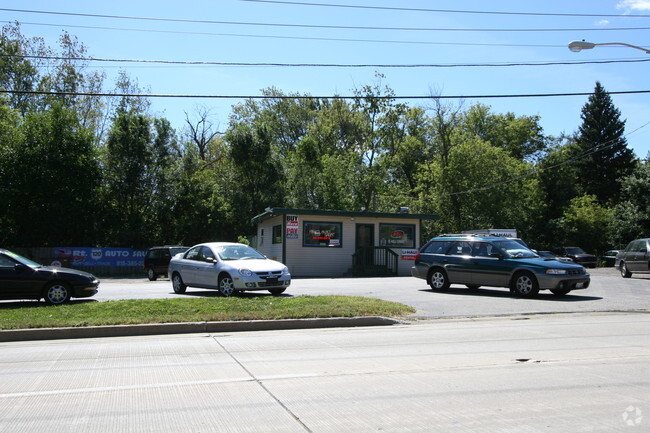
723 W Rand Rd, Mchenry, IL 60051


NEARBY LISTINGS FOR SALE OR LEASE
Property Detail
723 W Rand Rd
Chicago-Naperville-Elgin, IL-IN
Lilymoor Sub
10-32-331-020
DOC 2012R0037405 LTS 49, 50, 51, 52 BLK 9 /EX ROW/ LILYMOOR SUB
Commercialnec
McHenry
X
Illinois
17097C0104K
49-52
2024
0.12 AC
2024
McHenry County
870702
Chicago
810 SF
DEMOGRAPHICS near 723 W Rand Rd
1 Mile
3 Mile
5 Mile
2024 Total Population
3,621
23,598
84,126
2029 Population
3,656
23,812
84,223
Pop Growth 2024-2029
+ 0.97%
+ 0.91%
+ 0.12%
Average Age
40
41
41
2024 Total Households
1,411
9,323
32,705
HH Growth 2024-2029
+ 0.99%
+ 0.89%
+ 0.12%
Median Household Inc
$78,222
$89,898
$85,591
Avg Household Size
2.50
2.50
2.50
2024 Avg HH Vehicles
2.00
2.00
2.00
Median Home Value
$225,000
$244,292
$227,196
Median Year Built
1990
1991
1988
Nearby Places
Map Layers
Map Styles
 Street
 Aerial
- Restaurants
- Banks
- Shops
- Fitness
- Groceries
PUBLIC TRANSPORTATION
COMMUTER RAIL
Mchenry Station (Union Pacific Northwest Line - Northeast Illinois Regional Commuter Railroad (Metra))
DRIVE
WALK
Distance
Mchenry Station (Union Pacific Northwest Line - Northeast Illinois Regional Commuter Railroad (Metra))
8 min
3.9 mi
Ingleside Station (Milwaukee District North Line - Northeast Illinois Regional Commuter Railroad (Metra))
DRIVE
WALK
Distance
Ingleside Station (Milwaukee District North Line - Northeast Illinois Regional Commuter Railroad (Metra))
13 min
7.7 mi
AIRPORT
Chicago O'Hare International
DRIVE
WALK
Distance
Chicago O'Hare International
52 min
38.2 mi
Freight Ports
Port Milwaukee
DRIVE
WALK
Distance
Port Milwaukee
79 min
62.8 mi
Nearby Properties
Address
Land Use
TOTAL SIZE
Lot Size
Zoning
Address
Land Use
TOTAL SIZE
Lot Size
Zoning
12.28 AC
Address
Land Use
TOTAL SIZE
Lot Size
Zoning
Address
Land Use
TOTAL SIZE
Lot Size
Zoning
124,114 SF
6.05 AC
Address
Land Use
TOTAL SIZE
Lot Size
Zoning
241,227 SF
15.79 AC
Address
Land Use
TOTAL SIZE
Lot Size
Zoning
12.56 AC
Address
Land Use
TOTAL SIZE
Lot Size
Zoning
18.82 AC
Address
Land Use
TOTAL SIZE
Lot Size
Zoning
20.47 AC
Address
Land Use
TOTAL SIZE
Lot Size
Zoning
57,000 SF
0.86 AC
Address
Land Use
TOTAL SIZE
Lot Size
Zoning
448,000 SF
8.28 AC
Address
Land Use
TOTAL SIZE
Lot Size
Zoning
1,704 SF
0.25 AC
Address
Land Use
TOTAL SIZE
Lot Size
Zoning
302,400 SF
7.37 AC
Address
Land Use
TOTAL SIZE
Lot Size
Zoning
81,478 SF
9.25 AC
Address
Land Use
TOTAL SIZE
Lot Size
Zoning
Address
Land Use
TOTAL SIZE
Lot Size
Zoning
26,896 SF
4.03 AC
Address
Land Use
TOTAL SIZE
Lot Size
Zoning
20,403 SF
6.47 AC
Address
Land Use
TOTAL SIZE
Lot Size
Zoning
23,489 SF
5.42 AC
Address
Land Use
TOTAL SIZE
Lot Size
Zoning
19,500 SF
0.78 AC
Address
Land Use
TOTAL SIZE
Lot Size
Zoning
2.28 AC
Address
Land Use
TOTAL SIZE
Lot Size
Zoning
23,640 SF
1.26 AC
Address
Land Use
TOTAL SIZE
Lot Size
Zoning
4.19 AC
Address
Land Use
TOTAL SIZE
Lot Size
Zoning
5,398 SF
38 AC
Address
Land Use
TOTAL SIZE
Lot Size
Zoning
21,802 SF
2 AC
Address
Land Use
TOTAL SIZE
Lot Size
Zoning
17,898 SF
0.60 AC
Address
Land Use
TOTAL SIZE
Lot Size
Zoning
2.16 AC
Address
Land Use
TOTAL SIZE
Lot Size
Zoning
53,160 SF
1 AC
Address
Land Use
TOTAL SIZE
Lot Size
Zoning
Address
Land Use
TOTAL SIZE
Lot Size
Zoning
17,939 SF
16.60 AC
Address
Land Use
TOTAL SIZE
Lot Size
Zoning
Address
Land Use
TOTAL SIZE
Lot Size
Zoning
50,018 SF
0.25 AC
Address
Land Use
TOTAL SIZE
Lot Size
Zoning
3.23 AC
The World's #1 Commercial Real Estate Marketplace
Connect with us
© 2026 CoStar Group
The information above has been obtained from sources believed reliable. While we do not doubt its accuracy we have not verified it and make no guarantee, warranty or representation about it. It is your responsibility to independently confirm its accuracy and completeness. Any projections, opinions, assumptions, or estimates used are for example only and do not represent the current or future performance of the property. The value of this transaction to you depends on tax and other factors which should be evaluated by your tax, financial, and legal advisors. You and your advisors should conduct a careful, independent investigation of the property to determine to your satisfaction the suitability of the property for your needs.