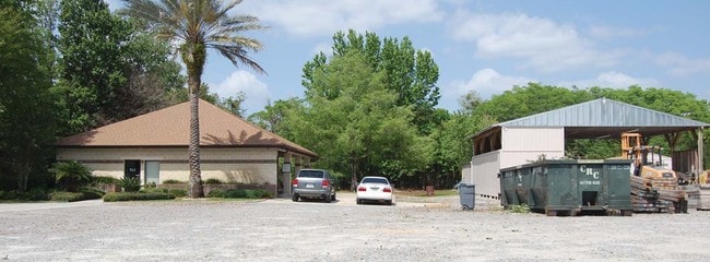
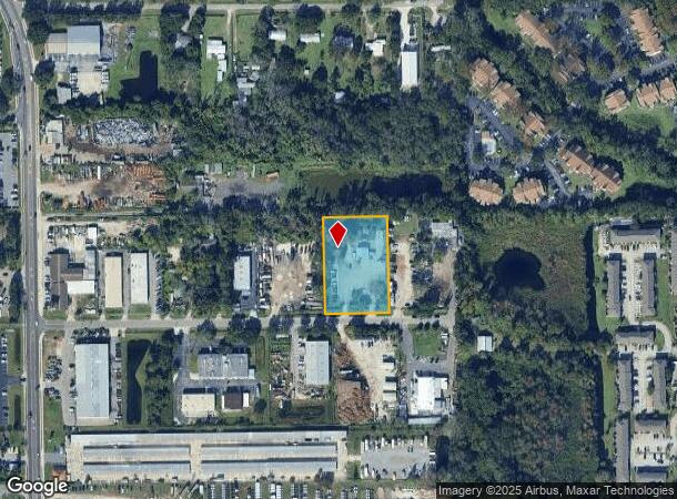
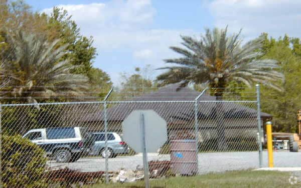
Property Record
7235 Gardner St, Winter Park, FL 32792

NEARBY LISTINGS FOR SALE OR LEASE
Property Detail
7235 Gardner St
Orlando-Kissimmee-Sanford, FL
Acreage & Unrec
11-2230-0000-00-034
W 200 FT OF E 420 FT OF N1/2 OF S1/2 OF NW1/4 OF SW1/4 (LESS S 30 FT FOR RD R/W) OF SEC 11-22-30
Officebuilding
Orange
X
Florida
12095C0260F
34
2024
1.38 AC
2025
SE Orange County
016407
Orlando
3,245 SF
DEMOGRAPHICS near 7235 Gardner St
1 Mile
3 Mile
5 Mile
2024 Total Population
13,294
107,611
278,173
2029 Population
13,645
110,700
286,616
Pop Growth 2024-2029
+ 2.64%
+ 2.87%
+ 3.04%
Average Age
36
39
39
2024 Total Households
5,784
43,507
110,278
HH Growth 2024-2029
+ 2.70%
+ 2.88%
+ 3.10%
Median Household Inc
$49,529
$61,607
$65,444
Avg Household Size
2.30
2.40
2.40
2024 Avg HH Vehicles
2.00
2.00
2.00
Median Home Value
$255,789
$297,995
$312,654
Median Year Built
1985
1984
1983
Nearby Places
Map Layers
Map Styles
 Street
 Aerial
- Restaurants
- Banks
- Shops
- Fitness
- Groceries
PUBLIC TRANSPORTATION
COMMUTER RAIL
DRIVE
WALK
Distance
13 min
5.1 mi
DRIVE
WALK
Distance
13 min
5.2 mi
AIRPORT
Orlando International
DRIVE
WALK
Distance
Orlando International
22 min
11.6 mi
Orlando Sanford International
DRIVE
WALK
Distance
Orlando Sanford International
29 min
18.3 mi
Nearby Properties
Address
Land Use
TOTAL SIZE
Lot Size
Zoning
Address
Land Use
TOTAL SIZE
Lot Size
Zoning
712,535 SF
16.90 AC
O-1
Address
Land Use
TOTAL SIZE
Lot Size
Zoning
483,552 SF
11.86 AC
PD/AN
Address
Land Use
TOTAL SIZE
Lot Size
Zoning
355,755 SF
50.32 AC
PQP
Address
Land Use
TOTAL SIZE
Lot Size
Zoning
676,774 SF
46.39 AC
R-4
Address
Land Use
TOTAL SIZE
Lot Size
Zoning
621,816 SF
36.92 AC
R-3
Address
Land Use
TOTAL SIZE
Lot Size
Zoning
428,559 SF
2.03 AC
PD
Address
Land Use
TOTAL SIZE
Lot Size
Zoning
565,620 SF
29.82 AC
R-3
Address
Land Use
TOTAL SIZE
Lot Size
Zoning
300,668 SF
40.51 AC
P
Address
Land Use
TOTAL SIZE
Lot Size
Zoning
476,200 SF
17.19 AC
P-D
Address
Land Use
TOTAL SIZE
Lot Size
Zoning
415,576 SF
U-ORG-P-D
Address
Land Use
TOTAL SIZE
Lot Size
Zoning
347,890 SF
43.43 AC
IND-4
Address
Land Use
TOTAL SIZE
Lot Size
Zoning
460,602 SF
5.45 AC
PD
Address
Land Use
TOTAL SIZE
Lot Size
Zoning
510,629 SF
23.08 AC
R-3
Address
Land Use
TOTAL SIZE
Lot Size
Zoning
414,790 SF
1.79 AC
RSTD R-3
Address
Land Use
TOTAL SIZE
Lot Size
Zoning
804,638 SF
62.04 AC
R-1A
Address
Land Use
TOTAL SIZE
Lot Size
Zoning
306,193 SF
10.11 AC
P-D
Address
Land Use
TOTAL SIZE
Lot Size
Zoning
419,099 SF
35.79 AC
R-3
Address
Land Use
TOTAL SIZE
Lot Size
Zoning
448,678 SF
4.55 AC
PD
Address
Land Use
TOTAL SIZE
Lot Size
Zoning
434,518 SF
24.96 AC
P-D
Address
Land Use
TOTAL SIZE
Lot Size
Zoning
414,036 SF
17.74 AC
R-3
Address
Land Use
TOTAL SIZE
Lot Size
Zoning
434,387 SF
26.01 AC
R3
Address
Land Use
TOTAL SIZE
Lot Size
Zoning
434,357 SF
20 AC
R-3
Address
Land Use
TOTAL SIZE
Lot Size
Zoning
321,144 SF
3.80 AC
R-3
Address
Land Use
TOTAL SIZE
Lot Size
Zoning
245,237 SF
7.83 AC
P-D
Address
Land Use
TOTAL SIZE
Lot Size
Zoning
344,304 SF
16.85 AC
R-3
Address
Land Use
TOTAL SIZE
Lot Size
Zoning
29,572 SF
66.27 AC
PR
Address
Land Use
TOTAL SIZE
Lot Size
Zoning
302,513 SF
12.82 AC
R-3
Address
Land Use
TOTAL SIZE
Lot Size
Zoning
245,421 SF
1.46 AC
R-3
Address
Land Use
TOTAL SIZE
Lot Size
Zoning
228,891 SF
6.89 AC
P-D
Address
Land Use
TOTAL SIZE
Lot Size
Zoning
422,450 SF
21.13 AC
R-3
The World's #1 Commercial Real Estate Marketplace
Connect with us
© 2025 CoStar Group
The information above has been obtained from sources believed reliable. While we do not doubt its accuracy we have not verified it and make no guarantee, warranty or representation about it. It is your responsibility to independently confirm its accuracy and completeness. Any projections, opinions, assumptions, or estimates used are for example only and do not represent the current or future performance of the property. The value of this transaction to you depends on tax and other factors which should be evaluated by your tax, financial, and legal advisors. You and your advisors should conduct a careful, independent investigation of the property to determine to your satisfaction the suitability of the property for your needs.