Property Record
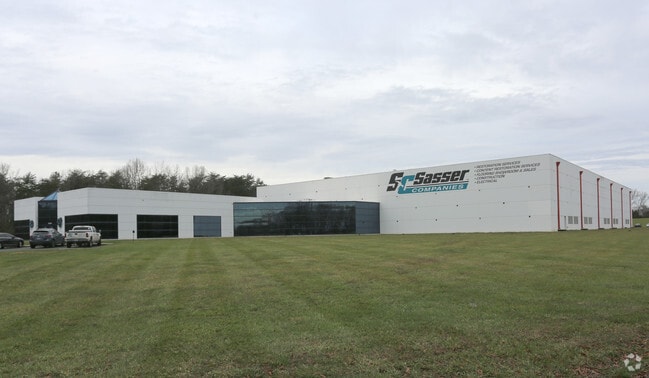
7237 Pace Dr, Whitsett, NC 27377


Property Detail
7237 Pace Dr
0103477
11.90AC PB113-108 & PB163 -70 PL:113-108
Industrialgeneral
Guilford
LI
North Carolina
B and X Area of moderate flood hazard, usually the area between the limits of the 100-year and 500-year floods.
69
2024
11.90 AC
2025
SE Guilford County
015202
Greensboro/Winston-Salem
53,090 SF
Greensboro-High Point, NC
NEARBY LISTINGS FOR SALE OR LEASE
DEMOGRAPHICS near 7237 Pace Dr
1 mile
3 mile
5 mile
2025 Total Population
3,462
24,524
51,167
2030 Population
3,670
25,854
53,711
Pop Growth 2025-2030
+ 6.01%
+ 5.42%
+ 4.97%
Average Age
37
41
41
2025 Total Households
1,282
10,095
20,554
HH Growth 2025-2030
+ 6.16%
+ 5.59%
+ 5.18%
Median Household Inc
$95,731
$77,374
$75,770
Avg Household Size
2.70
2.40
2.40
2025 Avg HH Vehicles
2.00
2.00
2.00
Median Home Value
$285,999
$334,850
$319,710
Median Year Built
2010
2004
2000
Nearby Places
Map Layers
Map Styles
 Street
 Aerial
Transit
 Traffic
 Biking
Places
Listings with unknown addresses are not visible on the map
- Restaurants
- Banks
- Shops
- Fitness
- Groceries
PUBLIC TRANSPORTATION
COMMUTER RAIL
Burlington Station (Piedmont - North Carolina by Train (NC Train))
Drive
Walk
Distance
Burlington Station (Piedmont - North Carolina by Train (NC Train))
18 min
9.8 mi
AIRPORT
Piedmont Triad International
Drive
Walk
Distance
Piedmont Triad International
39 min
25.0 mi
Freight Ports
Virginia Port Authority - Richmond
Drive
Walk
Distance
Virginia Port Authority - Richmond
214 min
185.1 mi
Nearby Properties
Address
Land Use
TOTAL SIZE
Lot Size
Zoning
Address
Land Use
TOTAL SIZE
Lot Size
Zoning
495,280 SF
105.18 AC
LI
Address
Land Use
TOTAL SIZE
Lot Size
Zoning
81,153 SF
62.10 AC
X 1
Address
Land Use
TOTAL SIZE
Lot Size
Zoning
26,280 SF
14.34 AC
R 15
Address
Land Use
TOTAL SIZE
Lot Size
Zoning
531,300 SF
29.40 AC
LI
Address
Land Use
TOTAL SIZE
Lot Size
Zoning
297,670 SF
37.41 AC
LI
Address
Land Use
TOTAL SIZE
Lot Size
Zoning
26,280 SF
11.24 AC
CR
Address
Land Use
TOTAL SIZE
Lot Size
Zoning
51,381 SF
34.69 AC
CB
Address
Land Use
TOTAL SIZE
Lot Size
Zoning
475,200 SF
46.54 AC
LI
Address
Land Use
TOTAL SIZE
Lot Size
Zoning
47,520 SF
6.10 AC
B 2
Address
Land Use
TOTAL SIZE
Lot Size
Zoning
23,265 SF
20.45 AC
MF A
Address
Land Use
TOTAL SIZE
Lot Size
Zoning
93,763 SF
33.51 AC
LI
Address
Land Use
TOTAL SIZE
Lot Size
Zoning
399,195 SF
24.84 AC
RM-12
Address
Land Use
TOTAL SIZE
Lot Size
Zoning
135,186 SF
15.60 AC
CR
Address
Land Use
TOTAL SIZE
Lot Size
Zoning
28,812 SF
15.63 AC
MFA
Address
Land Use
TOTAL SIZE
Lot Size
Zoning
84,783 SF
32.88 AC
CB
Address
Land Use
TOTAL SIZE
Lot Size
Zoning
298,682 SF
21.54 AC
CR
Address
Land Use
TOTAL SIZE
Lot Size
Zoning
300,464 SF
19.67 AC
LI
Address
Land Use
TOTAL SIZE
Lot Size
Zoning
257,796 SF
17.91 AC
CU-HI
Address
Land Use
TOTAL SIZE
Lot Size
Zoning
246,317 SF
18.72 AC
PD-R
Address
Land Use
TOTAL SIZE
Lot Size
Zoning
260,000 SF
20.35 AC
LI
Address
Land Use
TOTAL SIZE
Lot Size
Zoning
240,155 SF
21.72 AC
LI
Address
Land Use
TOTAL SIZE
Lot Size
Zoning
10,604 SF
24.43 AC
R 9
Address
Land Use
TOTAL SIZE
Lot Size
Zoning
81,726 SF
18.01 AC
R 15
Address
Land Use
TOTAL SIZE
Lot Size
Zoning
162,161 SF
19.18 AC
RM-8
Address
Land Use
TOTAL SIZE
Lot Size
Zoning
90,083 SF
2.33 AC
CB
Address
Land Use
TOTAL SIZE
Lot Size
Zoning
26,280 SF
9.64 AC
R15
Address
Land Use
TOTAL SIZE
Lot Size
Zoning
271,850 SF
25.24 AC
LI
Address
Land Use
TOTAL SIZE
Lot Size
Zoning
30,000 SF
3.48 AC
R 15
Address
Land Use
TOTAL SIZE
Lot Size
Zoning
215,233 SF
18.98 AC
LI
Address
Land Use
TOTAL SIZE
Lot Size
Zoning
92,497 SF
22.35 AC
LI
The World's #1 Commercial Real Estate Marketplace
Connect with us
© 2026 CoStar Group
The information above has been obtained from sources believed reliable. While we do not doubt its accuracy we have not verified it and make no guarantee, warranty or representation about it. It is your responsibility to independently confirm its accuracy and completeness. Any projections, opinions, assumptions, or estimates used are for example only and do not represent the current or future performance of the property. The value of this transaction to you depends on tax and other factors which should be evaluated by your tax, financial, and legal advisors. You and your advisors should conduct a careful, independent investigation of the property to determine to your satisfaction the suitability of the property for your needs.