Property Record
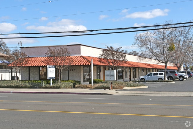
724 N Ben Maddox Way, Visalia, CA 93292


NEARBY LISTINGS FOR SALE OR LEASE
Property Detail
724 N Ben Maddox Way
Visalia, CA
Emerald Park 02
098-150-040-000
PAR 1 PM 4402 B45 P07
Medicalbuilding
Tulare
AE
California
06107C0934E
16
2024
0.46 AC
2025
North Visalia
001305
Visalia/Porterville
6,725 SF
DEMOGRAPHICS near 724 N Ben Maddox Way
1 Mile
3 Mile
5 Mile
2024 Total Population
13,673
98,539
171,010
2029 Population
14,122
102,177
177,383
Pop Growth 2024-2029
+ 3.28%
+ 3.69%
+ 3.73%
Average Age
35
35
36
2024 Total Households
4,320
31,569
55,271
HH Growth 2024-2029
+ 3.33%
+ 3.66%
+ 3.72%
Median Household Inc
$52,753
$65,387
$68,162
Avg Household Size
3.10
3.00
3.00
2024 Avg HH Vehicles
2.00
2.00
2.00
Median Home Value
$228,328
$283,449
$292,412
Median Year Built
1982
1984
1986
Nearby Places
Map Layers
Map Styles
 Street
 Aerial
- Restaurants
- Banks
- Shops
- Fitness
- Groceries
SALE & LEASE HISTORY
LISTING DATE
SALE/LEASE

Sep 25, 2016
For Lease
Sep 24, 2016
For Sale
Jun 02, 2025
For Lease
Dec 18, 2024
For Sale
Nearby Properties
Address
Land Use
TOTAL SIZE
Lot Size
Zoning
Address
Land Use
TOTAL SIZE
Lot Size
Zoning
393,784 SF
17.79 AC
CR
Address
Land Use
TOTAL SIZE
Lot Size
Zoning
47,768 SF
6.76 AC
RM2
Address
Land Use
TOTAL SIZE
Lot Size
Zoning
123.41 AC
Address
Land Use
TOTAL SIZE
Lot Size
Zoning
82.35 AC
QP
Address
Land Use
TOTAL SIZE
Lot Size
Zoning
146,890 SF
11.73 AC
CCM
Address
Land Use
TOTAL SIZE
Lot Size
Zoning
91,492 SF
4.80 AC
RM3
Address
Land Use
TOTAL SIZE
Lot Size
Zoning
61,587 SF
0.43 AC
PA
Address
Land Use
TOTAL SIZE
Lot Size
Zoning
4.24 AC
Address
Land Use
TOTAL SIZE
Lot Size
Zoning
185,883 SF
9.97 AC
CSO
Address
Land Use
TOTAL SIZE
Lot Size
Zoning
56,384 SF
9.14 AC
Address
Land Use
TOTAL SIZE
Lot Size
Zoning
126,532 SF
8.63 AC
RM2
Address
Land Use
TOTAL SIZE
Lot Size
Zoning
47,242 SF
3.94 AC
QP-PA
Address
Land Use
TOTAL SIZE
Lot Size
Zoning
54,674 SF
1.26 AC
CDT
Address
Land Use
TOTAL SIZE
Lot Size
Zoning
134,055 SF
3.49 AC
CDT
Address
Land Use
TOTAL SIZE
Lot Size
Zoning
5.85 AC
RM2
Address
Land Use
TOTAL SIZE
Lot Size
Zoning
82,200 SF
6.29 AC
CSO
Address
Land Use
TOTAL SIZE
Lot Size
Zoning
87,160 SF
0.75 AC
PA
Address
Land Use
TOTAL SIZE
Lot Size
Zoning
69,120 SF
5.23 AC
CR
Address
Land Use
TOTAL SIZE
Lot Size
Zoning
83,011 SF
4.46 AC
QP
Address
Land Use
TOTAL SIZE
Lot Size
Zoning
88,589 SF
7.98 AC
CR
Address
Land Use
TOTAL SIZE
Lot Size
Zoning
133,910 SF
14.35 AC
CSO
Address
Land Use
TOTAL SIZE
Lot Size
Zoning
17,933 SF
3.98 AC
CR
Address
Land Use
TOTAL SIZE
Lot Size
Zoning
1.07 AC
CDT
Address
Land Use
TOTAL SIZE
Lot Size
Zoning
8,319 SF
19.68 AC
Address
Land Use
TOTAL SIZE
Lot Size
Zoning
103,550 SF
8.63 AC
CR
Address
Land Use
TOTAL SIZE
Lot Size
Zoning
47,035 SF
3.29 AC
CCM
Address
Land Use
TOTAL SIZE
Lot Size
Zoning
6.42 AC
CN
Address
Land Use
TOTAL SIZE
Lot Size
Zoning
32,741 SF
1.87 AC
The World's #1 Commercial Real Estate Marketplace
Connect with us
© 2026 CoStar Group
The information above has been obtained from sources believed reliable. While we do not doubt its accuracy we have not verified it and make no guarantee, warranty or representation about it. It is your responsibility to independently confirm its accuracy and completeness. Any projections, opinions, assumptions, or estimates used are for example only and do not represent the current or future performance of the property. The value of this transaction to you depends on tax and other factors which should be evaluated by your tax, financial, and legal advisors. You and your advisors should conduct a careful, independent investigation of the property to determine to your satisfaction the suitability of the property for your needs.