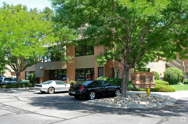
Property Record
724 Whalers Way, Fort Collins, CO 80525
This Property Is For Sale
Current Lease Availabilities
Property Detail
724 Whalers Way
97364-19-011
POR BLK 1, 1ST REP BOARKWALK AT THE LANDINGS PUD, FTC, DESC AS BEG AT NWRLY COR BLK 1 (BEING NERLY COR BOARDWALK DR); TH ERLY ALG NRLY LN SD BLK N 56 34 21 E 207.63 FT; S 90 E 161.27 FT; S 0 W 206.78 FT TPOB; TH N 89 51 48 E 73.6 FT, S 0 8 12 E 49.6
Officebuilding
Larimer
MMN
Colorado
B and X Area of moderate flood hazard, usually the area between the limits of the 100-year and 500-year floods.
0.08 AC
2024
Fort Collins/Loveland
2025
Denver
001007
Fort Collins-Loveland, CO
7,154 SF
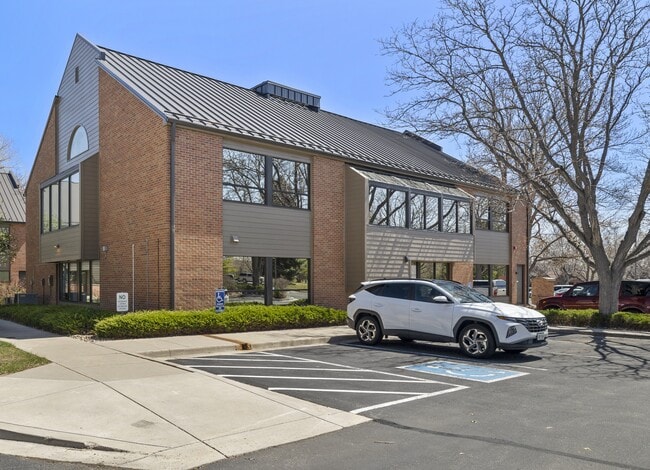
NEARBY LISTINGS FOR SALE OR LEASE
DEMOGRAPHICS near 724 Whalers Way
1 mile
3 mile
5 mile
2025 Total Population
10,134
96,526
176,079
2030 Population
10,474
99,200
182,184
Pop Growth 2025-2030
+ 3.36%
+ 2.77%
+ 3.47%
Average Age
42
39
37
2025 Total Households
5,062
40,229
70,699
HH Growth 2025-2030
+ 3.85%
+ 2.97%
+ 3.90%
Median Household Inc
$74,597
$91,504
$81,667
Avg Household Size
1.90
2.30
2.30
2025 Avg HH Vehicles
2.00
2.00
2.00
Median Home Value
$636,544
$620,385
$627,629
Median Year Built
1991
1993
1992
Nearby Places
Map Layers
Map Styles
 Street
 Aerial
Transit
 Traffic
 Biking
Places
Listings with unknown addresses are not visible on the map
- Restaurants
- Banks
- Shops
- Fitness
- Groceries
Nearby Properties
Address
Land Use
TOTAL SIZE
Lot Size
Zoning
Address
Land Use
TOTAL SIZE
Lot Size
Zoning
986,039 SF
69.46 AC
HC
Address
Land Use
TOTAL SIZE
Lot Size
Zoning
235,094 SF
20.06 AC
HC
Address
Land Use
TOTAL SIZE
Lot Size
Zoning
360,725 SF
33.93 AC
MMN
Address
Land Use
TOTAL SIZE
Lot Size
Zoning
536,325 SF
71.48 AC
Address
Land Use
TOTAL SIZE
Lot Size
Zoning
211,711 SF
19.22 AC
HC
Address
Land Use
TOTAL SIZE
Lot Size
Zoning
215,240 SF
29.22 AC
RL
Address
Land Use
TOTAL SIZE
Lot Size
Zoning
222,592 SF
21.69 AC
HC
Address
Land Use
TOTAL SIZE
Lot Size
Zoning
95,880 SF
16.69 AC
Address
Land Use
TOTAL SIZE
Lot Size
Zoning
283,141 SF
24 AC
RL
Address
Land Use
TOTAL SIZE
Lot Size
Zoning
137,014 SF
13.64 AC
HC
Address
Land Use
TOTAL SIZE
Lot Size
Zoning
146,813 SF
26.87 AC
Address
Land Use
TOTAL SIZE
Lot Size
Zoning
170,119 SF
12.83 AC
C
Address
Land Use
TOTAL SIZE
Lot Size
Zoning
337,566 SF
2.62 AC
Address
Land Use
TOTAL SIZE
Lot Size
Zoning
190,617 SF
10.30 AC
HC
Address
Land Use
TOTAL SIZE
Lot Size
Zoning
173,575 SF
28.86 AC
RL
Address
Land Use
TOTAL SIZE
Lot Size
Zoning
98,518 SF
7.54 AC
MMN
Address
Land Use
TOTAL SIZE
Lot Size
Zoning
227,180 SF
39 AC
E
Address
Land Use
TOTAL SIZE
Lot Size
Zoning
199,464 SF
29.36 AC
HC
Address
Land Use
TOTAL SIZE
Lot Size
Zoning
139,965 SF
8.62 AC
CSU
Address
Land Use
TOTAL SIZE
Lot Size
Zoning
115,260 SF
9.08 AC
HC
Address
Land Use
TOTAL SIZE
Lot Size
Zoning
181,956 SF
5 AC
C
Address
Land Use
TOTAL SIZE
Lot Size
Zoning
312,405 SF
16.01 AC
Address
Land Use
TOTAL SIZE
Lot Size
Zoning
189,255 SF
22.89 AC
Address
Land Use
TOTAL SIZE
Lot Size
Zoning
71,244 SF
5.96 AC
C
Address
Land Use
TOTAL SIZE
Lot Size
Zoning
42,205 SF
11.50 AC
Address
Land Use
TOTAL SIZE
Lot Size
Zoning
375,679 SF
17.13 AC
Address
Land Use
TOTAL SIZE
Lot Size
Zoning
189,920 SF
6 AC
E
Address
Land Use
TOTAL SIZE
Lot Size
Zoning
99,997 SF
10.47 AC
NC
The World's #1 Commercial Real Estate Marketplace
Connect with us
© 2026 CoStar Group
The information above has been obtained from sources believed reliable. While we do not doubt its accuracy we have not verified it and make no guarantee, warranty or representation about it. It is your responsibility to independently confirm its accuracy and completeness. Any projections, opinions, assumptions, or estimates used are for example only and do not represent the current or future performance of the property. The value of this transaction to you depends on tax and other factors which should be evaluated by your tax, financial, and legal advisors. You and your advisors should conduct a careful, independent investigation of the property to determine to your satisfaction the suitability of the property for your needs.