Property Record
7249 Factory Shoals Rd, Austell, GA 30168

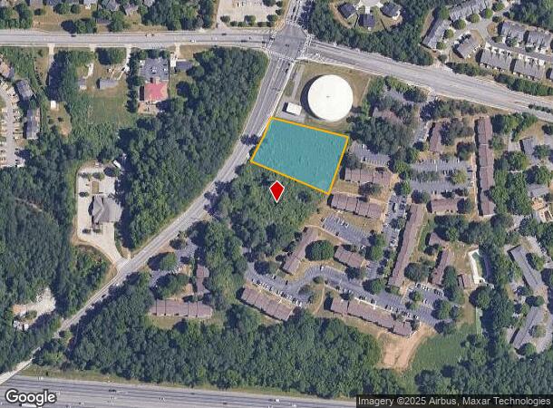
This Property Is For Sale
NEARBY LISTINGS FOR SALE OR LEASE
Property Detail
7249 Factory Shoals Rd
Atlanta-Sandy Springs-Roswell, GA
Homesite
18-0589-0-003-0
ALL THAT TRACT OR PARCEL OF LAND LYING AND BEING IN THE 18TH DISTRICT, 2ND SECTION, COBB COUNTY, GEORGIA, LYING WITHIN LAND LOT 589, IDENTIFIED AS TAX PARCEL 3, ON THE FIELD MAP
Recreationalacreage
Cobb
X
Georgia
13121C0214F
589
2025
1.10 AC
2025
Douglasville/Lithia Springs
031320
Atlanta
1,450 SF
DEMOGRAPHICS near 7249 Factory Shoals Rd
1 Mile
3 Mile
5 Mile
2024 Total Population
8,907
44,653
123,150
2029 Population
9,072
45,698
126,755
Pop Growth 2024-2029
+ 1.85%
+ 2.34%
+ 2.93%
Average Age
34
36
38
2024 Total Households
3,273
16,510
47,254
HH Growth 2024-2029
+ 1.89%
+ 2.30%
+ 2.91%
Median Household Inc
$45,232
$57,721
$66,955
Avg Household Size
2.70
2.60
2.50
2024 Avg HH Vehicles
2.00
2.00
2.00
Median Home Value
$155,805
$205,415
$262,933
Median Year Built
1983
1988
1989
Nearby Places
- Restaurants
- Banks
- Shops
- Fitness
- Groceries
PUBLIC TRANSPORTATION
AIRPORT
Hartsfield - Jackson Atlanta International
DRIVE
WALK
Distance
Hartsfield - Jackson Atlanta International
30 min
20.0 mi
Freight Ports
Georgia Ports - Savannah
DRIVE
WALK
Distance
Georgia Ports - Savannah
293 min
259.3 mi
Nearby Properties
Address
Land Use
TOTAL SIZE
Lot Size
Zoning
Address
Land Use
TOTAL SIZE
Lot Size
Zoning
454,000 SF
68.17 AC
LI-R
Address
Land Use
TOTAL SIZE
Lot Size
Zoning
840,110 SF
53.36 AC
PUD
Address
Land Use
TOTAL SIZE
Lot Size
Zoning
789,717 SF
68.55 AC
LI
Address
Land Use
TOTAL SIZE
Lot Size
Zoning
417,860 SF
40.32 AC
LI
Address
Land Use
TOTAL SIZE
Lot Size
Zoning
652,500 SF
52.87 AC
LI-R
Address
Land Use
TOTAL SIZE
Lot Size
Zoning
913,620 SF
58.88 AC
Address
Land Use
TOTAL SIZE
Lot Size
Zoning
603,096 SF
38.38 AC
HI
Address
Land Use
TOTAL SIZE
Lot Size
Zoning
728,121 SF
48.95 AC
LI
Address
Land Use
TOTAL SIZE
Lot Size
Zoning
307,169 SF
30.13 AC
LI
Address
Land Use
TOTAL SIZE
Lot Size
Zoning
285,933 SF
46.22 AC
R-MF
Address
Land Use
TOTAL SIZE
Lot Size
Zoning
290,784 SF
21.09 AC
RM-12
Address
Land Use
TOTAL SIZE
Lot Size
Zoning
494,858 SF
43.29 AC
IL
Address
Land Use
TOTAL SIZE
Lot Size
Zoning
732,688 SF
47.23 AC
LI-R
Address
Land Use
TOTAL SIZE
Lot Size
Zoning
283,396 SF
29.88 AC
RM-12
Address
Land Use
TOTAL SIZE
Lot Size
Zoning
538,748 SF
35.64 AC
LI
Address
Land Use
TOTAL SIZE
Lot Size
Zoning
245,812 SF
30.90 AC
DCD
Address
Land Use
TOTAL SIZE
Lot Size
Zoning
540,000 SF
35.76 AC
DCD
Address
Land Use
TOTAL SIZE
Lot Size
Zoning
523,551 SF
50.93 AC
LI
Address
Land Use
TOTAL SIZE
Lot Size
Zoning
490,726 SF
50.62 AC
LI-R
Address
Land Use
TOTAL SIZE
Lot Size
Zoning
567,480 SF
44.13 AC
LI
Address
Land Use
TOTAL SIZE
Lot Size
Zoning
70.12 AC
Address
Land Use
TOTAL SIZE
Lot Size
Zoning
527,000 SF
30.38 AC
LI
Address
Land Use
TOTAL SIZE
Lot Size
Zoning
241,200 SF
18.40 AC
RM-12
Address
Land Use
TOTAL SIZE
Lot Size
Zoning
240,612 SF
23.22 AC
R-6
Address
Land Use
TOTAL SIZE
Lot Size
Zoning
479,591 SF
29.76 AC
LI-R
Address
Land Use
TOTAL SIZE
Lot Size
Zoning
729,946 SF
34.07 AC
M2
Address
Land Use
TOTAL SIZE
Lot Size
Zoning
498,167 SF
11.18 AC
HI/WS
Address
Land Use
TOTAL SIZE
Lot Size
Zoning
428,974 SF
26.57 AC
LI-R
Address
Land Use
TOTAL SIZE
Lot Size
Zoning
351,845 SF
29.99 AC
LI-R
Address
Land Use
TOTAL SIZE
Lot Size
Zoning
283,585 SF
22.75 AC
LI
The World's #1 Commercial Real Estate Marketplace
Connect with us
© 2025 CoStar Group
The information above has been obtained from sources believed reliable. While we do not doubt its accuracy we have not verified it and make no guarantee, warranty or representation about it. It is your responsibility to independently confirm its accuracy and completeness. Any projections, opinions, assumptions, or estimates used are for example only and do not represent the current or future performance of the property. The value of this transaction to you depends on tax and other factors which should be evaluated by your tax, financial, and legal advisors. You and your advisors should conduct a careful, independent investigation of the property to determine to your satisfaction the suitability of the property for your needs.