Property Record
7249 Petrol St, Paramount, CA 90723
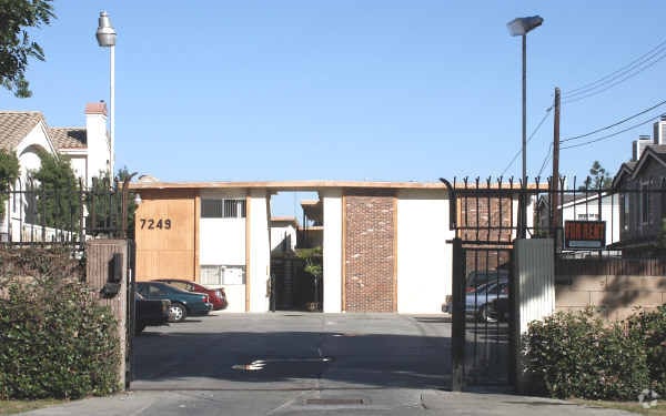


Property Detail
7249 Petrol St
Los Angeles-Long Beach-Glendale, CA
TRACT NO 11345 W 4O FT OF LOT 18 AND E 2O FT OF LOT 19 BLK C
6241-024-025
Los Angeles
Multifamilydwelling
California
PARM*
18,19
2024
0.42 AC
2025
Paramount
553601
Los Angeles
12,200 SF
NEARBY LISTINGS FOR SALE OR LEASE
-
-
-
-
-
-
No Photo
-
-
View all Paramount listings for sale on LoopNet.com
DEMOGRAPHICS near 7249 Petrol St
1 mile
3 mile
5 mile
2025 Total Population
28,441
310,348
775,074
2030 Population
27,990
305,396
762,846
Pop Growth 2025-2030
(1.59%)
(1.60%)
(1.58%)
Average Age
36
37
38
2025 Total Households
7,394
83,267
214,803
HH Growth 2025-2030
(1.84%)
(1.79%)
(1.79%)
Median Household Inc
$69,029
$76,060
$79,006
Avg Household Size
3.70
3.60
3.50
2025 Avg HH Vehicles
2.00
2.00
2.00
Median Home Value
$586,160
$673,915
$703,826
Median Year Built
1969
1958
1958
Nearby Places
Map Layers
Map Styles
 Street
 Aerial
Transit
 Traffic
 Biking
Places
Listings with unknown addresses are not visible on the map
- Restaurants
- Banks
- Shops
- Fitness
- Groceries
PUBLIC TRANSPORTATION
COMMUTER RAIL
Commerce (91 Line - Southern California Regional Rail Authority (Metrolink), Orange County Line - Southern California Regional Rail Authority (Metrolink))
Drive
Walk
Distance
Commerce (91 Line - Southern California Regional Rail Authority (Metrolink), Orange County Line - Southern California Regional Rail Authority (Metrolink))
18 min
7.6 mi
Norwalk/Santa Fe Springs (91 Line - Southern California Regional Rail Authority (Metrolink), Orange County Line - Southern California Regional Rail Authority (Metrolink))
Drive
Walk
Distance
Norwalk/Santa Fe Springs (91 Line - Southern California Regional Rail Authority (Metrolink), Orange County Line - Southern California Regional Rail Authority (Metrolink))
15 min
7.9 mi
AIRPORT
Long Beach (Daugherty Field)
Drive
Walk
Distance
Long Beach (Daugherty Field)
13 min
6.2 mi
Los Angeles International
Drive
Walk
Distance
Los Angeles International
24 min
16.8 mi
John Wayne/Orange County
Drive
Walk
Distance
John Wayne/Orange County
38 min
28.0 mi
Nearby Properties
Address
Land Use
TOTAL SIZE
Lot Size
Zoning
Address
Land Use
TOTAL SIZE
Lot Size
Zoning
1,339,758 SF
28.53 AC
DOM2-P*
Address
Land Use
TOTAL SIZE
Lot Size
Zoning
587,291 SF
11.42 AC
LYHMD*
Address
Land Use
TOTAL SIZE
Lot Size
Zoning
313,224 SF
4.41 AC
SGM2*
Address
Land Use
TOTAL SIZE
Lot Size
Zoning
556,348 SF
26.38 AC
PAM2
Address
Land Use
TOTAL SIZE
Lot Size
Zoning
730,731 SF
14.89 AC
BFCG*
Address
Land Use
TOTAL SIZE
Lot Size
Zoning
373,498 SF
5.20 AC
LBR4R
Address
Land Use
TOTAL SIZE
Lot Size
Zoning
395,436 SF
17.22 AC
LBMG
Address
Land Use
TOTAL SIZE
Lot Size
Zoning
622,175 SF
14.25 AC
LCM11/2*
Address
Land Use
TOTAL SIZE
Lot Size
Zoning
292,696 SF
11.48 AC
LBR4
Address
Land Use
TOTAL SIZE
Lot Size
Zoning
132,404 SF
4.84 AC
LBIG
Address
Land Use
TOTAL SIZE
Lot Size
Zoning
106,028 SF
6.42 AC
DOM2-P*
Address
Land Use
TOTAL SIZE
Lot Size
Zoning
99,674 SF
6.53 AC
DOM2-P*
Address
Land Use
TOTAL SIZE
Lot Size
Zoning
96,849 SF
7.56 AC
LKC3YY
Address
Land Use
TOTAL SIZE
Lot Size
Zoning
183,128 SF
10.77 AC
PAM2*
Address
Land Use
TOTAL SIZE
Lot Size
Zoning
111,746 SF
4.38 AC
DOM2-P*
Address
Land Use
TOTAL SIZE
Lot Size
Zoning
149,723 SF
9.90 AC
LBIG
Address
Land Use
TOTAL SIZE
Lot Size
Zoning
77,168 SF
2.90 AC
DOR3-P*
Address
Land Use
TOTAL SIZE
Lot Size
Zoning
126,905 SF
7.87 AC
LBCHW
Address
Land Use
TOTAL SIZE
Lot Size
Zoning
105,229 SF
2.08 AC
PACM*
Address
Land Use
TOTAL SIZE
Lot Size
Zoning
150,185 SF
2.78 AC
BFM1-CG*
Address
Land Use
TOTAL SIZE
Lot Size
Zoning
109,117 SF
6.58 AC
DOM2-P*
Address
Land Use
TOTAL SIZE
Lot Size
Zoning
380,681 SF
8.84 AC
BFM1*
Address
Land Use
TOTAL SIZE
Lot Size
Zoning
104,912 SF
4.79 AC
LKM1-C3*
Address
Land Use
TOTAL SIZE
Lot Size
Zoning
69,530 SF
2.27 AC
LBCCA
Address
Land Use
TOTAL SIZE
Lot Size
Zoning
51,593 SF
3.92 AC
LYM*
Address
Land Use
TOTAL SIZE
Lot Size
Zoning
45,726 SF
1.56 AC
BFCG-R3-R1
Address
Land Use
TOTAL SIZE
Lot Size
Zoning
114,768 SF
18.82 AC
LBIG
Address
Land Use
TOTAL SIZE
Lot Size
Zoning
446,770 SF
10.22 AC
LBIL
The World's #1 Commercial Real Estate Marketplace
Connect with us
© 2026 CoStar Group
The information above has been obtained from sources believed reliable. While we do not doubt its accuracy we have not verified it and make no guarantee, warranty or representation about it. It is your responsibility to independently confirm its accuracy and completeness. Any projections, opinions, assumptions, or estimates used are for example only and do not represent the current or future performance of the property. The value of this transaction to you depends on tax and other factors which should be evaluated by your tax, financial, and legal advisors. You and your advisors should conduct a careful, independent investigation of the property to determine to your satisfaction the suitability of the property for your needs.