Property Record
725 E Carrie Ave, Saint Louis, MO 63147

Property Detail
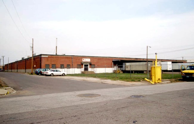
725 E Carrie Ave
St. Louis, MO-IL
C. B. 3477 CARRIE AVE 3.54 ACRES HARLEM HEIGHTS ADDN LOTS 1 TO 20 INCL & VAC ALLEY
3477-00-0010-0
Saint Louis City
Warehouse
Missouri
J
1-20
2024
3.08 AC
2025
St Louis City North
109600
St. Louis
103,650 SF
NEARBY LISTINGS FOR SALE OR LEASE
DEMOGRAPHICS near 725 E Carrie Ave
1 mile
3 mile
5 mile
2025 Total Population
4,363
68,678
225,535
2030 Population
4,370
69,105
225,449
Pop Growth 2025-2030
+ 0.16%
+ 0.62%
(0.04%)
Average Age
43
42
39
2025 Total Households
1,881
29,064
100,553
HH Growth 2025-2030
(0.21%)
+ 0.33%
(0.67%)
Median Household Inc
$36,555
$37,698
$44,163
Avg Household Size
2.20
2.20
2.10
2025 Avg HH Vehicles
1.00
1.00
1.00
Median Home Value
$73,805
$70,010
$88,609
Median Year Built
1946
1947
1950
Nearby Places
Map Layers
Map Styles
 Street
 Aerial
Layers
 Traffic
 Biking
Places
Listings with unknown addresses are not visible on the map
- Restaurants
- Banks
- Shops
- Fitness
- Groceries
PUBLIC TRANSPORTATION
COMMUTER RAIL
Union Station (Lambert Airport Shiloh-Scott - St. Louis MetroLink (MetroLink), Shrewsbury-Lansdowne I-44 Emerson Park - St. Louis MetroLink (MetroLink))
Drive
Walk
Distance
Union Station (Lambert Airport Shiloh-Scott - St. Louis MetroLink (MetroLink), Shrewsbury-Lansdowne I-44 Emerson Park - St. Louis MetroLink (MetroLink))
10 min
5.7 mi
Grand (Lambert Airport Shiloh-Scott - St. Louis MetroLink (MetroLink), Shrewsbury-Lansdowne I-44 Emerson Park - St. Louis MetroLink (MetroLink))
Drive
Walk
Distance
Grand (Lambert Airport Shiloh-Scott - St. Louis MetroLink (MetroLink), Shrewsbury-Lansdowne I-44 Emerson Park - St. Louis MetroLink (MetroLink))
11 min
6.6 mi
AIRPORT
St Louis Lambert International
Drive
Walk
Distance
St Louis Lambert International
16 min
10.0 mi
Scott AFB/Midamerica St Louis
Drive
Walk
Distance
Scott AFB/Midamerica St Louis
43 min
28.6 mi
Freight Ports
Port Milwaukee
Drive
Walk
Distance
Port Milwaukee
422 min
372.9 mi
SALE & LEASE HISTORY
LISTING DATE
SALE/LEASE

Jan 05, 2026
For Lease
Nearby Properties
Address
Land Use
TOTAL SIZE
Lot Size
Zoning
Address
Land Use
TOTAL SIZE
Lot Size
Zoning
Address
Land Use
TOTAL SIZE
Lot Size
Zoning
124.96 AC
J
Address
Land Use
TOTAL SIZE
Lot Size
Zoning
472,328 SF
19.85 AC
I
Address
Land Use
TOTAL SIZE
Lot Size
Zoning
98,308 SF
97.62 AC
H
Address
Land Use
TOTAL SIZE
Lot Size
Zoning
54.74 AC
K
Address
Land Use
TOTAL SIZE
Lot Size
Zoning
Address
Land Use
TOTAL SIZE
Lot Size
Zoning
46.18 AC
A
Address
Land Use
TOTAL SIZE
Lot Size
Zoning
298,990 SF
6.62 AC
I
Address
Land Use
TOTAL SIZE
Lot Size
Zoning
51,460 SF
101.96 AC
K
Address
Land Use
TOTAL SIZE
Lot Size
Zoning
Address
Land Use
TOTAL SIZE
Lot Size
Zoning
229.57 AC
A
Address
Land Use
TOTAL SIZE
Lot Size
Zoning
353,312 SF
17.84 AC
K
Address
Land Use
TOTAL SIZE
Lot Size
Zoning
429,181 SF
23.56 AC
K
Address
Land Use
TOTAL SIZE
Lot Size
Zoning
38.62 AC
AF
Address
Land Use
TOTAL SIZE
Lot Size
Zoning
471,077 SF
16.09 AC
K
Address
Land Use
TOTAL SIZE
Lot Size
Zoning
107,814 SF
5.89 AC
K
Address
Land Use
TOTAL SIZE
Lot Size
Zoning
130.85 AC
B
Address
Land Use
TOTAL SIZE
Lot Size
Zoning
127.48 AC
B
Address
Land Use
TOTAL SIZE
Lot Size
Zoning
297,169 SF
18.01 AC
K
Address
Land Use
TOTAL SIZE
Lot Size
Zoning
24,392 SF
2.26 AC
F
Address
Land Use
TOTAL SIZE
Lot Size
Zoning
118,410 SF
2.25 AC
D
Address
Land Use
TOTAL SIZE
Lot Size
Zoning
11,126 SF
7.21 AC
J
Address
Land Use
TOTAL SIZE
Lot Size
Zoning
45,106 SF
8.07 AC
G
Address
Land Use
TOTAL SIZE
Lot Size
Zoning
46,710 SF
4.53 AC
G
Address
Land Use
TOTAL SIZE
Lot Size
Zoning
76,200 SF
4.85 AC
A
Address
Land Use
TOTAL SIZE
Lot Size
Zoning
88,800 SF
1.20 AC
A
Address
Land Use
TOTAL SIZE
Lot Size
Zoning
22,500 SF
22.21 AC
Address
Land Use
TOTAL SIZE
Lot Size
Zoning
154,822 SF
Address
Land Use
TOTAL SIZE
Lot Size
Zoning
9.15 AC
Address
Land Use
TOTAL SIZE
Lot Size
Zoning
2,188,097 SF
27.13 AC
K
The World's #1 Commercial Real Estate Marketplace
Connect with us
© 2026 CoStar Group
The information above has been obtained from sources believed reliable. While we do not doubt its accuracy we have not verified it and make no guarantee, warranty or representation about it. It is your responsibility to independently confirm its accuracy and completeness. Any projections, opinions, assumptions, or estimates used are for example only and do not represent the current or future performance of the property. The value of this transaction to you depends on tax and other factors which should be evaluated by your tax, financial, and legal advisors. You and your advisors should conduct a careful, independent investigation of the property to determine to your satisfaction the suitability of the property for your needs.