Property Record
725 High St, Aurora, IL 60505
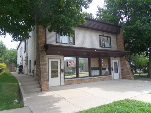

Property Detail
725 High St
Chicago-Naperville-Elgin, IL-IN
DEVISKURS ADDN : LOT 4 BLOCK 1 LOT DIMENSIONS: 77 X 122.6 APPROX LOT SQ FT 9440 SUBDIVISION: DEVISKURS ADDN RANGE CODE: 001
15-15-432-009
Kane
Commercialnec
Illinois
B and X Area of moderate flood hazard, usually the area between the limits of the 100-year and 500-year floods.
4
2024
0.22 AC
2024
Western East/West Corr
853300
Chicago
3,088 SF
NEARBY LISTINGS FOR SALE OR LEASE
DEMOGRAPHICS near 725 High St
1 mile
3 mile
5 mile
2025 Total Population
15,425
116,625
242,626
2030 Population
15,325
117,267
246,323
Pop Growth 2025-2030
(0.65%)
+ 0.55%
+ 1.52%
Average Age
36
37
38
2025 Total Households
4,677
37,846
83,110
HH Growth 2025-2030
(0.38%)
+ 0.68%
+ 1.59%
Median Household Inc
$67,846
$77,534
$93,535
Avg Household Size
3.20
2.90
2.80
2025 Avg HH Vehicles
2.00
2.00
2.00
Median Home Value
$199,950
$247,663
$279,150
Median Year Built
1951
1968
1987
Nearby Places
Map Layers
Map Styles
 Street
 Aerial
Layers
 Traffic
 Biking
Places
Listings with unknown addresses are not visible on the map
- Restaurants
- Banks
- Shops
- Fitness
- Groceries
PUBLIC TRANSPORTATION
COMMUTER RAIL
Aurora Station (Burlington Northern-Santa Fe Railway Line - Northeast Illinois Regional Commuter Railroad (Metra))
Drive
Walk
Distance
Aurora Station (Burlington Northern-Santa Fe Railway Line - Northeast Illinois Regional Commuter Railroad (Metra))
4 min
1.4 mi
Route 59 Station (Burlington Northern-Santa Fe Railway Line - Northeast Illinois Regional Commuter Railroad (Metra))
Drive
Walk
Distance
Route 59 Station (Burlington Northern-Santa Fe Railway Line - Northeast Illinois Regional Commuter Railroad (Metra))
13 min
5.6 mi
AIRPORT
Chicago Midway International
Drive
Walk
Distance
Chicago Midway International
53 min
34.9 mi
Chicago O'Hare International
Drive
Walk
Distance
Chicago O'Hare International
52 min
35.8 mi
Freight Ports
Port Milwaukee
Drive
Walk
Distance
Port Milwaukee
133 min
107.5 mi
Nearby Properties
Address
Land Use
TOTAL SIZE
Lot Size
Zoning
Address
Land Use
TOTAL SIZE
Lot Size
Zoning
41.29 AC
Address
Land Use
TOTAL SIZE
Lot Size
Zoning
28.52 AC
R
Address
Land Use
TOTAL SIZE
Lot Size
Zoning
27.18 AC
Address
Land Use
TOTAL SIZE
Lot Size
Zoning
10.62 AC
Address
Land Use
TOTAL SIZE
Lot Size
Zoning
Address
Land Use
TOTAL SIZE
Lot Size
Zoning
18.48 AC
Address
Land Use
TOTAL SIZE
Lot Size
Zoning
692,020 SF
33.90 AC
Address
Land Use
TOTAL SIZE
Lot Size
Zoning
Address
Land Use
TOTAL SIZE
Lot Size
Zoning
581,960 SF
17.63 AC
Address
Land Use
TOTAL SIZE
Lot Size
Zoning
20.56 AC
Address
Land Use
TOTAL SIZE
Lot Size
Zoning
12.80 AC
Address
Land Use
TOTAL SIZE
Lot Size
Zoning
622,072 SF
6.04 AC
Address
Land Use
TOTAL SIZE
Lot Size
Zoning
521,922 SF
19.87 AC
Address
Land Use
TOTAL SIZE
Lot Size
Zoning
Address
Land Use
TOTAL SIZE
Lot Size
Zoning
607,706 SF
16.55 AC
Address
Land Use
TOTAL SIZE
Lot Size
Zoning
25.07 AC
Address
Land Use
TOTAL SIZE
Lot Size
Zoning
11.79 AC
Address
Land Use
TOTAL SIZE
Lot Size
Zoning
320,874 SF
1.49 AC
Address
Land Use
TOTAL SIZE
Lot Size
Zoning
Address
Land Use
TOTAL SIZE
Lot Size
Zoning
383,948 SF
17.92 AC
Address
Land Use
TOTAL SIZE
Lot Size
Zoning
17.42 AC
Address
Land Use
TOTAL SIZE
Lot Size
Zoning
317,815 SF
21.29 AC
Address
Land Use
TOTAL SIZE
Lot Size
Zoning
307,544 SF
22.99 AC
I
Address
Land Use
TOTAL SIZE
Lot Size
Zoning
173,240 SF
0.90 AC
Address
Land Use
TOTAL SIZE
Lot Size
Zoning
100,340 SF
1.80 AC
Address
Land Use
TOTAL SIZE
Lot Size
Zoning
289,366 SF
14.53 AC
Address
Land Use
TOTAL SIZE
Lot Size
Zoning
73,880 SF
0.75 AC
Address
Land Use
TOTAL SIZE
Lot Size
Zoning
306,707 SF
8.15 AC
I
Address
Land Use
TOTAL SIZE
Lot Size
Zoning
Address
Land Use
TOTAL SIZE
Lot Size
Zoning
181,268 SF
7.62 AC
The World's #1 Commercial Real Estate Marketplace
Connect with us
© 2026 CoStar Group
The information above has been obtained from sources believed reliable. While we do not doubt its accuracy we have not verified it and make no guarantee, warranty or representation about it. It is your responsibility to independently confirm its accuracy and completeness. Any projections, opinions, assumptions, or estimates used are for example only and do not represent the current or future performance of the property. The value of this transaction to you depends on tax and other factors which should be evaluated by your tax, financial, and legal advisors. You and your advisors should conduct a careful, independent investigation of the property to determine to your satisfaction the suitability of the property for your needs.