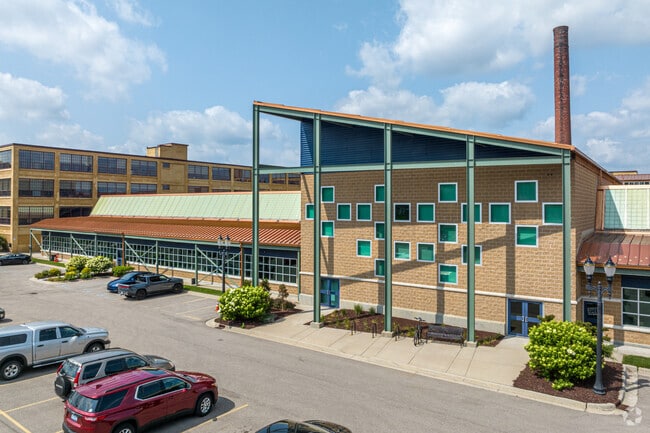
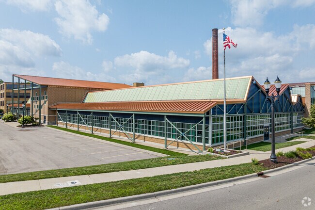
Property Record
May St, Lansing, MI 48906

Current Lease Availabilities
NEARBY LISTINGS FOR SALE OR LEASE
Property Detail
May St
Lansing-East Lansing, MI
Prines Sub
01-01-10-351-013
LOTS 1 THRU 8 BLOCK 1 PRINES SUB & PARTS VAC N EAST ST ADJ THERETO, ALSO S 100 FT OF LOTS 9 AND 10,ALL OF LOT 12 ASSESSOR'S
Industrialacreage
Ingham
X
Michigan
26065C0131D
1-10,12
2024
2.96 AC
2025
Central Lansing
003200
West Michigan
DEMOGRAPHICS near May St
1 mile
3 mile
5 mile
2024 Total Population
12,932
87,700
180,803
2029 Population
13,035
88,020
181,189
Pop Growth 2024-2029
+ 0.80%
+ 0.36%
+ 0.21%
Average Age
35
36
37
2024 Total Households
5,914
37,830
78,702
HH Growth 2024-2029
+ 0.73%
+ 0.31%
+ 0.20%
Median Household Inc
$45,125
$47,330
$47,473
Avg Household Size
2.00
2.10
2.10
2024 Avg HH Vehicles
1.00
1.00
2.00
Median Home Value
$83,289
$123,432
$141,238
Median Year Built
1948
1955
1966
Nearby Places
Map Layers
Map Styles
 Street
 Aerial
Transit
 Traffic
 Biking
Places
Listings with unknown addresses are not visible on the map
- Restaurants
- Banks
- Shops
- Fitness
- Groceries
PUBLIC TRANSPORTATION
COMMUTER RAIL
East Lansing Amtrak Station (Blue Water - Amtrak)
Drive
Walk
Distance
East Lansing Amtrak Station (Blue Water - Amtrak)
8 min
4.0 mi
AIRPORT
Capital Region International
Drive
Walk
Distance
Capital Region International
8 min
4.0 mi
Freight Ports
Port of Toledo
Drive
Walk
Distance
Port of Toledo
147 min
115.2 mi
Nearby Properties
Address
Land Use
TOTAL SIZE
Lot Size
Zoning
Address
Land Use
TOTAL SIZE
Lot Size
Zoning
42,875 SF
35 AC
PD
Address
Land Use
TOTAL SIZE
Lot Size
Zoning
7,579 SF
83.53 AC
PD
Address
Land Use
TOTAL SIZE
Lot Size
Zoning
42,875 SF
28.77 AC
Address
Land Use
TOTAL SIZE
Lot Size
Zoning
111,180 SF
3.63 AC
G-1 BUS
Address
Land Use
TOTAL SIZE
Lot Size
Zoning
14,304 SF
3.37 AC
MIXED Z
Address
Land Use
TOTAL SIZE
Lot Size
Zoning
274,720 SF
10.55 AC
Address
Land Use
TOTAL SIZE
Lot Size
Zoning
12,435 SF
0.52 AC
B3
Address
Land Use
TOTAL SIZE
Lot Size
Zoning
63,461 SF
32 AC
F COMM
Address
Land Use
TOTAL SIZE
Lot Size
Zoning
177,300 SF
8.72 AC
Address
Land Use
TOTAL SIZE
Lot Size
Zoning
69,851 SF
134.23 AC
I HVY
Address
Land Use
TOTAL SIZE
Lot Size
Zoning
13.13 AC
Address
Land Use
TOTAL SIZE
Lot Size
Zoning
66.43 AC
Address
Land Use
TOTAL SIZE
Lot Size
Zoning
195,094 SF
1.89 AC
Address
Land Use
TOTAL SIZE
Lot Size
Zoning
2,137 SF
12.72 AC
H LT IN
Address
Land Use
TOTAL SIZE
Lot Size
Zoning
19,035 SF
12.32 AC
RM08
Address
Land Use
TOTAL SIZE
Lot Size
Zoning
185,190 SF
0.41 AC
G-1 BUS
Address
Land Use
TOTAL SIZE
Lot Size
Zoning
150,589 SF
3.06 AC
D-1 PRO
Address
Land Use
TOTAL SIZE
Lot Size
Zoning
183,047 SF
24.36 AC
B4
Address
Land Use
TOTAL SIZE
Lot Size
Zoning
131,234 SF
2.49 AC
Address
Land Use
TOTAL SIZE
Lot Size
Zoning
9,628 SF
1.86 AC
B2
Address
Land Use
TOTAL SIZE
Lot Size
Zoning
332,832 SF
2.48 AC
G-1 BUS
Address
Land Use
TOTAL SIZE
Lot Size
Zoning
51,248 SF
4.85 AC
I HVY
Address
Land Use
TOTAL SIZE
Lot Size
Zoning
141,026 SF
0.45 AC
B3
Address
Land Use
TOTAL SIZE
Lot Size
Zoning
169,704 SF
0.67 AC
G-1 BUS
Address
Land Use
TOTAL SIZE
Lot Size
Zoning
118,415 SF
4.74 AC
RM22
Address
Land Use
TOTAL SIZE
Lot Size
Zoning
63.94 AC
Address
Land Use
TOTAL SIZE
Lot Size
Zoning
165,684 SF
1.20 AC
G-1 BUS
Address
Land Use
TOTAL SIZE
Lot Size
Zoning
19,035 SF
11.98 AC
RM08
Address
Land Use
TOTAL SIZE
Lot Size
Zoning
159,455 SF
0.42 AC
Address
Land Use
TOTAL SIZE
Lot Size
Zoning
112,248 SF
3.70 AC
B2
The World's #1 Commercial Real Estate Marketplace
Connect with us
© 2026 CoStar Group
The information above has been obtained from sources believed reliable. While we do not doubt its accuracy we have not verified it and make no guarantee, warranty or representation about it. It is your responsibility to independently confirm its accuracy and completeness. Any projections, opinions, assumptions, or estimates used are for example only and do not represent the current or future performance of the property. The value of this transaction to you depends on tax and other factors which should be evaluated by your tax, financial, and legal advisors. You and your advisors should conduct a careful, independent investigation of the property to determine to your satisfaction the suitability of the property for your needs.