Property Record
7250 3Rd St Se, Turner, OR 97392

Save to a Folder
{{folder.Name}}
{{folder.ListingIds.length}} Properties
{{folder.ListingIds.length}} Property
Create a New Folder
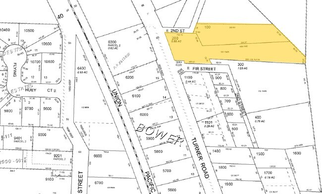
Property Detail
7250 3Rd St Se
530959
ACRES 1.37
Officebuilding
Marion
P-1; C-1
Oregon
B and X Area of moderate flood hazard, usually the area between the limits of the 100-year and 500-year floods.
1.37 AC
2024
Marion County
2025
Portland
002701
Salem, OR
9,002 SF
NEARBY LISTINGS FOR SALE OR LEASE
-
-
View all Turner listings for sale on LoopNet.com
DEMOGRAPHICS near 7250 3Rd St Se
1 mile
3 mile
5 mile
2025 Total Population
3,372
10,463
57,670
2030 Population
3,476
10,669
58,366
Pop Growth 2025-2030
+ 3.08%
+ 1.97%
+ 1.21%
Average Age
43
43
41
2025 Total Households
1,253
3,081
20,398
HH Growth 2025-2030
+ 3.27%
+ 2.21%
+ 1.31%
Median Household Inc
$104,106
$102,021
$88,808
Avg Household Size
2.70
2.70
2.60
2025 Avg HH Vehicles
2.00
2.00
2.00
Median Home Value
$659,206
$685,174
$465,022
Median Year Built
1989
1992
1991
Nearby Places
Map Layers
Map Styles
 Street
 Aerial
Layers
 Traffic
 Biking
Places
Listings with unknown addresses are not visible on the map
- Restaurants
- Banks
- Shops
- Fitness
- Groceries
PUBLIC TRANSPORTATION
COMMUTER RAIL
Salem (Amtrak Cascades - Amtrak, Coast Starlight - Amtrak)
Drive
Walk
Distance
Salem (Amtrak Cascades - Amtrak, Coast Starlight - Amtrak)
14 min
7.7 mi
Freight Ports
Port of Portland
Drive
Walk
Distance
Port of Portland
73 min
55.9 mi
Nearby Properties
Address
Land Use
TOTAL SIZE
Lot Size
Zoning
Address
Land Use
TOTAL SIZE
Lot Size
Zoning
412,248 SF
27.80 AC
Address
Land Use
TOTAL SIZE
Lot Size
Zoning
310,408 SF
203.73 AC
PH; PE
Address
Land Use
TOTAL SIZE
Lot Size
Zoning
Address
Land Use
TOTAL SIZE
Lot Size
Zoning
174,632 SF
4.58 AC
CO
Address
Land Use
TOTAL SIZE
Lot Size
Zoning
51,473 SF
5.01 AC
CO
Address
Land Use
TOTAL SIZE
Lot Size
Zoning
127,442 SF
8.69 AC
R-11
Address
Land Use
TOTAL SIZE
Lot Size
Zoning
161,616 SF
6.74 AC
EC
Address
Land Use
TOTAL SIZE
Lot Size
Zoning
59,705 SF
10.08 AC
UT-10
Address
Land Use
TOTAL SIZE
Lot Size
Zoning
48,762 SF
8.78 AC
P-1; R-11
Address
Land Use
TOTAL SIZE
Lot Size
Zoning
74,519 SF
36.38 AC
R-2
Address
Land Use
TOTAL SIZE
Lot Size
Zoning
Address
Land Use
TOTAL SIZE
Lot Size
Zoning
Address
Land Use
TOTAL SIZE
Lot Size
Zoning
3,975 SF
10 AC
Address
Land Use
TOTAL SIZE
Lot Size
Zoning
30,320 SF
3.06 AC
R-11
Address
Land Use
TOTAL SIZE
Lot Size
Zoning
Address
Land Use
TOTAL SIZE
Lot Size
Zoning
1,234 SF
0.69 AC
CO; RA
Address
Land Use
TOTAL SIZE
Lot Size
Zoning
35.04 AC
EC
Address
Land Use
TOTAL SIZE
Lot Size
Zoning
45,740 SF
4.74 AC
IG-LU
Address
Land Use
TOTAL SIZE
Lot Size
Zoning
36,213 SF
C
Address
Land Use
TOTAL SIZE
Lot Size
Zoning
26.17 AC
EC
Address
Land Use
TOTAL SIZE
Lot Size
Zoning
39,316 SF
5.08 AC
IG
Address
Land Use
TOTAL SIZE
Lot Size
Zoning
Address
Land Use
TOTAL SIZE
Lot Size
Zoning
12,930 SF
1.79 AC
P-1
Address
Land Use
TOTAL SIZE
Lot Size
Zoning
36,720 SF
5 AC
M-1
Address
Land Use
TOTAL SIZE
Lot Size
Zoning
38,401 SF
19.74 AC
R-2
Address
Land Use
TOTAL SIZE
Lot Size
Zoning
55,915 SF
9.55 AC
UT-10
Address
Land Use
TOTAL SIZE
Lot Size
Zoning
31,088 SF
188.73 AC
EFU; SA
Address
Land Use
TOTAL SIZE
Lot Size
Zoning
13,560 SF
5.81 AC
M-1
Address
Land Use
TOTAL SIZE
Lot Size
Zoning
21,000 SF
3.40 AC
UT-10
The World's #1 Commercial Real Estate Marketplace
Connect with us
© 2026 CoStar Group
The information above has been obtained from sources believed reliable. While we do not doubt its accuracy we have not verified it and make no guarantee, warranty or representation about it. It is your responsibility to independently confirm its accuracy and completeness. Any projections, opinions, assumptions, or estimates used are for example only and do not represent the current or future performance of the property. The value of this transaction to you depends on tax and other factors which should be evaluated by your tax, financial, and legal advisors. You and your advisors should conduct a careful, independent investigation of the property to determine to your satisfaction the suitability of the property for your needs.