Property Record
7211 Gabe Ct, Manassas, VA 20109
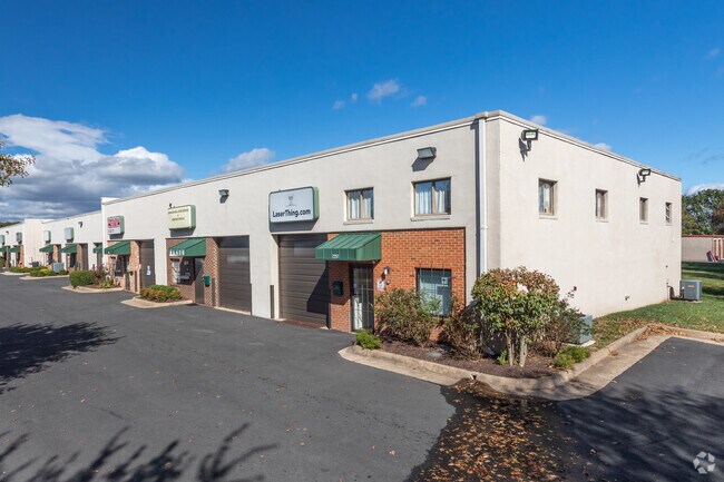
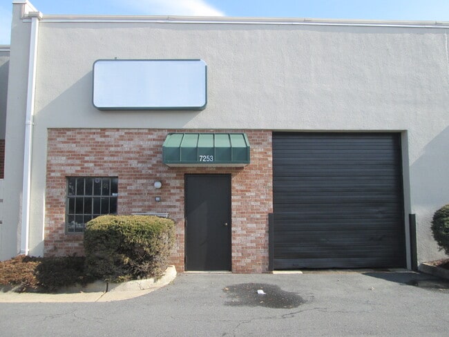
Property Detail
7211 Gabe Ct
7697-16-2808.01
BUILD AMERICA PH 1 U 6 BLDG A
Storebuilding
PRINCE WILLIAM
B1
Virginia
B and X Area of moderate flood hazard, usually the area between the limits of the 100-year and 500-year floods.
2808.
2024
0.04 AC
2025
Rt 29/I-66 Corridor
901403
Washington, DC
1,700 SF
Washington-Arlington-Alexandria, DC-VA-MD-WV
NEARBY LISTINGS FOR SALE OR LEASE
DEMOGRAPHICS near 7211 Gabe Ct
1 mile
3 mile
5 mile
2025 Total Population
13,576
56,805
179,392
2030 Population
14,039
58,259
182,952
Pop Growth 2025-2030
+ 3.41%
+ 2.56%
+ 1.98%
Average Age
33
35
37
2025 Total Households
4,520
18,279
57,028
HH Growth 2025-2030
+ 3.52%
+ 2.63%
+ 2.00%
Median Household Inc
$84,054
$95,784
$120,186
Avg Household Size
3.00
3.00
3.10
2025 Avg HH Vehicles
2.00
2.00
2.00
Median Home Value
$407,904
$436,825
$496,936
Median Year Built
1989
1986
1990
Nearby Places
Map Layers
Map Styles
 Street
 Aerial
Transit
 Traffic
 Biking
Places
Listings with unknown addresses are not visible on the map
- Restaurants
- Banks
- Shops
- Fitness
- Groceries
PUBLIC TRANSPORTATION
COMMUTER RAIL
Manassas Amtrak Station (Cardinal - Amtrak, Crescent - Amtrak, Manassas Line - Amtrak, Northeast Regional - Amtrak)
Drive
Walk
Distance
Manassas Amtrak Station (Cardinal - Amtrak, Crescent - Amtrak, Manassas Line - Amtrak, Northeast Regional - Amtrak)
11 min
4.9 mi
Lead (Manassas Line - Virginia Railway Express)
Drive
Walk
Distance
Lead (Manassas Line - Virginia Railway Express)
14 min
6.6 mi
AIRPORT
Washington Dulles International
Drive
Walk
Distance
Washington Dulles International
30 min
17.7 mi
Ronald Reagan Washington Ntl
Drive
Walk
Distance
Ronald Reagan Washington Ntl
44 min
32.3 mi
Freight Ports
Port of Baltimore
Drive
Walk
Distance
Port of Baltimore
89 min
68.1 mi
SALE & LEASE HISTORY
LISTING DATE
SALE/LEASE

Sep 24, 2016
For Lease
Jun 19, 2017
For Lease
Jun 18, 2018
For Lease
Jan 17, 2018
For Lease
Aug 22, 2017
For Lease
Apr 16, 2019
For Lease
Apr 16, 2019
For Sale
Apr 13, 2021
For Lease
Apr 07, 2020
For Lease
Nearby Properties
Address
Land Use
TOTAL SIZE
Lot Size
Zoning
Address
Land Use
TOTAL SIZE
Lot Size
Zoning
389,649 SF
11.82 AC
M2
Address
Land Use
TOTAL SIZE
Lot Size
Zoning
325,918 SF
41.38 AC
M2
Address
Land Use
TOTAL SIZE
Lot Size
Zoning
230,706 SF
13.94 AC
PMD
Address
Land Use
TOTAL SIZE
Lot Size
Zoning
117.22 AC
M1
Address
Land Use
TOTAL SIZE
Lot Size
Zoning
719,742 SF
62.13 AC
M2
Address
Land Use
TOTAL SIZE
Lot Size
Zoning
115,600 SF
10.06 AC
M1
Address
Land Use
TOTAL SIZE
Lot Size
Zoning
123,534 SF
7.85 AC
M1
Address
Land Use
TOTAL SIZE
Lot Size
Zoning
312,931 SF
83 AC
M2
Address
Land Use
TOTAL SIZE
Lot Size
Zoning
127,700 SF
7.92 AC
M1
Address
Land Use
TOTAL SIZE
Lot Size
Zoning
409,252 SF
18.75 AC
M2
Address
Land Use
TOTAL SIZE
Lot Size
Zoning
165,230 SF
12 AC
M2
Address
Land Use
TOTAL SIZE
Lot Size
Zoning
270,540 SF
13.65 AC
PBD
Address
Land Use
TOTAL SIZE
Lot Size
Zoning
311,198 SF
23.50 AC
M2
Address
Land Use
TOTAL SIZE
Lot Size
Zoning
40.47 AC
PBD
Address
Land Use
TOTAL SIZE
Lot Size
Zoning
402,166 SF
16.72 AC
M2
Address
Land Use
TOTAL SIZE
Lot Size
Zoning
395,617 SF
19.08 AC
PMD
Address
Land Use
TOTAL SIZE
Lot Size
Zoning
51.84 AC
MIXED
Address
Land Use
TOTAL SIZE
Lot Size
Zoning
75,816 SF
29.15 AC
R16
Address
Land Use
TOTAL SIZE
Lot Size
Zoning
29,500 SF
21.97 AC
M1
Address
Land Use
TOTAL SIZE
Lot Size
Zoning
327,574 SF
34.13 AC
R16
Address
Land Use
TOTAL SIZE
Lot Size
Zoning
380,264 SF
15.25 AC
PMD
Address
Land Use
TOTAL SIZE
Lot Size
Zoning
240,103 SF
19.93 AC
R16
Address
Land Use
TOTAL SIZE
Lot Size
Zoning
69,276 SF
18.15 AC
R16
Address
Land Use
TOTAL SIZE
Lot Size
Zoning
406,297 SF
67.08 AC
A1
Address
Land Use
TOTAL SIZE
Lot Size
Zoning
34.66 AC
PBD
Address
Land Use
TOTAL SIZE
Lot Size
Zoning
290,307 SF
23.74 AC
MIXED
Address
Land Use
TOTAL SIZE
Lot Size
Zoning
3,621 SF
48.25 AC
A1
Address
Land Use
TOTAL SIZE
Lot Size
Zoning
213,662 SF
22.18 AC
R16
Address
Land Use
TOTAL SIZE
Lot Size
Zoning
371,926 SF
38.17 AC
B1
Address
Land Use
TOTAL SIZE
Lot Size
Zoning
217,934 SF
10.17 AC
M2
The World's #1 Commercial Real Estate Marketplace
Connect with us
© 2026 CoStar Group
The information above has been obtained from sources believed reliable. While we do not doubt its accuracy we have not verified it and make no guarantee, warranty or representation about it. It is your responsibility to independently confirm its accuracy and completeness. Any projections, opinions, assumptions, or estimates used are for example only and do not represent the current or future performance of the property. The value of this transaction to you depends on tax and other factors which should be evaluated by your tax, financial, and legal advisors. You and your advisors should conduct a careful, independent investigation of the property to determine to your satisfaction the suitability of the property for your needs.