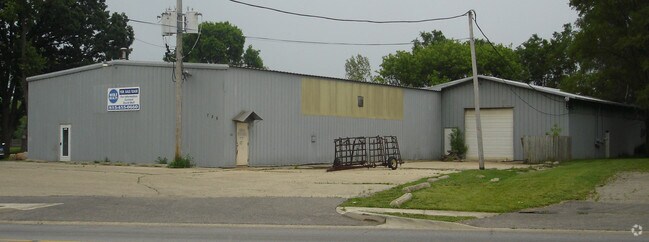
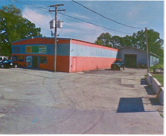
Property Record
726 Mchenry Ave, Woodstock, IL 60098


NEARBY LISTINGS FOR SALE OR LEASE
Property Detail
726 Mchenry Ave
13-05-277-007
DOC 2022R0010123 PT W 130FT CREAMERY LT PT LT 12 ASSRS PLAT
Industrialgeneral
McHenry
X
Illinois
17111C0183J
12
2024
1 AC
2024
McHenry County
870903
Chicago
16,898 SF
Chicago-Naperville-Elgin, IL-IN-WI
DEMOGRAPHICS near 726 Mchenry Ave
1 Mile
3 Mile
5 Mile
2024 Total Population
8,588
27,483
34,096
2029 Population
8,566
27,519
34,123
Pop Growth 2024-2029
(0.26%)
+ 0.13%
+ 0.08%
Average Age
39
40
40
2024 Total Households
3,362
10,471
12,795
HH Growth 2024-2029
(0.30%)
+ 0.10%
+ 0.05%
Median Household Inc
$64,311
$75,890
$80,072
Avg Household Size
2.40
2.50
2.60
2024 Avg HH Vehicles
2.00
2.00
2.00
Median Home Value
$173,251
$207,170
$224,606
Median Year Built
1972
1982
1984
Nearby Places
Map Layers
Map Styles
 Street
 Aerial
- Restaurants
- Banks
- Shops
- Fitness
- Groceries
PUBLIC TRANSPORTATION
TRANSIT/SUBWAY
Woodstock Station (Union Pacific Northwest Line - Northeast Illinois Regional Commuter Railroad (Metra))
DRIVE
WALK
Distance
Woodstock Station (Union Pacific Northwest Line - Northeast Illinois Regional Commuter Railroad (Metra))
2 min
18 min
0.9 mi
COMMUTER RAIL
Woodstock Station (Union Pacific Northwest Line - Northeast Illinois Regional Commuter Railroad (Metra))
DRIVE
WALK
Distance
Woodstock Station (Union Pacific Northwest Line - Northeast Illinois Regional Commuter Railroad (Metra))
2 min
18 min
0.9 mi
Crystal Lake Station (Union Pacific Northwest Line - Northeast Illinois Regional Commuter Railroad (Metra))
DRIVE
WALK
Distance
Crystal Lake Station (Union Pacific Northwest Line - Northeast Illinois Regional Commuter Railroad (Metra))
18 min
9.8 mi
AIRPORT
Chicago/Rockford International
DRIVE
WALK
Distance
Chicago/Rockford International
71 min
44.4 mi
Freight Ports
Port Milwaukee
DRIVE
WALK
Distance
Port Milwaukee
93 min
67.9 mi
Nearby Properties
Address
Land Use
TOTAL SIZE
Lot Size
Zoning
Address
Land Use
TOTAL SIZE
Lot Size
Zoning
41,872 SF
19.37 AC
Address
Land Use
TOTAL SIZE
Lot Size
Zoning
58,535 SF
6.26 AC
Address
Land Use
TOTAL SIZE
Lot Size
Zoning
219,350 SF
19.83 AC
Address
Land Use
TOTAL SIZE
Lot Size
Zoning
352,260 SF
20.65 AC
Address
Land Use
TOTAL SIZE
Lot Size
Zoning
107,299 SF
19.62 AC
Address
Land Use
TOTAL SIZE
Lot Size
Zoning
129,755 SF
13.01 AC
Address
Land Use
TOTAL SIZE
Lot Size
Zoning
214,500 SF
21.21 AC
Address
Land Use
TOTAL SIZE
Lot Size
Zoning
64,528 SF
9.51 AC
Address
Land Use
TOTAL SIZE
Lot Size
Zoning
383,325 SF
30.77 AC
Address
Land Use
TOTAL SIZE
Lot Size
Zoning
50,749 SF
5.92 AC
Address
Land Use
TOTAL SIZE
Lot Size
Zoning
96,633 SF
3.97 AC
Address
Land Use
TOTAL SIZE
Lot Size
Zoning
137,539 SF
22.05 AC
Address
Land Use
TOTAL SIZE
Lot Size
Zoning
164,167 SF
16.11 AC
Address
Land Use
TOTAL SIZE
Lot Size
Zoning
581,330 SF
15.02 AC
Address
Land Use
TOTAL SIZE
Lot Size
Zoning
148,917 SF
9.22 AC
Address
Land Use
TOTAL SIZE
Lot Size
Zoning
72,582 SF
3.74 AC
Address
Land Use
TOTAL SIZE
Lot Size
Zoning
45,876 SF
5.02 AC
Address
Land Use
TOTAL SIZE
Lot Size
Zoning
42,772 SF
4.81 AC
Address
Land Use
TOTAL SIZE
Lot Size
Zoning
93,884 SF
7.46 AC
Address
Land Use
TOTAL SIZE
Lot Size
Zoning
178,561 SF
19.09 AC
Address
Land Use
TOTAL SIZE
Lot Size
Zoning
12,699 SF
8 AC
Address
Land Use
TOTAL SIZE
Lot Size
Zoning
127,765 SF
7.91 AC
Address
Land Use
TOTAL SIZE
Lot Size
Zoning
71,740 SF
4.66 AC
Address
Land Use
TOTAL SIZE
Lot Size
Zoning
64,973 SF
6.54 AC
Address
Land Use
TOTAL SIZE
Lot Size
Zoning
2.78 AC
Address
Land Use
TOTAL SIZE
Lot Size
Zoning
24,968 SF
0.50 AC
Address
Land Use
TOTAL SIZE
Lot Size
Zoning
93,280 SF
11.89 AC
Address
Land Use
TOTAL SIZE
Lot Size
Zoning
189,136 SF
26.97 AC
Address
Land Use
TOTAL SIZE
Lot Size
Zoning
32,308 SF
4.58 AC
Address
Land Use
TOTAL SIZE
Lot Size
Zoning
130,669 SF
13.20 AC
The World's #1 Commercial Real Estate Marketplace
Connect with us
© 2025 CoStar Group
The information above has been obtained from sources believed reliable. While we do not doubt its accuracy we have not verified it and make no guarantee, warranty or representation about it. It is your responsibility to independently confirm its accuracy and completeness. Any projections, opinions, assumptions, or estimates used are for example only and do not represent the current or future performance of the property. The value of this transaction to you depends on tax and other factors which should be evaluated by your tax, financial, and legal advisors. You and your advisors should conduct a careful, independent investigation of the property to determine to your satisfaction the suitability of the property for your needs.