Property Record
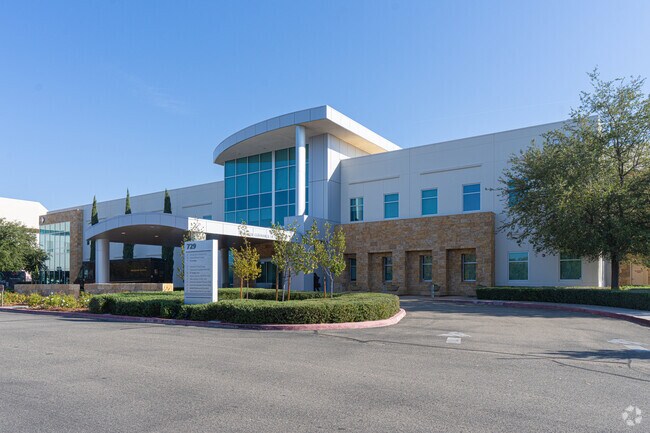
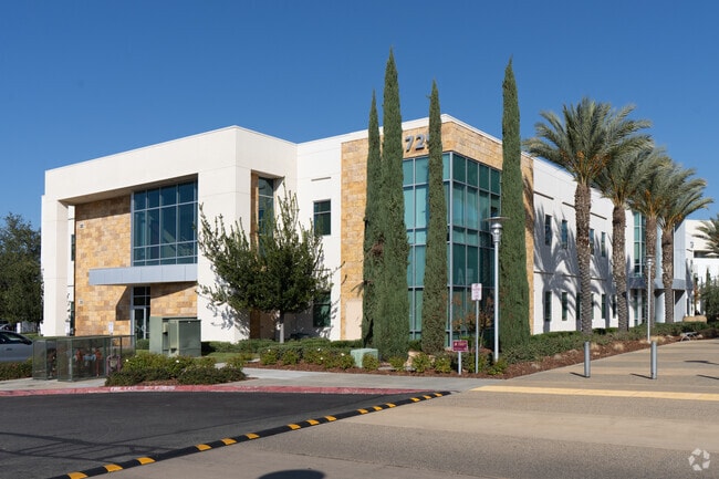
721 N Medical Center Dr W, Clovis, CA 93611


Property Detail
721 N Medical Center Dr W
564-042-82S
10.59 AC POR PAR 2 PM 67-1
Medicalbuilding
FRESNO
CP
California
B and X Area of moderate flood hazard, usually the area between the limits of the 100-year and 500-year floods.
10.59 AC
2025
E Outlying Fresno County
2025
Fresno
005907
Fresno, CA
102,688 SF
NEARBY LISTINGS FOR SALE OR LEASE
DEMOGRAPHICS near 721 N Medical Center Dr W
1 mile
3 mile
5 mile
2025 Total Population
5,935
72,597
183,830
2030 Population
6,021
73,752
187,176
Pop Growth 2025-2030
+ 1.45%
+ 1.59%
+ 1.82%
Average Age
39
38
38
2025 Total Households
2,031
24,424
63,107
HH Growth 2025-2030
+ 1.58%
+ 1.59%
+ 1.80%
Median Household Inc
$126,610
$115,773
$99,094
Avg Household Size
2.90
2.90
2.90
2025 Avg HH Vehicles
2.00
2.00
2.00
Median Home Value
$474,828
$529,798
$486,089
Median Year Built
1997
1999
1995
Nearby Places
Map Layers
Map Styles
 Street
 Aerial
Transit
 Traffic
 Biking
Places
Listings with unknown addresses are not visible on the map
- Restaurants
- Banks
- Shops
- Fitness
- Groceries
PUBLIC TRANSPORTATION
AIRPORT
Fresno Yosemite International
Drive
Walk
Distance
Fresno Yosemite International
16 min
10.2 mi
SALE & LEASE HISTORY
LISTING DATE
SALE/LEASE

Sep 25, 2016
For Lease
Mar 02, 2018
For Lease
Dec 20, 2018
For Lease
Aug 31, 2018
For Lease
Aug 31, 2018
For Lease
Nearby Properties
Address
Land Use
TOTAL SIZE
Lot Size
Zoning
Address
Land Use
TOTAL SIZE
Lot Size
Zoning
397,556 SF
20.45 AC
CP
Address
Land Use
TOTAL SIZE
Lot Size
Zoning
110,872 SF
2.62 AC
CP
Address
Land Use
TOTAL SIZE
Lot Size
Zoning
165,476 SF
13.90 AC
CP
Address
Land Use
TOTAL SIZE
Lot Size
Zoning
96,386 SF
8.47 AC
RT
Address
Land Use
TOTAL SIZE
Lot Size
Zoning
182,606 SF
6.51 AC
RA
Address
Land Use
TOTAL SIZE
Lot Size
Zoning
191,177 SF
19.19 AC
C2
Address
Land Use
TOTAL SIZE
Lot Size
Zoning
91,715 SF
4.50 AC
R3
Address
Land Use
TOTAL SIZE
Lot Size
Zoning
86,678 SF
4.16 AC
CP
Address
Land Use
TOTAL SIZE
Lot Size
Zoning
32,151 SF
14.84 AC
Address
Land Use
TOTAL SIZE
Lot Size
Zoning
67,465 SF
12.60 AC
C
Address
Land Use
TOTAL SIZE
Lot Size
Zoning
8.11 AC
Address
Land Use
TOTAL SIZE
Lot Size
Zoning
86,136 SF
5.50 AC
M2
Address
Land Use
TOTAL SIZE
Lot Size
Zoning
124,728 SF
10.96 AC
R2
Address
Land Use
TOTAL SIZE
Lot Size
Zoning
30,149 SF
16.79 AC
CP
Address
Land Use
TOTAL SIZE
Lot Size
Zoning
114,460 SF
7.79 AC
R2
Address
Land Use
TOTAL SIZE
Lot Size
Zoning
57,695 SF
4.99 AC
R2A
Address
Land Use
TOTAL SIZE
Lot Size
Zoning
109,347 SF
9.12 AC
R3
Address
Land Use
TOTAL SIZE
Lot Size
Zoning
83,543 SF
6.79 AC
C2
Address
Land Use
TOTAL SIZE
Lot Size
Zoning
32,230 SF
7.76 AC
R2
Address
Land Use
TOTAL SIZE
Lot Size
Zoning
34,949 SF
2.69 AC
C2
Address
Land Use
TOTAL SIZE
Lot Size
Zoning
112,554 SF
7.76 AC
R3
Address
Land Use
TOTAL SIZE
Lot Size
Zoning
15,840 SF
1.80 AC
CP
Address
Land Use
TOTAL SIZE
Lot Size
Zoning
111,788 SF
7.64 AC
R3
Address
Land Use
TOTAL SIZE
Lot Size
Zoning
170,688 SF
9.53 AC
R2
Address
Land Use
TOTAL SIZE
Lot Size
Zoning
164,055 SF
12.44 AC
PCC
Address
Land Use
TOTAL SIZE
Lot Size
Zoning
79,624 SF
10.42 AC
M1
Address
Land Use
TOTAL SIZE
Lot Size
Zoning
103,826 SF
5.58 AC
R2
The World's #1 Commercial Real Estate Marketplace
Connect with us
© 2026 CoStar Group
The information above has been obtained from sources believed reliable. While we do not doubt its accuracy we have not verified it and make no guarantee, warranty or representation about it. It is your responsibility to independently confirm its accuracy and completeness. Any projections, opinions, assumptions, or estimates used are for example only and do not represent the current or future performance of the property. The value of this transaction to you depends on tax and other factors which should be evaluated by your tax, financial, and legal advisors. You and your advisors should conduct a careful, independent investigation of the property to determine to your satisfaction the suitability of the property for your needs.