Property Record
726 N Padre Island Dr, Corpus Christi, TX 78406
NEARBY LISTINGS FOR SALE OR LEASE
Property Detail
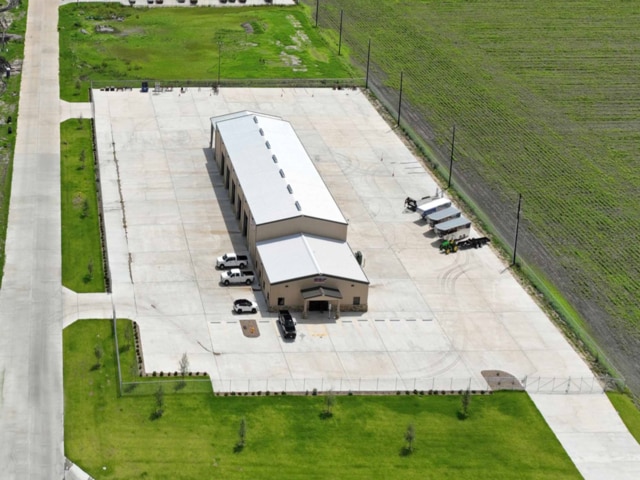
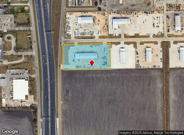
726 N Padre Island Dr
Corpus Christi, TX
Roblex Industrial Subdivision Unit 3
594216
ROBLEX INDUSTRIAL SUBDIVISION UNIT 3 BLK 2 LOT 1
Commercialnec
Nueces
X
Texas
48355C0315G
1
2024
3.75 AC
2025
West Side
000800
Corpus Christi
13,500 SF
DEMOGRAPHICS near 726 N Padre Island Dr
1 Mile
3 Mile
5 Mile
2024 Total Population
688
32,664
92,650
2029 Population
688
32,293
91,942
Pop Growth 2024-2029
0.00%
(1.14%)
(0.76%)
Average Age
37
39
39
2024 Total Households
235
11,370
32,783
HH Growth 2024-2029
0.00%
(1.28%)
(0.77%)
Median Household Inc
$29,090
$37,701
$40,099
Avg Household Size
2.50
2.80
2.70
2024 Avg HH Vehicles
1.00
2.00
2.00
Median Home Value
$77,142
$65,179
$85,975
Median Year Built
1999
1965
1960
Nearby Places
Map Layers
Map Styles
 Street
 Aerial
- Restaurants
- Banks
- Shops
- Fitness
- Groceries
PUBLIC TRANSPORTATION
AIRPORT
Corpus Christi International
DRIVE
WALK
Distance
Corpus Christi International
8 min
3.7 mi
Freight Ports
Port of Corpus Christi
DRIVE
WALK
Distance
Port of Corpus Christi
10 min
6.8 mi
SALE & LEASE HISTORY
LISTING DATE
SALE/LEASE

Nov 10, 2022
For Sale
Feb 24, 2021
For Lease
Nearby Properties
Address
Land Use
TOTAL SIZE
Lot Size
Zoning
Address
Land Use
TOTAL SIZE
Lot Size
Zoning
382,448 SF
14.98 AC
Address
Land Use
TOTAL SIZE
Lot Size
Zoning
174,650 SF
1.95 AC
I3
Address
Land Use
TOTAL SIZE
Lot Size
Zoning
233,436 SF
Address
Land Use
TOTAL SIZE
Lot Size
Zoning
105,979 SF
25 AC
I2SP92
Address
Land Use
TOTAL SIZE
Lot Size
Zoning
74,247 SF
6.39 AC
Address
Land Use
TOTAL SIZE
Lot Size
Zoning
67,009 SF
6.99 AC
R1B
Address
Land Use
TOTAL SIZE
Lot Size
Zoning
85,871 SF
18.68 AC
R1B
Address
Land Use
TOTAL SIZE
Lot Size
Zoning
11,109 SF
76.58 AC
R1B
Address
Land Use
TOTAL SIZE
Lot Size
Zoning
89,537 SF
11.35 AC
R1B
Address
Land Use
TOTAL SIZE
Lot Size
Zoning
52,121 SF
27.73 AC
Address
Land Use
TOTAL SIZE
Lot Size
Zoning
101,912 SF
13.89 AC
I-2
Address
Land Use
TOTAL SIZE
Lot Size
Zoning
74,261 SF
4.44 AC
R1B
Address
Land Use
TOTAL SIZE
Lot Size
Zoning
105.49 AC
R1B
Address
Land Use
TOTAL SIZE
Lot Size
Zoning
42,984 SF
5.20 AC
Address
Land Use
TOTAL SIZE
Lot Size
Zoning
72.29 AC
OCL
Address
Land Use
TOTAL SIZE
Lot Size
Zoning
129,210 SF
11.63 AC
R1B
Address
Land Use
TOTAL SIZE
Lot Size
Zoning
83,499 SF
5.38 AC
III
Address
Land Use
TOTAL SIZE
Lot Size
Zoning
72,689 SF
4.07 AC
B-4&B-1
Address
Land Use
TOTAL SIZE
Lot Size
Zoning
120,822 SF
0.50 AC
I3
Address
Land Use
TOTAL SIZE
Lot Size
Zoning
97,550 SF
9.53 AC
B-4
Address
Land Use
TOTAL SIZE
Lot Size
Zoning
50.32 AC
OCL
Address
Land Use
TOTAL SIZE
Lot Size
Zoning
57,600 SF
9.97 AC
I2
Address
Land Use
TOTAL SIZE
Lot Size
Zoning
122,706 SF
25.85 AC
R1B
Address
Land Use
TOTAL SIZE
Lot Size
Zoning
26,200 SF
4.86 AC
I-2
Address
Land Use
TOTAL SIZE
Lot Size
Zoning
83,539 SF
13.77 AC
I2
Address
Land Use
TOTAL SIZE
Lot Size
Zoning
101.58 AC
I-3
Address
Land Use
TOTAL SIZE
Lot Size
Zoning
108,360 SF
8.12 AC
B4
Address
Land Use
TOTAL SIZE
Lot Size
Zoning
131,238 SF
16.51 AC
I-2
Address
Land Use
TOTAL SIZE
Lot Size
Zoning
93,700 SF
5.38 AC
I2
Address
Land Use
TOTAL SIZE
Lot Size
Zoning
71,125 SF
8.83 AC
R1B
The World's #1 Commercial Real Estate Marketplace
Connect with us
© 2026 CoStar Group
The information above has been obtained from sources believed reliable. While we do not doubt its accuracy we have not verified it and make no guarantee, warranty or representation about it. It is your responsibility to independently confirm its accuracy and completeness. Any projections, opinions, assumptions, or estimates used are for example only and do not represent the current or future performance of the property. The value of this transaction to you depends on tax and other factors which should be evaluated by your tax, financial, and legal advisors. You and your advisors should conduct a careful, independent investigation of the property to determine to your satisfaction the suitability of the property for your needs.