Property Record
7270 University Pkwy, Sarasota, FL 34240
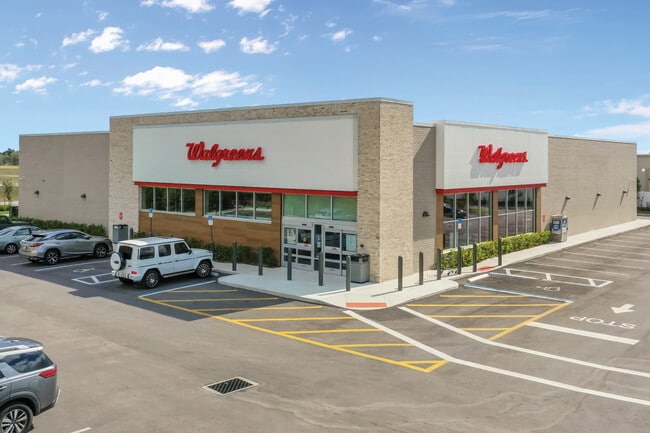

This Property Is For Sale
NEARBY LISTINGS FOR SALE OR LEASE
-
-
View all Sarasota listings for sale on LoopNet.com
Property Detail
7270 University Pkwy
Tampa/St Petersburg
Not Part Of A Subdivision
North Port-Sarasota-Bradenton, FL
TRACT OF LAND LYING IN SEC 3-36-19 DESC AS COM AT NW COR OF SAID SEC 3, ALSO BEING SLY R/W OF UNIVERSITY PKWY DEDICATED BY PLAT OF LAKE CLUB PH 1 PB 47 PG 21 OF MANATEE COUNTY TH
0183-01-0013
Sarasota
Storemultistory
Florida
2024
1
2025
1.52 AC
002725
Sarasota Outlying
14,820 SF
DEMOGRAPHICS near 7270 University Pkwy
1 Mile
3 Mile
5 Mile
2024 Total Population
1,306
21,437
63,642
2029 Population
1,513
25,131
73,943
Pop Growth 2024-2029
+ 15.85%
+ 17.23%
+ 16.19%
Average Age
57
53
49
2024 Total Households
603
9,213
27,488
HH Growth 2024-2029
+ 14.76%
+ 16.55%
+ 15.54%
Median Household Inc
$124,620
$117,228
$102,743
Avg Household Size
2.10
2.30
2.20
2024 Avg HH Vehicles
2.00
2.00
2.00
Median Home Value
$648,058
$602,044
$468,442
Median Year Built
2007
2010
2007
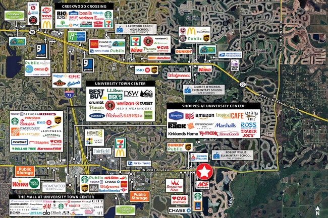
Nearby Places
Map Layers
Map Styles
 Street
 Aerial
- Restaurants
- Banks
- Shops
- Fitness
- Groceries
PUBLIC TRANSPORTATION
AIRPORT
Sarasota/Bradenton International
DRIVE
WALK
Distance
Sarasota/Bradenton International
23 min
12.1 mi
Freight Ports
Port Manatee
DRIVE
WALK
Distance
Port Manatee
36 min
24.6 mi
Nearby Properties
Address
Land Use
TOTAL SIZE
Lot Size
Zoning
Address
Land Use
TOTAL SIZE
Lot Size
Zoning
343,370 SF
10.77 AC
VPD
Address
Land Use
TOTAL SIZE
Lot Size
Zoning
343,100 SF
13.67 AC
VPD
Address
Land Use
TOTAL SIZE
Lot Size
Zoning
332,686 SF
37.78 AC
VPD
Address
Land Use
TOTAL SIZE
Lot Size
Zoning
268,645 SF
9.38 AC
VPD
Address
Land Use
TOTAL SIZE
Lot Size
Zoning
228,240 SF
23.48 AC
Address
Land Use
TOTAL SIZE
Lot Size
Zoning
122,380 SF
26.49 AC
VPD
Address
Land Use
TOTAL SIZE
Lot Size
Zoning
204,843 SF
27.48 AC
PCD
Address
Land Use
TOTAL SIZE
Lot Size
Zoning
206,326 SF
5.01 AC
VPD
Address
Land Use
TOTAL SIZE
Lot Size
Zoning
235,732 SF
49.34 AC
PD-PI
Address
Land Use
TOTAL SIZE
Lot Size
Zoning
223,054 SF
21.72 AC
Address
Land Use
TOTAL SIZE
Lot Size
Zoning
120,140 SF
5.09 AC
VPD
Address
Land Use
TOTAL SIZE
Lot Size
Zoning
128,638 SF
59.55 AC
PCD
Address
Land Use
TOTAL SIZE
Lot Size
Zoning
76,844 SF
6.79 AC
PCD
Address
Land Use
TOTAL SIZE
Lot Size
Zoning
180,574 SF
22 AC
A GENERAL
Address
Land Use
TOTAL SIZE
Lot Size
Zoning
75,197 SF
6.46 AC
PCD
Address
Land Use
TOTAL SIZE
Lot Size
Zoning
75,712 SF
33.55 AC
PD-MU
Address
Land Use
TOTAL SIZE
Lot Size
Zoning
143,277 SF
21.39 AC
PCD
Address
Land Use
TOTAL SIZE
Lot Size
Zoning
119,960 SF
27.91 AC
PID
Address
Land Use
TOTAL SIZE
Lot Size
Zoning
78,000 SF
6.81 AC
PCD
Address
Land Use
TOTAL SIZE
Lot Size
Zoning
77,072 SF
10.17 AC
PCD
Address
Land Use
TOTAL SIZE
Lot Size
Zoning
146,176 SF
33.37 AC
PID
Address
Land Use
TOTAL SIZE
Lot Size
Zoning
78,773 SF
15.34 AC
Address
Land Use
TOTAL SIZE
Lot Size
Zoning
84,440 SF
9.25 AC
PCD
Address
Land Use
TOTAL SIZE
Lot Size
Zoning
40,583 SF
2.21 AC
PCD
Address
Land Use
TOTAL SIZE
Lot Size
Zoning
68,761 SF
10.85 AC
OUE
Address
Land Use
TOTAL SIZE
Lot Size
Zoning
101.28 AC
VPD
Address
Land Use
TOTAL SIZE
Lot Size
Zoning
61,650 SF
0.57 AC
PD-MU
Address
Land Use
TOTAL SIZE
Lot Size
Zoning
107,858 SF
7.60 AC
PCD
Address
Land Use
TOTAL SIZE
Lot Size
Zoning
70,120 SF
12.23 AC
A,PD-MU
Address
Land Use
TOTAL SIZE
Lot Size
Zoning
60,949 SF
5.69 AC
PCD
The World's #1 Commercial Real Estate Marketplace
Connect with us
© 2025 CoStar Group
The information above has been obtained from sources believed reliable. While we do not doubt its accuracy we have not verified it and make no guarantee, warranty or representation about it. It is your responsibility to independently confirm its accuracy and completeness. Any projections, opinions, assumptions, or estimates used are for example only and do not represent the current or future performance of the property. The value of this transaction to you depends on tax and other factors which should be evaluated by your tax, financial, and legal advisors. You and your advisors should conduct a careful, independent investigation of the property to determine to your satisfaction the suitability of the property for your needs.