Property Record
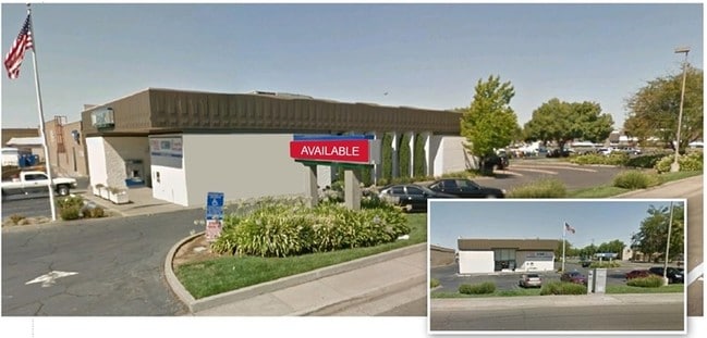
7272 Franklin Blvd, Sacramento, CA 95823


NEARBY LISTINGS FOR SALE OR LEASE
Property Detail
7272 Franklin Blvd
Sacramento-Roseville-Folsom, CA
Parcel Map
049-0380-010
PARCEL MAP, LOT B
Storebuilding
Sacramento
X
California
06067C0302H
b
2024
0.74 AC
2025
South Sacramento
004908
Sacramento
7,120 SF
DEMOGRAPHICS near 7272 Franklin Blvd
1 Mile
3 Mile
5 Mile
2024 Total Population
23,944
185,296
387,139
2029 Population
24,121
186,390
389,504
Pop Growth 2024-2029
+ 0.74%
+ 0.59%
+ 0.61%
Average Age
35
36
38
2024 Total Households
7,001
56,036
131,571
HH Growth 2024-2029
+ 0.76%
+ 0.55%
+ 0.63%
Median Household Inc
$50,902
$56,802
$71,015
Avg Household Size
3.20
3.10
2.80
2024 Avg HH Vehicles
2.00
2.00
2.00
Median Home Value
$310,130
$336,790
$431,249
Median Year Built
1974
1971
1975
Nearby Places
Map Layers
Map Styles
 Street
 Aerial
- Restaurants
- Banks
- Shops
- Fitness
- Groceries
PUBLIC TRANSPORTATION
COMMUTER RAIL
DRIVE
WALK
Distance
14 min
9.1 mi
AIRPORT
Sacramento International
DRIVE
WALK
Distance
Sacramento International
29 min
20.5 mi
Freight Ports
Port of Stockton
DRIVE
WALK
Distance
Port of Stockton
52 min
43.1 mi
SALE & LEASE HISTORY
LISTING DATE
SALE/LEASE

Sep 25, 2016
For Lease
Nearby Properties
Address
Land Use
TOTAL SIZE
Lot Size
Zoning
Address
Land Use
TOTAL SIZE
Lot Size
Zoning
728,235 SF
29.15 AC
H-R
Address
Land Use
TOTAL SIZE
Lot Size
Zoning
12.70 AC
SC-PUD
Address
Land Use
TOTAL SIZE
Lot Size
Zoning
7.55 AC
SPA
Address
Land Use
TOTAL SIZE
Lot Size
Zoning
53,386 SF
7.75 AC
C-2-SPD
Address
Land Use
TOTAL SIZE
Lot Size
Zoning
173,323 SF
10.39 AC
C-2-PUD
Address
Land Use
TOTAL SIZE
Lot Size
Zoning
13.87 AC
C-2-PUD
Address
Land Use
TOTAL SIZE
Lot Size
Zoning
249,868 SF
15.23 AC
R-2B-R
Address
Land Use
TOTAL SIZE
Lot Size
Zoning
213,445 SF
18.25 AC
SC
Address
Land Use
TOTAL SIZE
Lot Size
Zoning
186.36 AC
R-1-PUD R-
Address
Land Use
TOTAL SIZE
Lot Size
Zoning
156,873 SF
14.98 AC
C-2-PUD
Address
Land Use
TOTAL SIZE
Lot Size
Zoning
86,094 SF
6.17 AC
H-PUD
Address
Land Use
TOTAL SIZE
Lot Size
Zoning
58.59 AC
R-1
Address
Land Use
TOTAL SIZE
Lot Size
Zoning
144,849 SF
5.72 AC
R-3
Address
Land Use
TOTAL SIZE
Lot Size
Zoning
69,411 SF
7.21 AC
OB
Address
Land Use
TOTAL SIZE
Lot Size
Zoning
109,532 SF
5.03 AC
R-3
Address
Land Use
TOTAL SIZE
Lot Size
Zoning
50,729 SF
12.30 AC
H-R
Address
Land Use
TOTAL SIZE
Lot Size
Zoning
95,548 SF
24.25 AC
R-1
Address
Land Use
TOTAL SIZE
Lot Size
Zoning
91,586 SF
6.03 AC
R-3-R
Address
Land Use
TOTAL SIZE
Lot Size
Zoning
95,427 SF
7.07 AC
LC
Address
Land Use
TOTAL SIZE
Lot Size
Zoning
100,704 SF
5.63 AC
RD-20
Address
Land Use
TOTAL SIZE
Lot Size
Zoning
162,259 SF
12.73 AC
R-3
Address
Land Use
TOTAL SIZE
Lot Size
Zoning
165,523 SF
15.76 AC
A-PUD OB-P
Address
Land Use
TOTAL SIZE
Lot Size
Zoning
100,787 SF
8.78 AC
SPA
Address
Land Use
TOTAL SIZE
Lot Size
Zoning
6.90 AC
RD-20
Address
Land Use
TOTAL SIZE
Lot Size
Zoning
129,305 SF
9.37 AC
C-2-SPD
Address
Land Use
TOTAL SIZE
Lot Size
Zoning
90,716 SF
7.52 AC
C-2-R
Address
Land Use
TOTAL SIZE
Lot Size
Zoning
29.28 AC
C-2-PUD
Address
Land Use
TOTAL SIZE
Lot Size
Zoning
111,196 SF
5.40 AC
C-2-R
Address
Land Use
TOTAL SIZE
Lot Size
Zoning
126,358 SF
7.30 AC
RD-20
Address
Land Use
TOTAL SIZE
Lot Size
Zoning
105,700 SF
12.41 AC
C-2-R
The World's #1 Commercial Real Estate Marketplace
Connect with us
© 2026 CoStar Group
The information above has been obtained from sources believed reliable. While we do not doubt its accuracy we have not verified it and make no guarantee, warranty or representation about it. It is your responsibility to independently confirm its accuracy and completeness. Any projections, opinions, assumptions, or estimates used are for example only and do not represent the current or future performance of the property. The value of this transaction to you depends on tax and other factors which should be evaluated by your tax, financial, and legal advisors. You and your advisors should conduct a careful, independent investigation of the property to determine to your satisfaction the suitability of the property for your needs.