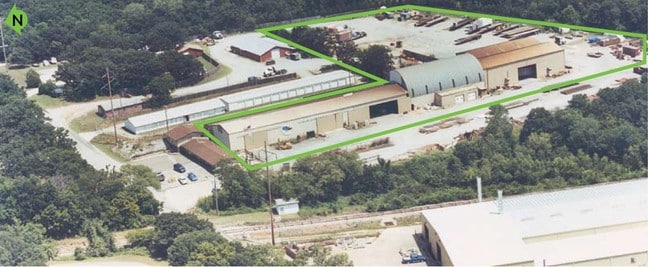
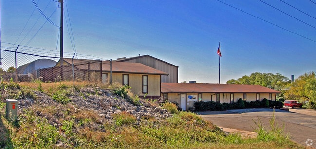
Property Record
7274 W 81St St, Tulsa, OK 74131
NEARBY LISTINGS FOR SALE OR LEASE
Property Detail
7274 W 81St St
0000-18-018-012-0-085-00
T18n-R12e
Officebuilding
18-18N-12E S/2 NE/4 NE/4 NW/4 OF SEC 18 LESS AND EXCEPT THE FOLLOWING DESCRIBED TRACT OF LAND BEING MORE PATICUALRLY DESCRIBE
X
Creek
40037C0190D
Oklahoma
2024
1.74 AC
2025
Creek County
020103
Tulsa
2,868 SF
Tulsa, OK
DEMOGRAPHICS near 7274 W 81St St
1 Mile
3 Mile
5 Mile
2024 Total Population
1,547
14,165
60,097
2029 Population
1,568
14,790
62,496
Pop Growth 2024-2029
+ 1.36%
+ 4.41%
+ 3.99%
Average Age
40
42
39
2024 Total Households
589
5,457
23,311
HH Growth 2024-2029
+ 1.19%
+ 4.42%
+ 3.96%
Median Household Inc
$61,031
$64,479
$60,890
Avg Household Size
2.50
2.50
2.50
2024 Avg HH Vehicles
2.00
2.00
2.00
Median Home Value
$170,833
$194,952
$178,837
Median Year Built
1986
1986
1982
Nearby Places
Map Layers
Map Styles
 Street
 Aerial
- Restaurants
- Banks
- Shops
- Fitness
- Groceries
PUBLIC TRANSPORTATION
AIRPORT
Tulsa International
DRIVE
WALK
Distance
Tulsa International
28 min
18.7 mi
Freight Ports
DRIVE
WALK
Distance
37 min
27.4 mi
Nearby Properties
Address
Land Use
TOTAL SIZE
Lot Size
Zoning
Address
Land Use
TOTAL SIZE
Lot Size
Zoning
1,134,776 SF
35.85 AC
CN
Address
Land Use
TOTAL SIZE
Lot Size
Zoning
47,670 SF
10.05 AC
RS
Address
Land Use
TOTAL SIZE
Lot Size
Zoning
117,372 SF
11.87 AC
CN
Address
Land Use
TOTAL SIZE
Lot Size
Zoning
38,940 SF
16.24 AC
Address
Land Use
TOTAL SIZE
Lot Size
Zoning
2,152 SF
8.88 AC
Address
Land Use
TOTAL SIZE
Lot Size
Zoning
31,600 SF
13.46 AC
Address
Land Use
TOTAL SIZE
Lot Size
Zoning
41,444 SF
4.71 AC
CG
Address
Land Use
TOTAL SIZE
Lot Size
Zoning
4,785 SF
7.34 AC
Address
Land Use
TOTAL SIZE
Lot Size
Zoning
23,100 SF
30 AC
IM
Address
Land Use
TOTAL SIZE
Lot Size
Zoning
9,282 SF
4.83 AC
Address
Land Use
TOTAL SIZE
Lot Size
Zoning
52,050 SF
16.29 AC
Address
Land Use
TOTAL SIZE
Lot Size
Zoning
15,230 SF
8.65 AC
Address
Land Use
TOTAL SIZE
Lot Size
Zoning
86,700 SF
22.68 AC
Address
Land Use
TOTAL SIZE
Lot Size
Zoning
66,975 SF
7.80 AC
Address
Land Use
TOTAL SIZE
Lot Size
Zoning
172,256 SF
10.76 AC
Address
Land Use
TOTAL SIZE
Lot Size
Zoning
20,625 SF
13.39 AC
TM
Address
Land Use
TOTAL SIZE
Lot Size
Zoning
22,721 SF
13.12 AC
Address
Land Use
TOTAL SIZE
Lot Size
Zoning
59,780 SF
10.01 AC
IM
Address
Land Use
TOTAL SIZE
Lot Size
Zoning
8,250 SF
Address
Land Use
TOTAL SIZE
Lot Size
Zoning
8,240 SF
8.45 AC
Address
Land Use
TOTAL SIZE
Lot Size
Zoning
9,600 SF
3.02 AC
Address
Land Use
TOTAL SIZE
Lot Size
Zoning
9,360 SF
3.85 AC
C2
Address
Land Use
TOTAL SIZE
Lot Size
Zoning
1,360 SF
11.70 AC
Address
Land Use
TOTAL SIZE
Lot Size
Zoning
80,800 SF
11.94 AC
Address
Land Use
TOTAL SIZE
Lot Size
Zoning
10,822 SF
10.32 AC
Address
Land Use
TOTAL SIZE
Lot Size
Zoning
158,735 SF
12.99 AC
CH
Address
Land Use
TOTAL SIZE
Lot Size
Zoning
23,377 SF
2.68 AC
CG
Address
Land Use
TOTAL SIZE
Lot Size
Zoning
36,168 SF
1.23 AC
IL
Address
Land Use
TOTAL SIZE
Lot Size
Zoning
51,950 SF
6.41 AC
CH
The World's #1 Commercial Real Estate Marketplace
Connect with us
© 2025 CoStar Group
The information above has been obtained from sources believed reliable. While we do not doubt its accuracy we have not verified it and make no guarantee, warranty or representation about it. It is your responsibility to independently confirm its accuracy and completeness. Any projections, opinions, assumptions, or estimates used are for example only and do not represent the current or future performance of the property. The value of this transaction to you depends on tax and other factors which should be evaluated by your tax, financial, and legal advisors. You and your advisors should conduct a careful, independent investigation of the property to determine to your satisfaction the suitability of the property for your needs.