Property Record
7279 Liberty Park Rd, Liberty, NC 27298


NEARBY LISTINGS FOR SALE OR LEASE
Property Detail
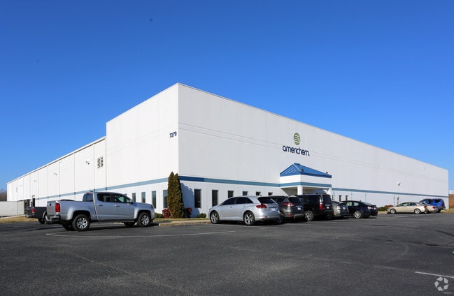
7279 Liberty Park Rd
Greensboro-High Point, NC
Liberty Business Pk
8735-44-1640
LIBERTY BUSINESS PK;PT L1 PL:PB61-PG94
Warehouse
Randolph
X
North Carolina
3710872400K
1
2024
9.01 AC
2024
NE Randolph County
031200
Greensboro/Winston-Salem
89,754 SF
DEMOGRAPHICS near 7279 Liberty Park Rd
1 Mile
3 Mile
5 Mile
2024 Total Population
232
4,595
8,230
2029 Population
239
4,744
8,592
Pop Growth 2024-2029
+ 3.02%
+ 3.24%
+ 4.40%
Average Age
42
42
42
2024 Total Households
95
1,861
3,332
HH Growth 2024-2029
+ 3.16%
+ 3.28%
+ 4.44%
Median Household Inc
$52,500
$50,251
$51,548
Avg Household Size
2.40
2.40
2.40
2024 Avg HH Vehicles
2.00
2.00
2.00
Median Home Value
$150,000
$159,177
$170,399
Median Year Built
1973
1978
1981
Nearby Places
Map Layers
Map Styles
 Street
 Aerial
- Restaurants
- Banks
- Shops
- Fitness
- Groceries
PUBLIC TRANSPORTATION
AIRPORT
Piedmont Triad International
DRIVE
WALK
Distance
Piedmont Triad International
48 min
34.0 mi
Nearby Properties
Address
Land Use
TOTAL SIZE
Lot Size
Zoning
Address
Land Use
TOTAL SIZE
Lot Size
Zoning
89,754 SF
9.01 AC
I-P
Address
Land Use
TOTAL SIZE
Lot Size
Zoning
87,544 SF
11.89 AC
I-P
Address
Land Use
TOTAL SIZE
Lot Size
Zoning
53,084 SF
8.85 AC
B-2
Address
Land Use
TOTAL SIZE
Lot Size
Zoning
64,444 SF
28.59 AC
I
Address
Land Use
TOTAL SIZE
Lot Size
Zoning
87,544 SF
11.95 AC
IP
Address
Land Use
TOTAL SIZE
Lot Size
Zoning
0.96 AC
R-12
Address
Land Use
TOTAL SIZE
Lot Size
Zoning
20,927 SF
64.31 AC
LI
Address
Land Use
TOTAL SIZE
Lot Size
Zoning
47,760 SF
17.95 AC
I
Address
Land Use
TOTAL SIZE
Lot Size
Zoning
4,884 SF
9.20 AC
I
Address
Land Use
TOTAL SIZE
Lot Size
Zoning
14,160 SF
3.03 AC
B-2
Address
Land Use
TOTAL SIZE
Lot Size
Zoning
39,528 SF
4.82 AC
B-2
Address
Land Use
TOTAL SIZE
Lot Size
Zoning
755 SF
5 AC
R-MF
Address
Land Use
TOTAL SIZE
Lot Size
Zoning
12,000 SF
16.70 AC
HC-CD
Address
Land Use
TOTAL SIZE
Lot Size
Zoning
10,044 SF
2.65 AC
B-2
Address
Land Use
TOTAL SIZE
Lot Size
Zoning
8,650 SF
0.93 AC
B-2
Address
Land Use
TOTAL SIZE
Lot Size
Zoning
3,468 SF
86.83 AC
Address
Land Use
TOTAL SIZE
Lot Size
Zoning
87,680 SF
4.74 AC
I
Address
Land Use
TOTAL SIZE
Lot Size
Zoning
39,400 SF
7.44 AC
I
Address
Land Use
TOTAL SIZE
Lot Size
Zoning
51,464 SF
19.12 AC
I
Address
Land Use
TOTAL SIZE
Lot Size
Zoning
24,740 SF
32.95 AC
I
Address
Land Use
TOTAL SIZE
Lot Size
Zoning
4,000 SF
6.60 AC
B-2
Address
Land Use
TOTAL SIZE
Lot Size
Zoning
3,610 SF
1.12 AC
B-1
Address
Land Use
TOTAL SIZE
Lot Size
Zoning
1,460 SF
19.87 AC
LI
Address
Land Use
TOTAL SIZE
Lot Size
Zoning
14,284 SF
5.01 AC
I
Address
Land Use
TOTAL SIZE
Lot Size
Zoning
151.87 AC
I
Address
Land Use
TOTAL SIZE
Lot Size
Zoning
8,080 SF
1.18 AC
B-2
Address
Land Use
TOTAL SIZE
Lot Size
Zoning
4,908 SF
1.55 AC
R-6
Address
Land Use
TOTAL SIZE
Lot Size
Zoning
24,950 SF
14.10 AC
LI
Address
Land Use
TOTAL SIZE
Lot Size
Zoning
6,636 SF
2.76 AC
RR
The World's #1 Commercial Real Estate Marketplace
Connect with us
© 2026 CoStar Group
The information above has been obtained from sources believed reliable. While we do not doubt its accuracy we have not verified it and make no guarantee, warranty or representation about it. It is your responsibility to independently confirm its accuracy and completeness. Any projections, opinions, assumptions, or estimates used are for example only and do not represent the current or future performance of the property. The value of this transaction to you depends on tax and other factors which should be evaluated by your tax, financial, and legal advisors. You and your advisors should conduct a careful, independent investigation of the property to determine to your satisfaction the suitability of the property for your needs.