Property Record
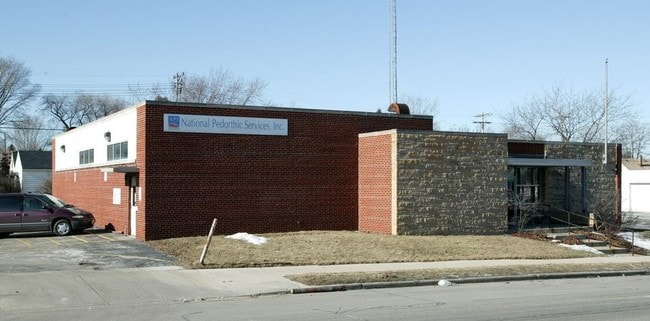
7283 W Appleton Ave, Milwaukee, WI 53216


Property Detail
7283 W Appleton Ave
264-0050-110-5
CAPITOL INTERSECTION IN NW 1/4 SEC 10-7-21 BLOCK 5 LOTS 1 THRU 4
Miscellaneous
Milwaukee
LB1
Wisconsin
B and X Area of moderate flood hazard, usually the area between the limits of the 100-year and 500-year floods.
1-4
2024
0.45 AC
2025
Milwaukee NW
005100
Milwaukee/Madison
5,491 SF
Milwaukee-Waukesha, WI
NEARBY LISTINGS FOR SALE OR LEASE
DEMOGRAPHICS near 7283 W Appleton Ave
1 mile
3 mile
5 mile
2025 Total Population
19,830
177,492
375,121
2030 Population
19,756
177,657
376,620
Pop Growth 2025-2030
(0.37%)
+ 0.09%
+ 0.40%
Average Age
38
37
37
2025 Total Households
8,116
70,520
150,605
HH Growth 2025-2030
(0.43%)
(0.05%)
+ 0.28%
Median Household Inc
$56,043
$56,203
$53,504
Avg Household Size
2.40
2.40
2.40
2025 Avg HH Vehicles
1.00
1.00
1.00
Median Home Value
$159,987
$185,589
$195,465
Median Year Built
1956
1952
1952
Nearby Places
Map Layers
Map Styles
 Street
 Aerial
Layers
 Traffic
 Biking
Places
Listings with unknown addresses are not visible on the map
- Restaurants
- Banks
- Shops
- Fitness
- Groceries
PUBLIC TRANSPORTATION
COMMUTER RAIL
Drive
Walk
Distance
14 min
7.3 mi
AIRPORT
General Mitchell International
Drive
Walk
Distance
General Mitchell International
26 min
13.9 mi
Freight Ports
Port Milwaukee
Drive
Walk
Distance
Port Milwaukee
19 min
9.7 mi
Nearby Properties
Address
Land Use
TOTAL SIZE
Lot Size
Zoning
Address
Land Use
TOTAL SIZE
Lot Size
Zoning
70.73 AC
Address
Land Use
TOTAL SIZE
Lot Size
Zoning
5,104 SF
0.11 AC
LB1
Address
Land Use
TOTAL SIZE
Lot Size
Zoning
78,185 SF
73.67 AC
M1
Address
Land Use
TOTAL SIZE
Lot Size
Zoning
1.91 AC
Address
Land Use
TOTAL SIZE
Lot Size
Zoning
28,800 SF
3.30 AC
C2
Address
Land Use
TOTAL SIZE
Lot Size
Zoning
18.95 AC
Address
Land Use
TOTAL SIZE
Lot Size
Zoning
21.66 AC
M2
Address
Land Use
TOTAL SIZE
Lot Size
Zoning
3.74 AC
PUD
Address
Land Use
TOTAL SIZE
Lot Size
Zoning
106,495 SF
9.70 AC
PUD
Address
Land Use
TOTAL SIZE
Lot Size
Zoning
0.36 AC
Address
Land Use
TOTAL SIZE
Lot Size
Zoning
2.45 AC
C2
Address
Land Use
TOTAL SIZE
Lot Size
Zoning
8.78 AC
Address
Land Use
TOTAL SIZE
Lot Size
Zoning
Address
Land Use
TOTAL SIZE
Lot Size
Zoning
0.71 AC
RM2
Address
Land Use
TOTAL SIZE
Lot Size
Zoning
8.03 AC
RM1
Address
Land Use
TOTAL SIZE
Lot Size
Zoning
1.76 AC
LB2
Address
Land Use
TOTAL SIZE
Lot Size
Zoning
Address
Land Use
TOTAL SIZE
Lot Size
Zoning
1.74 AC
Address
Land Use
TOTAL SIZE
Lot Size
Zoning
28.28 AC
M2
Address
Land Use
TOTAL SIZE
Lot Size
Zoning
12.49 AC
TL
Address
Land Use
TOTAL SIZE
Lot Size
Zoning
1.84 AC
Address
Land Use
TOTAL SIZE
Lot Size
Zoning
4.03 AC
C2
Address
Land Use
TOTAL SIZE
Lot Size
Zoning
169,550 SF
12.04 AC
RB2
Address
Land Use
TOTAL SIZE
Lot Size
Zoning
17.84 AC
TL
Address
Land Use
TOTAL SIZE
Lot Size
Zoning
2.21 AC
C2
Address
Land Use
TOTAL SIZE
Lot Size
Zoning
6.75 AC
PUD
Address
Land Use
TOTAL SIZE
Lot Size
Zoning
14.96 AC
C2
Address
Land Use
TOTAL SIZE
Lot Size
Zoning
18.54 AC
RS6
Address
Land Use
TOTAL SIZE
Lot Size
Zoning
12.10 AC
M1
Address
Land Use
TOTAL SIZE
Lot Size
Zoning
163,539 SF
7.17 AC
PUD
The World's #1 Commercial Real Estate Marketplace
Connect with us
© 2026 CoStar Group
The information above has been obtained from sources believed reliable. While we do not doubt its accuracy we have not verified it and make no guarantee, warranty or representation about it. It is your responsibility to independently confirm its accuracy and completeness. Any projections, opinions, assumptions, or estimates used are for example only and do not represent the current or future performance of the property. The value of this transaction to you depends on tax and other factors which should be evaluated by your tax, financial, and legal advisors. You and your advisors should conduct a careful, independent investigation of the property to determine to your satisfaction the suitability of the property for your needs.