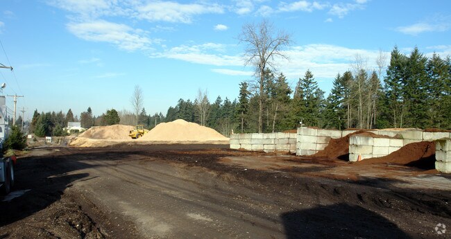
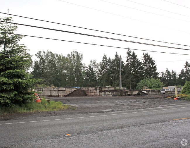
Property Record
72871 Pipeline Rd E, Puyallup, WA 98371
NEARBY LISTINGS FOR SALE OR LEASE
Property Detail
72871 Pipeline Rd E
Seattle-Tacoma-Bellevue, WA
SECTION 31 TOWNSHIP 20 RANGE 04 QUARTER 33 : PARCEL B OF DBLR 2001-01-26-5004 DESC AS S 1/2 OF NW OF SW OF SW BEING GOVT LOT 4 EXC W 30 FT FOR CANYON RD EXC THAT POR APPROP BY CY OF TACOMA FOR WATER PIPELI PER SUP CT 72871 & EXC S 50 FT OF W 192 FT T
042031-3046
Pierce
Storebuilding
Washington
AE
4
53053C0336E
0.73 AC
2024
Spanaway
2025
Seattle/Puget Sound
071205
DEMOGRAPHICS near 72871 Pipeline Rd E
1 Mile
3 Mile
5 Mile
2024 Total Population
5,950
58,480
238,755
2029 Population
6,099
60,240
246,054
Pop Growth 2024-2029
+ 2.50%
+ 3.01%
+ 3.06%
Average Age
44
40
38
2024 Total Households
2,358
21,763
86,543
HH Growth 2024-2029
+ 2.50%
+ 3.07%
+ 3.15%
Median Household Inc
$98,068
$92,169
$80,459
Avg Household Size
2.50
2.60
2.60
2024 Avg HH Vehicles
2.00
2.00
2.00
Median Home Value
$480,882
$465,451
$422,496
Median Year Built
1979
1981
1984
Nearby Places
Map Layers
Map Styles
 Street
 Aerial
- Restaurants
- Banks
- Shops
- Fitness
- Groceries
PUBLIC TRANSPORTATION
COMMUTER RAIL
Puyallup Station (Sounder South Line - Central Puget Sound Regional Transit Authority Rail (Link Light Rail/Sounder))
DRIVE
WALK
Distance
Puyallup Station (Sounder South Line - Central Puget Sound Regional Transit Authority Rail (Link Light Rail/Sounder))
9 min
4.4 mi
Puyallup Station (Seattle - Tacoma/Lakewood - Sound Transit)
DRIVE
WALK
Distance
Puyallup Station (Seattle - Tacoma/Lakewood - Sound Transit)
10 min
4.4 mi
AIRPORT
Seattle-Tacoma International
DRIVE
WALK
Distance
Seattle-Tacoma International
42 min
24.0 mi
Freight Ports
Port of Tacoma
DRIVE
WALK
Distance
Port of Tacoma
14 min
7.5 mi
Nearby Properties
Address
Land Use
TOTAL SIZE
Lot Size
Zoning
Address
Land Use
TOTAL SIZE
Lot Size
Zoning
325,526 SF
17.31 AC
UCOR
Address
Land Use
TOTAL SIZE
Lot Size
Zoning
793,470 SF
50.76 AC
FAIR
Address
Land Use
TOTAL SIZE
Lot Size
Zoning
226,029 SF
15.19 AC
UCOR
Address
Land Use
TOTAL SIZE
Lot Size
Zoning
258,250 SF
10.83 AC
NCOR
Address
Land Use
TOTAL SIZE
Lot Size
Zoning
143,374 SF
4.84 AC
RM-20
Address
Land Use
TOTAL SIZE
Lot Size
Zoning
158,177 SF
8.50 AC
NCOR
Address
Land Use
TOTAL SIZE
Lot Size
Zoning
139,910 SF
2.37 AC
RM-20
Address
Land Use
TOTAL SIZE
Lot Size
Zoning
297,048 SF
50.92 AC
NCOR
Address
Land Use
TOTAL SIZE
Lot Size
Zoning
129,783 SF
5.28 AC
RM-20
Address
Land Use
TOTAL SIZE
Lot Size
Zoning
108,807 SF
17.67 AC
PF
Address
Land Use
TOTAL SIZE
Lot Size
Zoning
181,427 SF
29.70 AC
ARL
Address
Land Use
TOTAL SIZE
Lot Size
Zoning
202,424 SF
3.50 AC
ECOR
Address
Land Use
TOTAL SIZE
Lot Size
Zoning
100,948 SF
7.33 AC
RM-20
Address
Land Use
TOTAL SIZE
Lot Size
Zoning
104,071 SF
6 AC
Address
Land Use
TOTAL SIZE
Lot Size
Zoning
99,821 SF
22.84 AC
PF
Address
Land Use
TOTAL SIZE
Lot Size
Zoning
102,303 SF
10.09 AC
UCOR
Address
Land Use
TOTAL SIZE
Lot Size
Zoning
147,501 SF
25.48 AC
CB
Address
Land Use
TOTAL SIZE
Lot Size
Zoning
171,755 SF
8.38 AC
PF
Address
Land Use
TOTAL SIZE
Lot Size
Zoning
76,349 SF
3.76 AC
UCOR
Address
Land Use
TOTAL SIZE
Lot Size
Zoning
110,132 SF
12.81 AC
CCX
Address
Land Use
TOTAL SIZE
Lot Size
Zoning
95,154 SF
3.77 AC
CB
Address
Land Use
TOTAL SIZE
Lot Size
Zoning
43,349 SF
8.80 AC
Address
Land Use
TOTAL SIZE
Lot Size
Zoning
78,023 SF
1.21 AC
CG
Address
Land Use
TOTAL SIZE
Lot Size
Zoning
104,827 SF
9.04 AC
ECOR
Address
Land Use
TOTAL SIZE
Lot Size
Zoning
102,795 SF
1.74 AC
CG
Address
Land Use
TOTAL SIZE
Lot Size
Zoning
52,314 SF
9.58 AC
MSF
Address
Land Use
TOTAL SIZE
Lot Size
Zoning
20,332 SF
40.42 AC
Address
Land Use
TOTAL SIZE
Lot Size
Zoning
52,314 SF
2 AC
RSEP
Address
Land Use
TOTAL SIZE
Lot Size
Zoning
65,818 SF
1.48 AC
CG
Address
Land Use
TOTAL SIZE
Lot Size
Zoning
1 SF
3.03 AC
PF
The World's #1 Commercial Real Estate Marketplace
Connect with us
© 2025 CoStar Group
The information above has been obtained from sources believed reliable. While we do not doubt its accuracy we have not verified it and make no guarantee, warranty or representation about it. It is your responsibility to independently confirm its accuracy and completeness. Any projections, opinions, assumptions, or estimates used are for example only and do not represent the current or future performance of the property. The value of this transaction to you depends on tax and other factors which should be evaluated by your tax, financial, and legal advisors. You and your advisors should conduct a careful, independent investigation of the property to determine to your satisfaction the suitability of the property for your needs.