Property Record
7292 Highway 509, Mansfield, LA 71052

Property Detail
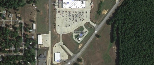
7292 Highway 509
Shreveport-Bossier City, LA
COMMENCING AT A MONUMENTED POINT MARKING THE NORTHEAST CORNER OF THE SOUTHWEST QUARTER OF THE SOUTHEAST QUARTER OF SECTION 3, TOWNSHIP 12 NORTH, RANG E 13WEST; THENCE PROCEED NORTH 42 DEGREES 17 MINUTES 50 SECONDS EAST, BEING ASSUMED, A DISTANCE OF 3
0400518200E
De Soto
Storebuilding
Louisiana
B and X Area of moderate flood hazard, usually the area between the limits of the 100-year and 500-year floods.
8
2025
15 AC
2025
DeSoto Parish
950400
Shreveport/Bossier City
NEARBY LISTINGS FOR SALE OR LEASE
DEMOGRAPHICS near 7292 Highway 509
1 mile
3 mile
5 mile
2025 Total Population
467
6,099
7,962
2030 Population
467
6,157
8,060
Pop Growth 2025-2030
0.00%
+ 0.95%
+ 1.23%
Average Age
40
40
41
2025 Total Households
187
2,463
3,271
HH Growth 2025-2030
0.00%
+ 0.97%
+ 1.25%
Median Household Inc
$29,999
$32,780
$33,450
Avg Household Size
2.30
2.30
2.30
2025 Avg HH Vehicles
1.00
1.00
1.00
Median Home Value
$91,666
$103,385
$106,098
Median Year Built
1976
1979
1980
Nearby Places
Map Layers
Map Styles
 Street
 Aerial
Layers
 Traffic
 Biking
Places
Listings with unknown addresses are not visible on the map
- Restaurants
- Banks
- Shops
- Fitness
- Groceries
PUBLIC TRANSPORTATION
AIRPORT
Shreveport Regional
Drive
Walk
Distance
Shreveport Regional
52 min
36.7 mi
SALE & LEASE HISTORY
LISTING DATE
SALE/LEASE

Aug 16, 2017
For Sale
Nearby Properties
Address
Land Use
TOTAL SIZE
Lot Size
Zoning
Address
Land Use
TOTAL SIZE
Lot Size
Zoning
Address
Land Use
TOTAL SIZE
Lot Size
Zoning
Address
Land Use
TOTAL SIZE
Lot Size
Zoning
Address
Land Use
TOTAL SIZE
Lot Size
Zoning
Address
Land Use
TOTAL SIZE
Lot Size
Zoning
Address
Land Use
TOTAL SIZE
Lot Size
Zoning
Address
Land Use
TOTAL SIZE
Lot Size
Zoning
Address
Land Use
TOTAL SIZE
Lot Size
Zoning
Address
Land Use
TOTAL SIZE
Lot Size
Zoning
Address
Land Use
TOTAL SIZE
Lot Size
Zoning
Address
Land Use
TOTAL SIZE
Lot Size
Zoning
Address
Land Use
TOTAL SIZE
Lot Size
Zoning
Address
Land Use
TOTAL SIZE
Lot Size
Zoning
Address
Land Use
TOTAL SIZE
Lot Size
Zoning
Address
Land Use
TOTAL SIZE
Lot Size
Zoning
Address
Land Use
TOTAL SIZE
Lot Size
Zoning
Address
Land Use
TOTAL SIZE
Lot Size
Zoning
Address
Land Use
TOTAL SIZE
Lot Size
Zoning
Address
Land Use
TOTAL SIZE
Lot Size
Zoning
Address
Land Use
TOTAL SIZE
Lot Size
Zoning
Address
Land Use
TOTAL SIZE
Lot Size
Zoning
Address
Land Use
TOTAL SIZE
Lot Size
Zoning
Address
Land Use
TOTAL SIZE
Lot Size
Zoning
Address
Land Use
TOTAL SIZE
Lot Size
Zoning
Address
Land Use
TOTAL SIZE
Lot Size
Zoning
The World's #1 Commercial Real Estate Marketplace
Connect with us
© 2026 CoStar Group
The information above has been obtained from sources believed reliable. While we do not doubt its accuracy we have not verified it and make no guarantee, warranty or representation about it. It is your responsibility to independently confirm its accuracy and completeness. Any projections, opinions, assumptions, or estimates used are for example only and do not represent the current or future performance of the property. The value of this transaction to you depends on tax and other factors which should be evaluated by your tax, financial, and legal advisors. You and your advisors should conduct a careful, independent investigation of the property to determine to your satisfaction the suitability of the property for your needs.