Property Record
72950 Highway 111, Palm Desert, CA 92260


NEARBY LISTINGS FOR SALE OR LEASE
Property Detail
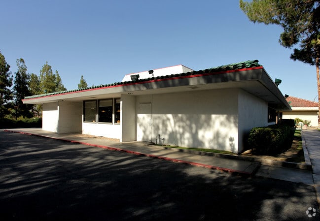
72950 Highway 111
640-140-003
.55 ACRES M/L IN POR NE 1/4 OF SEC 19 T5S R6E FOR TOTAL DESCRIPTION SEE ASSESSORS MAPS
Storebuilding
Riverside
X
California
06065C2207H
0.55 AC
2024
Coachella Valley
2025
Inland Empire (California)
045118
Riverside-San Bernardino-Ontario, CA
4,375 SF
DEMOGRAPHICS near 72950 Highway 111
1 Mile
3 Mile
5 Mile
2024 Total Population
10,428
53,768
94,213
2029 Population
11,475
59,492
104,840
Pop Growth 2024-2029
+ 10.04%
+ 10.65%
+ 11.28%
Average Age
44
52
54
2024 Total Households
4,718
25,817
45,917
HH Growth 2024-2029
+ 9.96%
+ 10.47%
+ 11.11%
Median Household Inc
$49,705
$78,858
$85,765
Avg Household Size
2.20
2.00
2.00
2024 Avg HH Vehicles
2.00
2.00
2.00
Median Home Value
$575,513
$619,196
$625,706
Median Year Built
1979
1982
1985
Nearby Places
Map Layers
Map Styles
 Street
 Aerial
- Restaurants
- Banks
- Shops
- Fitness
- Groceries
PUBLIC TRANSPORTATION
AIRPORT
Palm Springs International
DRIVE
WALK
Distance
Palm Springs International
19 min
11.3 mi
Freight Ports
Port of San Diego
DRIVE
WALK
Distance
Port of San Diego
164 min
123.5 mi
SALE & LEASE HISTORY
LISTING DATE
SALE/LEASE

Oct 05, 2016
For Lease
Feb 14, 2017
For Sale
Apr 18, 2017
For Lease
Nearby Properties
Address
Land Use
TOTAL SIZE
Lot Size
Zoning
Address
Land Use
TOTAL SIZE
Lot Size
Zoning
52,981 SF
16.98 AC
Address
Land Use
TOTAL SIZE
Lot Size
Zoning
400,240 SF
9.40 AC
PR060
Address
Land Use
TOTAL SIZE
Lot Size
Zoning
488,725 SF
24.17 AC
C1
Address
Land Use
TOTAL SIZE
Lot Size
Zoning
445,569 SF
17.55 AC
PUDC
Address
Land Use
TOTAL SIZE
Lot Size
Zoning
21,118 SF
162.93 AC
Address
Land Use
TOTAL SIZE
Lot Size
Zoning
217,730 SF
8.64 AC
R1010
Address
Land Use
TOTAL SIZE
Lot Size
Zoning
186,531 SF
6 AC
Address
Land Use
TOTAL SIZE
Lot Size
Zoning
306,484 SF
17.64 AC
OS
Address
Land Use
TOTAL SIZE
Lot Size
Zoning
164,751 SF
8.25 AC
Address
Land Use
TOTAL SIZE
Lot Size
Zoning
103,940 SF
4.56 AC
Address
Land Use
TOTAL SIZE
Lot Size
Zoning
214,678 SF
6.43 AC
Address
Land Use
TOTAL SIZE
Lot Size
Zoning
179,685 SF
9.36 AC
Address
Land Use
TOTAL SIZE
Lot Size
Zoning
146,996 SF
6.75 AC
R1010
Address
Land Use
TOTAL SIZE
Lot Size
Zoning
137,962 SF
8.90 AC
Address
Land Use
TOTAL SIZE
Lot Size
Zoning
30,961 SF
14.07 AC
W1
Address
Land Use
TOTAL SIZE
Lot Size
Zoning
136,875 SF
8.87 AC
O
Address
Land Use
TOTAL SIZE
Lot Size
Zoning
150,818 SF
2.02 AC
R3
Address
Land Use
TOTAL SIZE
Lot Size
Zoning
58,823 SF
5.87 AC
C-N
Address
Land Use
TOTAL SIZE
Lot Size
Zoning
41,533 SF
1.38 AC
C1SP
Address
Land Use
TOTAL SIZE
Lot Size
Zoning
209,000 SF
7.12 AC
Address
Land Use
TOTAL SIZE
Lot Size
Zoning
82,028 SF
8.32 AC
PR6
Address
Land Use
TOTAL SIZE
Lot Size
Zoning
44,823 SF
12.07 AC
CG
Address
Land Use
TOTAL SIZE
Lot Size
Zoning
65,000 SF
9.51 AC
Address
Land Use
TOTAL SIZE
Lot Size
Zoning
86,064 SF
6.95 AC
Address
Land Use
TOTAL SIZE
Lot Size
Zoning
50,318 SF
0.87 AC
PR060
Address
Land Use
TOTAL SIZE
Lot Size
Zoning
66,156 SF
5.85 AC
Address
Land Use
TOTAL SIZE
Lot Size
Zoning
36,514 SF
2.10 AC
PUDA
Address
Land Use
TOTAL SIZE
Lot Size
Zoning
124,230 SF
9.83 AC
Address
Land Use
TOTAL SIZE
Lot Size
Zoning
61,100 SF
5.82 AC
Address
Land Use
TOTAL SIZE
Lot Size
Zoning
92,722 SF
5.55 AC
O
The World's #1 Commercial Real Estate Marketplace
Connect with us
© 2025 CoStar Group
The information above has been obtained from sources believed reliable. While we do not doubt its accuracy we have not verified it and make no guarantee, warranty or representation about it. It is your responsibility to independently confirm its accuracy and completeness. Any projections, opinions, assumptions, or estimates used are for example only and do not represent the current or future performance of the property. The value of this transaction to you depends on tax and other factors which should be evaluated by your tax, financial, and legal advisors. You and your advisors should conduct a careful, independent investigation of the property to determine to your satisfaction the suitability of the property for your needs.