Property Record
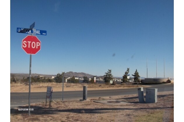
7298 Yucca Trl, Yucca Valley, CA 92284


NEARBY LISTINGS FOR SALE OR LEASE
Property Detail
7298 Yucca Trl
Riverside-San Bernardino-Ontario, CA
Parcel Map 14121
0601-551-32
PARCEL MAP 14121 PTN PARCEL NO 2 LYING SOUTHERLY OF PTN DESCRIBED AS FOLLOWS COMMENCING AT THE CENTERLINE INTERSECTION OF MIRAMAR DRIVE AND INDIO AVENUE AS SHOWN ON SAID PARCEL MAP NO. 14121 THENCE SOUTH 89 DEG 4715 WEST ALONG SAID CENTERLINE OF MIRA
Vacantlandnec
San Bernardino
D
California
06065C0250G
10.02 AC
2024
Twentynine Palms
2025
Inland Empire (California)
010428
DEMOGRAPHICS near 7298 Yucca Trl
1 Mile
3 Mile
5 Mile
2024 Total Population
1,880
15,718
31,799
2029 Population
1,936
16,243
32,918
Pop Growth 2024-2029
+ 2.98%
+ 3.34%
+ 3.52%
Average Age
40
41
42
2024 Total Households
696
6,172
13,025
HH Growth 2024-2029
+ 3.02%
+ 3.37%
+ 3.57%
Median Household Inc
$77,385
$70,357
$59,986
Avg Household Size
2.60
2.50
2.40
2024 Avg HH Vehicles
2.00
2.00
2.00
Median Home Value
$388,461
$308,031
$304,760
Median Year Built
1988
1982
1980
Nearby Places
Map Layers
Map Styles
 Street
 Aerial
- Restaurants
- Banks
- Shops
- Fitness
- Groceries
PUBLIC TRANSPORTATION
AIRPORT
Palm Springs International
DRIVE
WALK
Distance
Palm Springs International
46 min
33.6 mi
Freight Ports
Port of Long Beach
DRIVE
WALK
Distance
Port of Long Beach
158 min
125.5 mi
SALE & LEASE HISTORY
LISTING DATE
SALE/LEASE

Feb 27, 2024
For Sale
Nearby Properties
Address
Land Use
TOTAL SIZE
Lot Size
Zoning
Address
Land Use
TOTAL SIZE
Lot Size
Zoning
196,781 SF
23.85 AC
Address
Land Use
TOTAL SIZE
Lot Size
Zoning
102,500 SF
13.07 AC
Address
Land Use
TOTAL SIZE
Lot Size
Zoning
178,083 SF
1.75 AC
Address
Land Use
TOTAL SIZE
Lot Size
Zoning
51,455 SF
2.83 AC
Address
Land Use
TOTAL SIZE
Lot Size
Zoning
31,345 SF
10.12 AC
Address
Land Use
TOTAL SIZE
Lot Size
Zoning
104,442 SF
7.29 AC
Address
Land Use
TOTAL SIZE
Lot Size
Zoning
17,299 SF
1.74 AC
Address
Land Use
TOTAL SIZE
Lot Size
Zoning
45,139 SF
3.67 AC
Address
Land Use
TOTAL SIZE
Lot Size
Zoning
19,950 SF
1.57 AC
Address
Land Use
TOTAL SIZE
Lot Size
Zoning
41,321 SF
1.83 AC
Address
Land Use
TOTAL SIZE
Lot Size
Zoning
89,981 SF
8.08 AC
Address
Land Use
TOTAL SIZE
Lot Size
Zoning
30,393 SF
3.83 AC
Address
Land Use
TOTAL SIZE
Lot Size
Zoning
20,485 SF
2.39 AC
Address
Land Use
TOTAL SIZE
Lot Size
Zoning
50,784 SF
11.37 AC
Address
Land Use
TOTAL SIZE
Lot Size
Zoning
10,399 SF
22.87 AC
Address
Land Use
TOTAL SIZE
Lot Size
Zoning
14,285 SF
1.52 AC
Address
Land Use
TOTAL SIZE
Lot Size
Zoning
46,334 SF
2.20 AC
Address
Land Use
TOTAL SIZE
Lot Size
Zoning
52,500 SF
2.97 AC
926
Address
Land Use
TOTAL SIZE
Lot Size
Zoning
24,693 SF
2.31 AC
Address
Land Use
TOTAL SIZE
Lot Size
Zoning
7,668 SF
0.99 AC
Address
Land Use
TOTAL SIZE
Lot Size
Zoning
17,422 SF
2.40 AC
Address
Land Use
TOTAL SIZE
Lot Size
Zoning
32,900 SF
4.18 AC
Address
Land Use
TOTAL SIZE
Lot Size
Zoning
40,000 SF
3.03 AC
Address
Land Use
TOTAL SIZE
Lot Size
Zoning
18,124 SF
1.07 AC
Address
Land Use
TOTAL SIZE
Lot Size
Zoning
10,064 SF
0.88 AC
Address
Land Use
TOTAL SIZE
Lot Size
Zoning
17,422 SF
2.36 AC
Address
Land Use
TOTAL SIZE
Lot Size
Zoning
22,981 SF
2.02 AC
Address
Land Use
TOTAL SIZE
Lot Size
Zoning
43,920 SF
4.38 AC
Address
Land Use
TOTAL SIZE
Lot Size
Zoning
13,696 SF
2.13 AC
Address
Land Use
TOTAL SIZE
Lot Size
Zoning
4,264 SF
0.60 AC
The World's #1 Commercial Real Estate Marketplace
Connect with us
© 2025 CoStar Group
The information above has been obtained from sources believed reliable. While we do not doubt its accuracy we have not verified it and make no guarantee, warranty or representation about it. It is your responsibility to independently confirm its accuracy and completeness. Any projections, opinions, assumptions, or estimates used are for example only and do not represent the current or future performance of the property. The value of this transaction to you depends on tax and other factors which should be evaluated by your tax, financial, and legal advisors. You and your advisors should conduct a careful, independent investigation of the property to determine to your satisfaction the suitability of the property for your needs.