Property Record
7299 Division St, Bedford, OH 44146


NEARBY LISTINGS FOR SALE OR LEASE
Property Detail
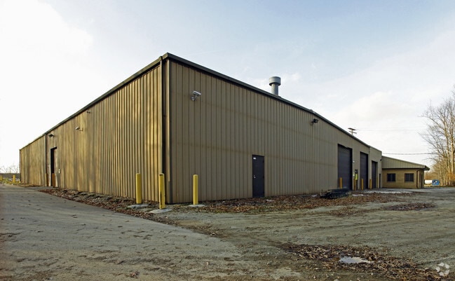
7299 Division St
Cleveland-Elyria, OH
Add
795-48-020
S/L G FF 189.00 D 693.00 3.105 AC OL 77 VOL 353 PG51 2008S/R ADDITIONAL PCL 79548021
Industrialgeneral
Cuyahoga
X
Ohio
39035C0332E
g
2024
3.11 AC
2024
Bedford/Walton Hills
195700
Cleveland
36,390 SF
DEMOGRAPHICS near 7299 Division St
1 Mile
3 Mile
5 Mile
2024 Total Population
2,805
41,251
130,846
2029 Population
2,749
40,513
128,249
Pop Growth 2024-2029
(2.00%)
(1.79%)
(1.98%)
Average Age
47
44
43
2024 Total Households
1,350
18,885
56,026
HH Growth 2024-2029
(2.15%)
(1.82%)
(2.08%)
Median Household Inc
$48,610
$57,417
$61,842
Avg Household Size
2.00
2.10
2.30
2024 Avg HH Vehicles
2.00
2.00
2.00
Median Home Value
$130,409
$165,037
$175,250
Median Year Built
1955
1967
1965
Nearby Places
Map Layers
Map Styles
 Street
 Aerial
- Restaurants
- Banks
- Shops
- Fitness
- Groceries
PUBLIC TRANSPORTATION
COMMUTER RAIL
DRIVE
WALK
Distance
16 min
6.7 mi
DRIVE
WALK
Distance
20 min
8.0 mi
AIRPORT
Cleveland-Hopkins International
DRIVE
WALK
Distance
Cleveland-Hopkins International
36 min
23.2 mi
Akron-Canton Regional
DRIVE
WALK
Distance
Akron-Canton Regional
49 min
35.7 mi
SALE & LEASE HISTORY
LISTING DATE
SALE/LEASE

Sep 25, 2016
For Lease
Nearby Properties
Address
Land Use
TOTAL SIZE
Lot Size
Zoning
Address
Land Use
TOTAL SIZE
Lot Size
Zoning
130,621 SF
67.21 AC
I-2
Address
Land Use
TOTAL SIZE
Lot Size
Zoning
49.31 AC
Address
Land Use
TOTAL SIZE
Lot Size
Zoning
90.68 AC
I-2
Address
Land Use
TOTAL SIZE
Lot Size
Zoning
11,808 SF
900.50 AC
1F-2
Address
Land Use
TOTAL SIZE
Lot Size
Zoning
109.65 AC
MUD
Address
Land Use
TOTAL SIZE
Lot Size
Zoning
18.38 AC
R2
Address
Land Use
TOTAL SIZE
Lot Size
Zoning
458,000 SF
35.06 AC
IG
Address
Land Use
TOTAL SIZE
Lot Size
Zoning
14.95 AC
I-1
Address
Land Use
TOTAL SIZE
Lot Size
Zoning
137,795 SF
37.09 AC
R-4
Address
Land Use
TOTAL SIZE
Lot Size
Zoning
20.49 AC
R-1-C
Address
Land Use
TOTAL SIZE
Lot Size
Zoning
69,033 SF
8.85 AC
R-3
Address
Land Use
TOTAL SIZE
Lot Size
Zoning
210,136 SF
21.69 AC
Address
Land Use
TOTAL SIZE
Lot Size
Zoning
350,592 SF
25.29 AC
O/I
Address
Land Use
TOTAL SIZE
Lot Size
Zoning
201,034 SF
21.07 AC
I-2
Address
Land Use
TOTAL SIZE
Lot Size
Zoning
164,157 SF
6.29 AC
BP
Address
Land Use
TOTAL SIZE
Lot Size
Zoning
268,672 SF
25.07 AC
R-3
Address
Land Use
TOTAL SIZE
Lot Size
Zoning
718,431 SF
18.75 AC
O/I
Address
Land Use
TOTAL SIZE
Lot Size
Zoning
155,974 SF
5.33 AC
R-3
Address
Land Use
TOTAL SIZE
Lot Size
Zoning
192,371 SF
22.06 AC
B3
Address
Land Use
TOTAL SIZE
Lot Size
Zoning
197,930 SF
14.80 AC
I-2
Address
Land Use
TOTAL SIZE
Lot Size
Zoning
210,600 SF
12.69 AC
I-2
Address
Land Use
TOTAL SIZE
Lot Size
Zoning
60,908 SF
46.85 AC
Address
Land Use
TOTAL SIZE
Lot Size
Zoning
41,566 SF
13.01 AC
R-1-D
Address
Land Use
TOTAL SIZE
Lot Size
Zoning
200,200 SF
11.88 AC
IG
Address
Land Use
TOTAL SIZE
Lot Size
Zoning
137,252 SF
9.85 AC
MS
Address
Land Use
TOTAL SIZE
Lot Size
Zoning
240,477 SF
16.57 AC
I-2
Address
Land Use
TOTAL SIZE
Lot Size
Zoning
227,086 SF
16.65 AC
IG
Address
Land Use
TOTAL SIZE
Lot Size
Zoning
89.60 AC
R-1-D
Address
Land Use
TOTAL SIZE
Lot Size
Zoning
2.31 AC
I-1
Address
Land Use
TOTAL SIZE
Lot Size
Zoning
15.33 AC
L-I
The World's #1 Commercial Real Estate Marketplace
Connect with us
© 2026 CoStar Group
The information above has been obtained from sources believed reliable. While we do not doubt its accuracy we have not verified it and make no guarantee, warranty or representation about it. It is your responsibility to independently confirm its accuracy and completeness. Any projections, opinions, assumptions, or estimates used are for example only and do not represent the current or future performance of the property. The value of this transaction to you depends on tax and other factors which should be evaluated by your tax, financial, and legal advisors. You and your advisors should conduct a careful, independent investigation of the property to determine to your satisfaction the suitability of the property for your needs.