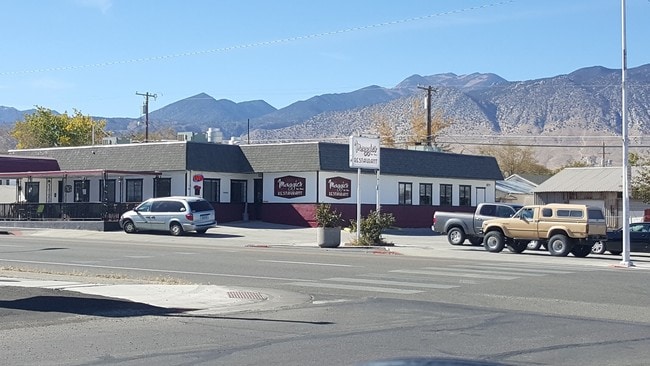
Property Record
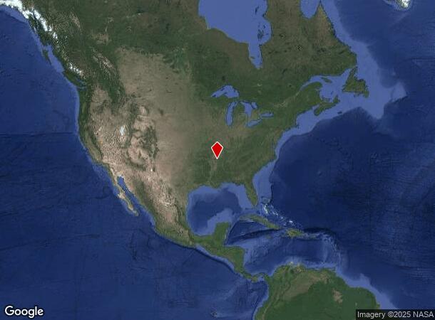
73 E Biscayne Rd, Memphis, TN 38109
NEARBY LISTINGS FOR SALE OR LEASE
Property Detail
73 E Biscayne Rd
001-035-12
Hawthorne
Officebuilding
HAWTHORNE STATE FARM
X
Mineral
32021C1015C
Nevada
2024
14
2025
0.10 AC
970700
Other Market Areas
810 SF
DEMOGRAPHICS near 73 E Biscayne Rd
1 Mile
3 Mile
5 Mile
2024 Total Population
2,544
3,032
3,161
2029 Population
2,501
2,981
3,109
Pop Growth 2024-2029
(1.69%)
(1.68%)
(1.65%)
Average Age
45
44
44
2024 Total Households
1,170
1,391
1,449
HH Growth 2024-2029
(1.71%)
(1.65%)
(1.66%)
Median Household Inc
$50,753
$51,304
$50,381
Avg Household Size
2.10
2.10
2.10
2024 Avg HH Vehicles
2.00
2.00
2.00
Median Home Value
$161,999
$159,832
$153,688
Median Year Built
1969
1970
1970
Nearby Places
Map Layers
Map Styles
 Street
 Aerial
- Restaurants
- Banks
- Shops
- Fitness
- Groceries
PUBLIC TRANSPORTATION
COMMUTER RAIL
Central Station (Riverfront Loop - Memphis Area Transit Authority Trolley (MataTrolley))
DRIVE
WALK
Distance
Central Station (Riverfront Loop - Memphis Area Transit Authority Trolley (MataTrolley))
8 min
5.3 mi
AIRPORT
Memphis International
DRIVE
WALK
Distance
Memphis International
9 min
5.7 mi
Freight Ports
Port of Shreveport
DRIVE
WALK
Distance
Port of Shreveport
403 min
372.5 mi
Nearby Properties
Address
Land Use
TOTAL SIZE
Lot Size
Zoning
Address
Land Use
TOTAL SIZE
Lot Size
Zoning
438,763 SF
64.67 AC
IH
Address
Land Use
TOTAL SIZE
Lot Size
Zoning
386,565 SF
29.49 AC
IH
Address
Land Use
TOTAL SIZE
Lot Size
Zoning
146,316 SF
18.07 AC
CMU-3
Address
Land Use
TOTAL SIZE
Lot Size
Zoning
105,841 SF
7.45 AC
IH
Address
Land Use
TOTAL SIZE
Lot Size
Zoning
38,600 SF
30.35 AC
RU-3
Address
Land Use
TOTAL SIZE
Lot Size
Zoning
345,806 SF
33.16 AC
RU-3
Address
Land Use
TOTAL SIZE
Lot Size
Zoning
253,883 SF
37.28 AC
IH
Address
Land Use
TOTAL SIZE
Lot Size
Zoning
95,307 SF
25.91 AC
RU-3
Address
Land Use
TOTAL SIZE
Lot Size
Zoning
214,950 SF
17.05 AC
CMU-2
Address
Land Use
TOTAL SIZE
Lot Size
Zoning
81,790 SF
17.82 AC
CMU-2
Address
Land Use
TOTAL SIZE
Lot Size
Zoning
222,777 SF
119.84 AC
IH
Address
Land Use
TOTAL SIZE
Lot Size
Zoning
381.30 AC
R-15
Address
Land Use
TOTAL SIZE
Lot Size
Zoning
147,890 SF
16.92 AC
EMP
Address
Land Use
TOTAL SIZE
Lot Size
Zoning
367,132 SF
18.54 AC
EMP
Address
Land Use
TOTAL SIZE
Lot Size
Zoning
233,060 SF
20 AC
EMP
Address
Land Use
TOTAL SIZE
Lot Size
Zoning
545,525 SF
31.04 AC
EMP
Address
Land Use
TOTAL SIZE
Lot Size
Zoning
316,830 SF
23.55 AC
EMP
Address
Land Use
TOTAL SIZE
Lot Size
Zoning
536,821 SF
32.62 AC
EMP
Address
Land Use
TOTAL SIZE
Lot Size
Zoning
54,000 SF
293.13 AC
IH
Address
Land Use
TOTAL SIZE
Lot Size
Zoning
359,274 SF
20.77 AC
EMP
Address
Land Use
TOTAL SIZE
Lot Size
Zoning
318,661 SF
26.92 AC
CMU-3
Address
Land Use
TOTAL SIZE
Lot Size
Zoning
13,978 SF
7 AC
RU-3
Address
Land Use
TOTAL SIZE
Lot Size
Zoning
371,916 SF
19.08 AC
IH
Address
Land Use
TOTAL SIZE
Lot Size
Zoning
217,994 SF
30.21 AC
EMP
Address
Land Use
TOTAL SIZE
Lot Size
Zoning
142,333 SF
29.69 AC
CMU-3
Address
Land Use
TOTAL SIZE
Lot Size
Zoning
46,840 SF
2.53 AC
EMP
Address
Land Use
TOTAL SIZE
Lot Size
Zoning
66,720 SF
7.19 AC
IH
Address
Land Use
TOTAL SIZE
Lot Size
Zoning
13,630 SF
3.02 AC
RU-3
Address
Land Use
TOTAL SIZE
Lot Size
Zoning
35,779 SF
13.37 AC
R-10
Address
Land Use
TOTAL SIZE
Lot Size
Zoning
20,624 SF
1.41 AC
CMU-3
The World's #1 Commercial Real Estate Marketplace
Connect with us
© 2026 CoStar Group
The information above has been obtained from sources believed reliable. While we do not doubt its accuracy we have not verified it and make no guarantee, warranty or representation about it. It is your responsibility to independently confirm its accuracy and completeness. Any projections, opinions, assumptions, or estimates used are for example only and do not represent the current or future performance of the property. The value of this transaction to you depends on tax and other factors which should be evaluated by your tax, financial, and legal advisors. You and your advisors should conduct a careful, independent investigation of the property to determine to your satisfaction the suitability of the property for your needs.